22 - 29th May, 2019
under construction
Trip Stats:
6 nights under canvas + one in a mine site donga
2615km travelled
303L fuel used
trip average of 11.6L/100
(worst 13.3, best 10.3)
cost of fuel $478
camp fees total $0 👍
With 6 nights under canvas on this trip, the yearly tally stands at 27. Does not include the donga on the 27th.
trip vids:
Thursday 30 May 2019
It's still got knobs on it (the little walk)
24 - 25th May, 2019
The definition of insanity is doing the same thing over and over again and expecting a different result. I must be barking mad. For you see, 12 months after the accomplishment of getting out to Nichol's Knob on foot, I am doing it again. Yep, that's batshit crazy alright.
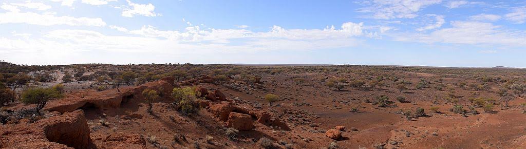
Nichols Knob, named by explorer Frank Hann in 1908, after one of his camels that died at the spot, lies some 130Km's North East of Laverton as the crow flies, in the Great Victoria Desert. Just a small lump of rock in an otherwise large plain of spinifex. If you blink you would miss it.....That said, I wouldn't mind betting the number of white men that have been here could be counted on less than two hands. No roads or tracks lead to this place and a vehicle entry (if you are brave enough) will have you bashing through virgin desert, mulga and spinifex for a minimum of 15Km's one way. The closest habitation is 60Km to the South at an indigenous community (Cosmo Newbery) or (if occupied at the time), Lake wells Station some 30Km's to the North. Such is the remoteness of the place.

Having been one of only 3 people that have found the geocache at that location, I feel a custodianship towards the cache. When there last year, I noted that the logbook has been water damaged and the 3 finders all had to fill out a scrap of paper to prove they had physically got to ground zero. I had been looking for another adventure, so I conjured up the idea of going back. The plan would be to take a new log book out with me for future finders. The problem was my feet were telling me ...nooooo! They remembered the pain they were put through last time.
So a few months beforehand, I purchased an ex army ammo can and a dry box. The plan was to carry the ammo can out to site, with the drybox inside that with a fresh logbook. This should future proof the cache. Unless caught out by fire, an ammo can will survive for an extremely long period, especially in such an arid landscape.
This blog entry will describe my overnight walk. The road trip, I will write up separately.
Two days after leaving home, I arrived at base camp, early afternoon. I therefore proceeded to set up camp. I was planning on being here 3 days. So along with all my usual clobber, I had to set solar going too.

It was an easy afternoon really, however, the flies were terrible. It was so different to last year. Also different was taking on-board the lessons learnt from the last expedition. Where as I did it very rough, last year - no tent, no sleeping gear, minimal water, and even an evening meal, this year I geared up accordingly. A new pack, a bivvy for protection, a sleep mat, a sleeping bag, more water and a dehydrated meal. Something I struggled with last year big time was having no chair. I cant believe how hard this was without one. So seating in the form of a little stool came along too. All this comes with an additional weight penalty though. I was a spent force when I returned last year and now with more weight to carry, I reckoned I would fare worse. I did a 20Km overnight hike the weekend prior to both break in my new hike boots and my legs/back with the additional weight. I did no training whatsoever last year.
Prior to sunset, I pre packed all my gear ready for an early morning departure. A few bevvies after dinner by the fire and it was time to retire for the night. The pain was no doubt coming in the morning.

I had set my alarm for an 0530 wakeup. The sky presented an amazing but alarming sight - you know, red sky in the morning, sailors warning:

A quick bite to eat, now dressed to kill and I was ready to depart at 0630 with a +15Kg pack on my back and I was carrying a 3L water bladder and an ammo can in an additional bag. Not for the feint hearted hey!

The plan at this stage was just to get to the mid point: Approximately 8Km as the crow flies. Once there, I would drop the waterbag as a reserve supply for the trip home. I had run out at this point last year and had to do the last 8Km without water. Not a good option. I had also broken the journey into 8 waypoints to help minimise the cross track error and reduce the kilometres under foot.
The first couple of kilometres were pretty easy. I was fresh and the ground was open. Good walking country and I was averaging 4Km/h speed over ground. The weather was a bit on the overcast side and this made for nice cool walking conditions. But I had an issue: It hadn't rained out here for ages and today it looks threatening. I have not packed any wet weather gear.....
I knew from last year though, the ground would change and soon after waypoint 2, the open ground finished and the mulga and spinifex started with a vengance:

This spinifex and mulga country is a lot harder to walk and presents some dangers. The last thing I needed was to be greeted by a mulga snake, or worse, having a spinifex adder strike me from behind as I put my foot over a clump of spinny. Fate was in the hands of god now.
A couple of kilometres of spinny and I was greeted with some more open country to the midpoint. Another difference from last year was the amount of animal tracks in the sand. camel, roo, dingo and emu prints were everywhere. last year there was only a couple of isolated patches of camel print. I really wasn't keen on meeting any angry bull camel, so if I never saw one, I would be happy.
It had taken me about 2 hours to get to the midpoint, so I was keeping my 4km/h speed over ground average. Here I had a break for 1/2 an hour or so. I still had a long way to go, so looking after ones feet was a must. Carrying that extra bag was a bit of a pain too, but now I could drop the 3 litres of water and just contend with the ammo can. The feet and back were faring up pretty well at this stage - which was just as well with another 24 odd Km's to go.

A feed, a rest and a drink and I had to push on. I took a different route from last year at this point. A more direct one, but google earth imagery showed it may be a bit rougher due to mulga. Only one way to find out I guess.
I crossed the creek bed I discovered last year. I still marvel at such a wonder in an extremely arid environment.

As google earth had shown, pretty soon I was into thick mulga/spinifex. That stretch was the hardest slog of the trip. And the one place I saw more wildlife than the rest combined. A few roo's were spotted and again I was wary, a lesson learnt from last year when one of the buggers charged me. this time however, we were both happy in the fact that if we left each other alone, we could both go on happy. I do wonder how many people these roo's may have seen in the past, not many, if any at all I reckon.

And then it happened. Deep in thick mulga and spinifex, now miles from the car, I spot camel. A mob of 4 grazing about 150 meters away. So I stopped and observed. They carried on grazing, I suspect they never even saw me. So onto waypoint 5 I go. The spinifex cleared into isolated lumps with sandy patches in between so that I could navigate around the insidious stuff. The mulga cleared too. The going got a bit easier, which was a good thing because pushing your way through thick, waist high spinifex isn't exactly confidence inspiring. This new route I plotted also avoided the large breakaway I had to ascend/descend last year. Whilst I never got to admire the beauty of such a structure, I also didn't have to contend with trying to make my way down it.
I came across some old camel bones nearing waypoint 6. For a good 500 meters, I would see isolated bones that I reckon was from the same animal, spread no doubt by something having a feed. Dingo no doubt. Then a skull and finally the bulk of the animal. The dingo's had had a field day. Being a carnivore in this environment, you have to admire their tenacity to survive in this country.

After a good couple of k's of easier going and nearing waypoint 6, I knew I was up for a final challenge. The last couple of K's was just a plain of spinifex. barely a place to stick a pin between subsequent plants. That would be tough. Just as I was breaking the last of the mulga belt, I spied another mob of 4 camel about 100m on the plain. God damn it!
So I watched and waited, knowing I at least had a tree or two to run around if need be. This mob of camel spotted me. A short duration ensued which led them to bugger off....into the spinifex plain. I just hoped they didn't head towards the knob.

Breaking out onto the plain, I could see the Red Bluff as described by Carnegie in 1897. I would dearly love to spend a week out here exploring both features, but I cant ever see that happening unfortunately. Maybe one day I might hire a chopper to drop me off with a weeks supplies? I couldn't do it on foot. The knob itself not readily able to be seen, such is its size.

Halfway through the plain with about a kilometre to go, Nichol's Knob becomes apparent. Only to those who know (and very few would) as its not very conspicuous:

I was nearing my target. A bit sore, a bit tired, but elated to be here once again. The sun had come out in the last few kilometres and now the flies were getting a bit up close and personal. I knew on arrival at the knob the fly net had to come out.
And then I saw it.....that bloody tree on the North slope of the knob. That tree is going to haunt me for the rest of my life. I have seen a picture of it when the cache was first placed here 16 years ago, and I crap you not, it hasn't grown an inch since that day:

Actually, that tree is going to haunt me for the rest of my days because I reckon I may not ever see it again. Its a bitter sweet accomplishment having got out here a second time, having to acknowledge it will possibly be my last. But here's the rub: as I write this, I reckon I would be a happy man if my urn were ever placed under that tree, such is the desire of finally achieving something that's been on your bucket list for a decade.
The sun had poked out by now and the temperature was warming. But oh boy - those flies:

I find the cache is in good order, just as I left it 1 year and 4 days prior. I photograph the only 3 logs the cache has had in its 16 year lifespan including my own:

To get here I have had to walk 17 odd kilometres and the journey has taken me about 6 hours. I arrive some 2 hours earlier than last year and have walked about 2km less.

There was also a secondary mission for coming out here. Last year I left a bottle of topaque for the next finder....well that just happens to be me, so I exchange the bottle with a fresh one. I now have a 12 month desert matured bottle to consume, should I make it back. Whilst here, I am amazed as an A380 flies directly overhead, no doubt a Middle Eastern flight bound for either Sydney or Melbourne. To top that off, another one on the exact same route follows behind about 10 minutes later:

I have to admit, sitting here, all alone, miles from anyone, is a surreal experience and I take in as much of the view as I can whilst I am still here:

I place all the old logs in the dry box, then placed that into the ammo can and leave a couple of sets of my pathtags for fellow adventurers to come get them.

The cache now future proofed, my job here is done.

So I have been on site for about an hour now and then I turn West for home. If not for the sight of that bloody 2km long spinifex plain I have to traverse again, I sadly say a few solemn farewells to a place that holds a special place in my memory.

Trudging along on foot again, I am making mental calculations: Can I actually make it back to camp tonight? apart from the fact I am looking at a 35km day, the sun sets at 1700 here and its too dark to travel after 1730. 16 Km's at 4km/h would put me back at camp at 1730...Hmmm maybe.
Yeah, maybe not. Factor into the account I am now tired, sore and slower and need to rest for short periods more often, it was never going to happen. But it was a great plan. I retrace my route and about 4km's from the knob, I find my old foot prints from a few hours ago. Who needs a gps hey!
Back through the semi open ground I go, no sight of camels now. Then onto the hard slog of the heavily vegetated and spinifex field I go. One foot in front of the other. I consider if I can push on further past the mid point making an easier day tomorrow, but that doesn't happen either. I finally break out of the spinifex and spot my water bag in a tree. Visions of Ernest Giles and his waterbag in a tree come flooding back to me.
It is now 1630, I have walked some +26Km's of nasty country and I'm feeling spent. Yep, I'm just going to stick to my original plan and camp here the night. I only have an hour of daylight left anyhow. I left camp 10 hours ago.

I get the tent set up, gather some wood, and before I know it, the sun has set and darkness is creeping in very fast. I boil some water and enjoy a most magnificent roast lamb freeze dried meal. It sure beats the two apples I had for dinner last year. At 1930 I retire for some rest. not long in bed, trying to no avail to get comfortable, I'm sure I hear a camel snort....great. now I can spend the rest of the night worrying about being run over by a camel.
Way off in the distance I also hear a pack of Dingos howling. This goes on for some time. I did manage to get some sleep that night, but not a lot. The fact I was uncomfortable all night, slightly cold and the unknown of it all, stuck in the middle of nowhere all conspired to make it an unusual night.
Morning comes around and it's a bit cool. I am up before sunrise. The bivvy, full of condensation inside even though I left my door open all night. I long for a coffee, but decide I wont stuff around lighting a fire to boil some water, seeing I left my stove behind as a weight reduction measure. I'll just tough it out:

Before I can get underway, I need to take some remedial steps on my feet. You see, these new boots are giving me blisters, and I'm sporting a beauty on my left big toe from the 20K over nighter I did the weekend before. I need to take care of that or I will be in trouble. last year, the pads on the bottom of my feet suffered badly. From those lessons learnt, I strap my feet accordingly:

I pack my gear, wet bivvy and all, and hit the desert at 0640 for the 8km trip back to base camp. I should be back at camp in around 2 hours. Easy going for the first two K's, I reach waypoint 3 and then I'm back into the thick mulga belt and tall, thick spinifex. This again slows me down. Considering the big day I put in yesterday, I'm pulling up pretty well, but the feet are sore. However, this thick country is devastating to walk:

I soldier on, weaving around that spinifex clump, then the next, hop over some fallen mulga and repeat the process for kilometers. Up until now, my navigation has been pretty bang on course. Another lesson learnt from last year, set multiple waypoints, closer together. I manually created a series 2 km apart from base camp to the knob. last year I only had 2, the mid point and the knob, 8 km apart. I found my cross track error blew out considerably and I walked some extra unnecessary miles on that trip. this time around, the 2km legs were working a treat........until now.
I noticed I was some 750+ meters south of the straight line path to waypoint 2. Partly due to having to avoid vegetation, partly due to poor navigation technique. I always try to sight and go......take a bearing on a landmark in the distance, in this country that usually relates to a tree, and walk towards that. It had worked up till now. I have seen this issue before, so I perform a compass recalibration on the Oregon 700 and try again. I decide its a waste of time heading back to my prior target, waypoint 2, and make a direct course for waypoint 1. More roo's spotted as I punch my way through the heavy ground, but again, they are happy, and so am I, except for punching ones way through this stuff:

My track is back to being straight as a die. Problem solvered. 1500m of slugging it out in the trees and again I make some open ground. Here I come across some small granite outcrops I have to climb up. That tells me my feet and legs are both tired and sore. Its a slow amble in those places, but plug on I must. I note the sun is still hidden in cloud cover and I wonder how my battery is faring back at camp with minimal solar to replenish what the fridge is taking out. I could so go a beer.....
Did I mention the flies......I reckon I must have had 3 Kilograms of flying sultana's on my hat alone:

And soon enough, I make waypoint 1. The compass re-cal worked a treat. With only 2k's back to base camp, I decide to take a 1/2 hour rest, the job is almost done. A good time for some breakfast me thinks:

The sun, now out from behind the clouds, its warming up again. I drink from my bladder in the pack and empty it. Not bad going, I ran out at the midpoint last year but this time I am carrying the bladder I left in the tree, so water is no issue this trip. I eat a fruit press roll and this supplies a sugar hit and some extra energy for the last leg home.
Again, some more small granite outcrops to traverse, then make my way on the home stretch through the breakaway's close to camp, noting all the camel print in the sand that wasn't there last year:

And sure enough, at 0930, I make base camp. Ahhh magoo, you have done it again:

I cant believe I have done it again. Crazy as a coconut indeed I am. But a wonderful feeling all the same. I have arrived in remarkable condition compared to last year where I was locked up like a 90 year old man. This year however, whilst still very happy with my feat of endurance, I don't have that elated feeling I arrived with. Possibly because I know this time I can do it. But it's time to get those bloody boots off:

I took on board lessons learnt from last year and made adjustments accordingly. These adjustments worked well, even though I had extra gear to carry. I have arrived an hour earlier than last year and saved 4km of distance walked. I returned with 2L of water as well.
27 hours, 35 kilometers of virgin Great Victoria Desert and I can continue on with the rest of the trip. No doubt with a whole lot less walking involved. Now, where's that bottle of desert matured topaque again......

I would like to extend my gratitude to a few people that helped me achieve this remarkable task of visiting Nichol's Knob once again. In order of appearance:

Oh and returning back home to Perth, look at all the crap one has to deal with 😎

Love your work fangirl! Cheers for the laugh.
Nichols Knob. Site of arguably Australia's most remote cache, geocache GCG3HJ. With 2 visits now under my belt I can safely assure you "it's still got knobs on it"
The vid:
The definition of insanity is doing the same thing over and over again and expecting a different result. I must be barking mad. For you see, 12 months after the accomplishment of getting out to Nichol's Knob on foot, I am doing it again. Yep, that's batshit crazy alright.
Nichols Knob, named by explorer Frank Hann in 1908, after one of his camels that died at the spot, lies some 130Km's North East of Laverton as the crow flies, in the Great Victoria Desert. Just a small lump of rock in an otherwise large plain of spinifex. If you blink you would miss it.....That said, I wouldn't mind betting the number of white men that have been here could be counted on less than two hands. No roads or tracks lead to this place and a vehicle entry (if you are brave enough) will have you bashing through virgin desert, mulga and spinifex for a minimum of 15Km's one way. The closest habitation is 60Km to the South at an indigenous community (Cosmo Newbery) or (if occupied at the time), Lake wells Station some 30Km's to the North. Such is the remoteness of the place.
Having been one of only 3 people that have found the geocache at that location, I feel a custodianship towards the cache. When there last year, I noted that the logbook has been water damaged and the 3 finders all had to fill out a scrap of paper to prove they had physically got to ground zero. I had been looking for another adventure, so I conjured up the idea of going back. The plan would be to take a new log book out with me for future finders. The problem was my feet were telling me ...nooooo! They remembered the pain they were put through last time.
So a few months beforehand, I purchased an ex army ammo can and a dry box. The plan was to carry the ammo can out to site, with the drybox inside that with a fresh logbook. This should future proof the cache. Unless caught out by fire, an ammo can will survive for an extremely long period, especially in such an arid landscape.
This blog entry will describe my overnight walk. The road trip, I will write up separately.
Two days after leaving home, I arrived at base camp, early afternoon. I therefore proceeded to set up camp. I was planning on being here 3 days. So along with all my usual clobber, I had to set solar going too.
It was an easy afternoon really, however, the flies were terrible. It was so different to last year. Also different was taking on-board the lessons learnt from the last expedition. Where as I did it very rough, last year - no tent, no sleeping gear, minimal water, and even an evening meal, this year I geared up accordingly. A new pack, a bivvy for protection, a sleep mat, a sleeping bag, more water and a dehydrated meal. Something I struggled with last year big time was having no chair. I cant believe how hard this was without one. So seating in the form of a little stool came along too. All this comes with an additional weight penalty though. I was a spent force when I returned last year and now with more weight to carry, I reckoned I would fare worse. I did a 20Km overnight hike the weekend prior to both break in my new hike boots and my legs/back with the additional weight. I did no training whatsoever last year.
Prior to sunset, I pre packed all my gear ready for an early morning departure. A few bevvies after dinner by the fire and it was time to retire for the night. The pain was no doubt coming in the morning.
I had set my alarm for an 0530 wakeup. The sky presented an amazing but alarming sight - you know, red sky in the morning, sailors warning:
A quick bite to eat, now dressed to kill and I was ready to depart at 0630 with a +15Kg pack on my back and I was carrying a 3L water bladder and an ammo can in an additional bag. Not for the feint hearted hey!
The plan at this stage was just to get to the mid point: Approximately 8Km as the crow flies. Once there, I would drop the waterbag as a reserve supply for the trip home. I had run out at this point last year and had to do the last 8Km without water. Not a good option. I had also broken the journey into 8 waypoints to help minimise the cross track error and reduce the kilometres under foot.
The first couple of kilometres were pretty easy. I was fresh and the ground was open. Good walking country and I was averaging 4Km/h speed over ground. The weather was a bit on the overcast side and this made for nice cool walking conditions. But I had an issue: It hadn't rained out here for ages and today it looks threatening. I have not packed any wet weather gear.....
I knew from last year though, the ground would change and soon after waypoint 2, the open ground finished and the mulga and spinifex started with a vengance:
This spinifex and mulga country is a lot harder to walk and presents some dangers. The last thing I needed was to be greeted by a mulga snake, or worse, having a spinifex adder strike me from behind as I put my foot over a clump of spinny. Fate was in the hands of god now.
A couple of kilometres of spinny and I was greeted with some more open country to the midpoint. Another difference from last year was the amount of animal tracks in the sand. camel, roo, dingo and emu prints were everywhere. last year there was only a couple of isolated patches of camel print. I really wasn't keen on meeting any angry bull camel, so if I never saw one, I would be happy.
It had taken me about 2 hours to get to the midpoint, so I was keeping my 4km/h speed over ground average. Here I had a break for 1/2 an hour or so. I still had a long way to go, so looking after ones feet was a must. Carrying that extra bag was a bit of a pain too, but now I could drop the 3 litres of water and just contend with the ammo can. The feet and back were faring up pretty well at this stage - which was just as well with another 24 odd Km's to go.
A feed, a rest and a drink and I had to push on. I took a different route from last year at this point. A more direct one, but google earth imagery showed it may be a bit rougher due to mulga. Only one way to find out I guess.
I crossed the creek bed I discovered last year. I still marvel at such a wonder in an extremely arid environment.
As google earth had shown, pretty soon I was into thick mulga/spinifex. That stretch was the hardest slog of the trip. And the one place I saw more wildlife than the rest combined. A few roo's were spotted and again I was wary, a lesson learnt from last year when one of the buggers charged me. this time however, we were both happy in the fact that if we left each other alone, we could both go on happy. I do wonder how many people these roo's may have seen in the past, not many, if any at all I reckon.
And then it happened. Deep in thick mulga and spinifex, now miles from the car, I spot camel. A mob of 4 grazing about 150 meters away. So I stopped and observed. They carried on grazing, I suspect they never even saw me. So onto waypoint 5 I go. The spinifex cleared into isolated lumps with sandy patches in between so that I could navigate around the insidious stuff. The mulga cleared too. The going got a bit easier, which was a good thing because pushing your way through thick, waist high spinifex isn't exactly confidence inspiring. This new route I plotted also avoided the large breakaway I had to ascend/descend last year. Whilst I never got to admire the beauty of such a structure, I also didn't have to contend with trying to make my way down it.
I came across some old camel bones nearing waypoint 6. For a good 500 meters, I would see isolated bones that I reckon was from the same animal, spread no doubt by something having a feed. Dingo no doubt. Then a skull and finally the bulk of the animal. The dingo's had had a field day. Being a carnivore in this environment, you have to admire their tenacity to survive in this country.
After a good couple of k's of easier going and nearing waypoint 6, I knew I was up for a final challenge. The last couple of K's was just a plain of spinifex. barely a place to stick a pin between subsequent plants. That would be tough. Just as I was breaking the last of the mulga belt, I spied another mob of 4 camel about 100m on the plain. God damn it!
So I watched and waited, knowing I at least had a tree or two to run around if need be. This mob of camel spotted me. A short duration ensued which led them to bugger off....into the spinifex plain. I just hoped they didn't head towards the knob.
Breaking out onto the plain, I could see the Red Bluff as described by Carnegie in 1897. I would dearly love to spend a week out here exploring both features, but I cant ever see that happening unfortunately. Maybe one day I might hire a chopper to drop me off with a weeks supplies? I couldn't do it on foot. The knob itself not readily able to be seen, such is its size.
Halfway through the plain with about a kilometre to go, Nichol's Knob becomes apparent. Only to those who know (and very few would) as its not very conspicuous:
I was nearing my target. A bit sore, a bit tired, but elated to be here once again. The sun had come out in the last few kilometres and now the flies were getting a bit up close and personal. I knew on arrival at the knob the fly net had to come out.
And then I saw it.....that bloody tree on the North slope of the knob. That tree is going to haunt me for the rest of my life. I have seen a picture of it when the cache was first placed here 16 years ago, and I crap you not, it hasn't grown an inch since that day:
Actually, that tree is going to haunt me for the rest of my days because I reckon I may not ever see it again. Its a bitter sweet accomplishment having got out here a second time, having to acknowledge it will possibly be my last. But here's the rub: as I write this, I reckon I would be a happy man if my urn were ever placed under that tree, such is the desire of finally achieving something that's been on your bucket list for a decade.
The sun had poked out by now and the temperature was warming. But oh boy - those flies:
I find the cache is in good order, just as I left it 1 year and 4 days prior. I photograph the only 3 logs the cache has had in its 16 year lifespan including my own:
To get here I have had to walk 17 odd kilometres and the journey has taken me about 6 hours. I arrive some 2 hours earlier than last year and have walked about 2km less.
There was also a secondary mission for coming out here. Last year I left a bottle of topaque for the next finder....well that just happens to be me, so I exchange the bottle with a fresh one. I now have a 12 month desert matured bottle to consume, should I make it back. Whilst here, I am amazed as an A380 flies directly overhead, no doubt a Middle Eastern flight bound for either Sydney or Melbourne. To top that off, another one on the exact same route follows behind about 10 minutes later:
I have to admit, sitting here, all alone, miles from anyone, is a surreal experience and I take in as much of the view as I can whilst I am still here:
I place all the old logs in the dry box, then placed that into the ammo can and leave a couple of sets of my pathtags for fellow adventurers to come get them.
The cache now future proofed, my job here is done.
So I have been on site for about an hour now and then I turn West for home. If not for the sight of that bloody 2km long spinifex plain I have to traverse again, I sadly say a few solemn farewells to a place that holds a special place in my memory.
Trudging along on foot again, I am making mental calculations: Can I actually make it back to camp tonight? apart from the fact I am looking at a 35km day, the sun sets at 1700 here and its too dark to travel after 1730. 16 Km's at 4km/h would put me back at camp at 1730...Hmmm maybe.
Yeah, maybe not. Factor into the account I am now tired, sore and slower and need to rest for short periods more often, it was never going to happen. But it was a great plan. I retrace my route and about 4km's from the knob, I find my old foot prints from a few hours ago. Who needs a gps hey!
Back through the semi open ground I go, no sight of camels now. Then onto the hard slog of the heavily vegetated and spinifex field I go. One foot in front of the other. I consider if I can push on further past the mid point making an easier day tomorrow, but that doesn't happen either. I finally break out of the spinifex and spot my water bag in a tree. Visions of Ernest Giles and his waterbag in a tree come flooding back to me.
It is now 1630, I have walked some +26Km's of nasty country and I'm feeling spent. Yep, I'm just going to stick to my original plan and camp here the night. I only have an hour of daylight left anyhow. I left camp 10 hours ago.
I get the tent set up, gather some wood, and before I know it, the sun has set and darkness is creeping in very fast. I boil some water and enjoy a most magnificent roast lamb freeze dried meal. It sure beats the two apples I had for dinner last year. At 1930 I retire for some rest. not long in bed, trying to no avail to get comfortable, I'm sure I hear a camel snort....great. now I can spend the rest of the night worrying about being run over by a camel.
Way off in the distance I also hear a pack of Dingos howling. This goes on for some time. I did manage to get some sleep that night, but not a lot. The fact I was uncomfortable all night, slightly cold and the unknown of it all, stuck in the middle of nowhere all conspired to make it an unusual night.
Morning comes around and it's a bit cool. I am up before sunrise. The bivvy, full of condensation inside even though I left my door open all night. I long for a coffee, but decide I wont stuff around lighting a fire to boil some water, seeing I left my stove behind as a weight reduction measure. I'll just tough it out:
Before I can get underway, I need to take some remedial steps on my feet. You see, these new boots are giving me blisters, and I'm sporting a beauty on my left big toe from the 20K over nighter I did the weekend before. I need to take care of that or I will be in trouble. last year, the pads on the bottom of my feet suffered badly. From those lessons learnt, I strap my feet accordingly:
I pack my gear, wet bivvy and all, and hit the desert at 0640 for the 8km trip back to base camp. I should be back at camp in around 2 hours. Easy going for the first two K's, I reach waypoint 3 and then I'm back into the thick mulga belt and tall, thick spinifex. This again slows me down. Considering the big day I put in yesterday, I'm pulling up pretty well, but the feet are sore. However, this thick country is devastating to walk:
I soldier on, weaving around that spinifex clump, then the next, hop over some fallen mulga and repeat the process for kilometers. Up until now, my navigation has been pretty bang on course. Another lesson learnt from last year, set multiple waypoints, closer together. I manually created a series 2 km apart from base camp to the knob. last year I only had 2, the mid point and the knob, 8 km apart. I found my cross track error blew out considerably and I walked some extra unnecessary miles on that trip. this time around, the 2km legs were working a treat........until now.
I noticed I was some 750+ meters south of the straight line path to waypoint 2. Partly due to having to avoid vegetation, partly due to poor navigation technique. I always try to sight and go......take a bearing on a landmark in the distance, in this country that usually relates to a tree, and walk towards that. It had worked up till now. I have seen this issue before, so I perform a compass recalibration on the Oregon 700 and try again. I decide its a waste of time heading back to my prior target, waypoint 2, and make a direct course for waypoint 1. More roo's spotted as I punch my way through the heavy ground, but again, they are happy, and so am I, except for punching ones way through this stuff:
My track is back to being straight as a die. Problem solvered. 1500m of slugging it out in the trees and again I make some open ground. Here I come across some small granite outcrops I have to climb up. That tells me my feet and legs are both tired and sore. Its a slow amble in those places, but plug on I must. I note the sun is still hidden in cloud cover and I wonder how my battery is faring back at camp with minimal solar to replenish what the fridge is taking out. I could so go a beer.....
Did I mention the flies......I reckon I must have had 3 Kilograms of flying sultana's on my hat alone:
And soon enough, I make waypoint 1. The compass re-cal worked a treat. With only 2k's back to base camp, I decide to take a 1/2 hour rest, the job is almost done. A good time for some breakfast me thinks:
The sun, now out from behind the clouds, its warming up again. I drink from my bladder in the pack and empty it. Not bad going, I ran out at the midpoint last year but this time I am carrying the bladder I left in the tree, so water is no issue this trip. I eat a fruit press roll and this supplies a sugar hit and some extra energy for the last leg home.
Again, some more small granite outcrops to traverse, then make my way on the home stretch through the breakaway's close to camp, noting all the camel print in the sand that wasn't there last year:
And sure enough, at 0930, I make base camp. Ahhh magoo, you have done it again:
I cant believe I have done it again. Crazy as a coconut indeed I am. But a wonderful feeling all the same. I have arrived in remarkable condition compared to last year where I was locked up like a 90 year old man. This year however, whilst still very happy with my feat of endurance, I don't have that elated feeling I arrived with. Possibly because I know this time I can do it. But it's time to get those bloody boots off:
I took on board lessons learnt from last year and made adjustments accordingly. These adjustments worked well, even though I had extra gear to carry. I have arrived an hour earlier than last year and saved 4km of distance walked. I returned with 2L of water as well.
27 hours, 35 kilometers of virgin Great Victoria Desert and I can continue on with the rest of the trip. No doubt with a whole lot less walking involved. Now, where's that bottle of desert matured topaque again......
I would like to extend my gratitude to a few people that helped me achieve this remarkable task of visiting Nichol's Knob once again. In order of appearance:
- David Carnegie, who passed the Red Bluff in 1897 on his way to Halls creek
- Frank Hann, who camped at this spot and Nichol, his dead camel who gave the site its name in 1908.
- Allan McCall, who back in 2003 somehow drove his landcruiser out here and placed the cache. With his mum as passenger no less 👍
- And last but not least, the boys and girls at Laverton police station who had my back should it all go tits up
Oh and returning back home to Perth, look at all the crap one has to deal with 😎
Love your work fangirl! Cheers for the laugh.
Nichols Knob. Site of arguably Australia's most remote cache, geocache GCG3HJ. With 2 visits now under my belt I can safely assure you "it's still got knobs on it"
The vid:
Cruizin' on 100
19 - 29th March, 2019
The following blog was written for and published in edition #114 of Western 4W Driver magazine:
western4wdriver.com.au/
With the sting of summer’s tail now behind us, now is the time for planning trips to the north and inland. This is a story of a geocaching adventure I took with my travel buddy, Warren, through the Mid-West and the Gascoyne. It was March, the wildflowers had gone, but so too had the tourists. I probably do not need to mention the flies. May to September is the best time for this region. Our primary goal was the Kennedy Ranges and Mt Augustus, with a personal milestone to complete on the way.
Our first camp was made inland of Geraldton at Ellendale pool. A picturesque place you must visit. I had left two caches behind the last time I was here, so upon arrival, I proceeded to get my name in the other logbooks. The first one could not to be found and I had little confidence in finding the second. A short walk from the camp and some ferreting around in the bush and I had found another, the second for the trip.
In the middle of the night I was woken by an animal of some sort running into my camp table. In the morning, a look of horror washed over my face …. there was only one shoe outside the swag! The noise I had heard earlier was a fox, making off with my sandal. This would be funny if I had brought a spare pair of shoes with me. Packing up with one foot in the gravel wasn’t much fun and we had to change our plans. Geraldton was now our first destination - for another pair of shoes. The Philosophy of “if it hasn’t got 2 uses, you don’t take it” doesn’t apply to shoes.
Missing a sandle:

It must have been a hilarious sight, me walking through the main street of town, sandal on one foot, nothing on the other. Warren deliberately followed quite a few steps behind. Inside the shopping center, I spied Best and less and had a win better than lotto. A $2 pair of thongs. The girl behind the counter in throws of laughter as I recounted my story of a dirty little fox and a sandal that had gone AWOL. But like a comfortable pair of old boots, I couldn’t let my one sandal go, so it was sandal on my left and thong on my right….for a while anyhow. I may as well milk it for all its worth.
Now on the coast, we decided on heading to Carnarvon before turning east for the Kennedy’s. We dropped into the Gladstone campground, but decided to give the limestone dust bowl a miss for a much nicer place just up the road. Wooramel River retreat, a fantastic station stay, even without any water in the river. It was a hot day, so we spent the remainder of the afternoon sitting in the shade of the numerous river gums with a refreshing ale as we watched the sun go down and the full moon come up.
Wooramel River retreat:

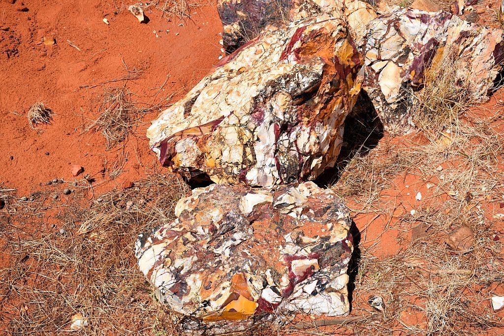
Arriving at the mookaite mine:

Mookaite mine:

Mookaite:
Mooka Spring:


There is a shack nearby, along with some heavy machinery. Obviously, it’s too hot to mine here at present, so the machinery and hut are in care and maintenance mode until the weather cools down a little.


If we would have found some shade by the water, we would have camped here the night, however, today is very hot, in excess of 40 degrees and its only lunchtime. We decide to push further north for Yenny Spring. It is slow going up the coarse stony track, with its numerous washouts that cut the track in numerous places. We arrive at most remarkable place, Yenny Spring. It’s too early to set up camp and too hot to stop, so after a quick explore on foot we drive further north, past Venny Peak and onwards a bit longer. The track gets a lot rougher past here and the washouts are getting deeper and more numerous. We decide not to continue into the unknown and double back for Yenny Spring.
Venny Peak:

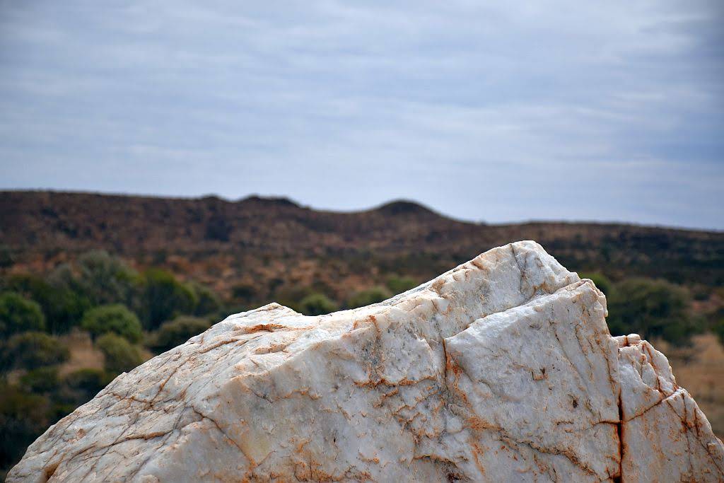
Parking in the shade of a patch of river gums, we do something a bit different and spend the rest of the afternoon cooling off with a relaxing ale. There is a trickle of water in the creek here, but it’s got nothing on Mookah Spring. A place where stock was once staged, we find some old troughs and a small spring, fenced off with old wooden posts and wire. The spring is a very small hole, full of vegetation. We are surprised when we test it for depth. A tree branch, 3 meters long doesn’t touch the bottom. If the vegetation was removed, it would be a splendid water source and more than likely, permanent.
Yenny Spring:


We watch as the full moon crests the southern side of the range whilst we cook dinner, the temperature now rather pleasant and the annoying flies have gone to bed for another day. Lying in the swag, I hear old mate dingo, off in the distance, howling from different parts of the range, obviously on the prowl in the light of the full moon. I now worry about my newly acquired $2 thong and my old comfortable sandal. I’m still milking the situation for all it’s worth:

Around 5am, I am woken by the blood curdling howl of old mate, still on the prowl. He is very close by. I note my shoes are still where I left them. With the dawning of the sun, comes the heat and the flies. We find the spring has overflowed during the night and the runoff is now making its way down to the creek. Breakfast done, we hit the track south for the highway to go explore the eastern side of the range.
From Gascoyne junction, we make the 50 odd kilometres to the eastern side and whilst cloud is forming in the sky, it’s still hot as hell. We hear on the radio, tropical cyclone Veronica, a category 4 low, is going to cross the coast to the north in a day or so. We start worry about the remainder of our trip out here as its no place to be when it’s wet.

Arriving at the East Kennedy's


We try to find some shelter in the minimal shade to be found at the campground. There is only one other camper here and he drops by for a chat. I ask if he knew what geocaching was about and he didn’t have a clue. I said I would show him what it was all about around 6pm, when it would be a bit cooler. We start off down the escarpment trail, on the understanding that daylight will be my issue departing this late in the day. Part way up the trail, the GPS points due north to the cache, only some 250 meters away. But the route is a very steep scree slope. I ponder the shortcut. If I can climb this slope, I will cut a couple of kilometres off my journey. It’s very steep, loose and somewhat dangerous. If there is a hard way to a cache, you can be sure I will find it. I make the decision to climb whilst our new found friend stays behind on the trail. The further I climb, the more I know I have made a bad decision. I am struggling to ascend this slope and my $2 thong is giving me grief: the sole of my foot is sweating profusely, and the thong and foot are constantly parting company. I should have put on 2 sandals at least.
A hard, silly climb:

Going up is the easy bit. The further up I go, the more difficult and dangerous it will be to come down. The GPS is egging me on. Down to 180 meters, then 150. Eventually after a lot of climbing, down to 100. I get to the top of the range, and there is a large prominent knob on top. The cache is still some 60 odd meters away, at the top of this knob, and I have no way to climb the vertical face I am presented with. All that work for nothing. The disappointment of having to log a did not find was a heavy load to bear after all the effort I had just put in. Mind you, the scenery was stunning.
Yep, its on top of that
un-climbable knob:


What’s worse, the more adventurous challenge of getting back down without breaking my neck was yet to come. The single plugger gave me more grief on the way down, constantly pulling the plug through the base, and the slip sliding of a sweaty foot on slippery rubber just compounded the problem. The terrain was intense to descend, but slowly and surely, I caught back up with my new friend, to make the short trek back to camp just before dark. Unfortunately I had no cache to show him. But I had gained knowledge on the stupidity of taking such a route in a two dollar thong.
Camped at the Kennedy's

The next morning, TC Veronica had made her presence felt. Although it was still warm, it was very dark and threatening and the wind ever increasing. It was due to hit Karratha, some 470Km’s away sometime today. With this in mind we headed for Mt Augustus, stopping to check potential camp spots by the Lyon’s river. Coming at the end of summer, the Lyon’s river disappointed with its lack of water. The scenery made up for it though, mounts such as Mt Phillips, providing small, isolated bumps in an otherwise flat landscape. From Cobra Station It is a short trip to the mountain where you drive parallel to the inselberg providing spectacular views. Cattle pool prior to the caravan park is a must see, though it was nothing like I had seen 6 months prior. Summer hadn’t been kind to the water sources out here.
Arriving at the mountain, we almost had the place to ourselves, with only one other here. We elected to set the swags up under the camp kitchen roof due to the wind and the risk of overnight rain – which didn’t eventuate. There are 3 geocaches located here, one I had found previously on the Kotka Gorge track. An earth cache and a traditional at the summit would have to wait for better weather conditions.
Mt Augustus :


The next morning with the wind howling, we left Mt Augustus without seeing anything so we could put as much distance between us and TC Veronica as we could. The Landor-Mt Augustus road is a part of the Kingsford Smith mail run – one of several tourist pathway’s in the region. A Gnamma hole with petroglyph’s can be found not too far south of the mountain.
Gnamma hole:

Heading further south we find on our maps a marked location for an old homestead well. We stopped to investigate. A derelict bore and signs of old cattle workings were to be found. Here I noticed a Mt James homestead to the west. Not knowing if it was a working station or abandoned, we went in for a look and were rewarded handsomely. The Homestead was abandoned and in quite reasonable shape. Evidence of prior occupation littered the landscape. Nestled on a plain surrounded by ranges, a large quartz blow rose out of plain a few hundred meters west of the homestead. It was a great little find and we spent a good while taking photographs and imagining the harsh existence one would have had trying to make a living off the land.
Mt James Homestead:


We continued south before arriving at the Mt Gould lockup for the night. Still windy and quite warm we had dodged a bullet. Veronica didn’t cross the coast and blew herself out. There was a remarkable sunset tonight with the cloud starting to break up. Lucky for me, there just so happens to be a geocache here and I had its log signed in no time.
Mt Gould and lockup:


The next morning, the wind had dropped off. Heading south, we crossed the 26th parallel and arrived in Meekatharra for some fuel. Warren had to replace his butane stove which had partially failed, and of course, another cache at the town lookout had to be found before we left. With the weather once again warming up and no evidence of a cyclone anymore the plan was to head West at Cue for Big Bell and Walga Rock, both places a must visit if in the area. On the way we stopped in at lake Nallan to pick up a cache at an old railway overpass and another detour to check out the graves at Milly Soak.
Milly Soak:


Lake Nallan:

I suggested we set up camp early today at Afghan Rock and we can do Big Bell the following morning. An early afternoon camp, with a cold beverage in the shade at the rock was hard to pass up. Climbing the rock to watch the sun go down was very worthwhile too.
Afghan Rock:


Big Bell Hotel:


We moved on down to Walga Rock. If you want to see some serious indigenous art, you have to come and check this place out. There is so much here to see, but please respect the indigenous heritage and stay behind the barrier. Treat it with respect so we get continued permission to visit. After Walga, we had to visit one other place that is essential to see – the Dalaranga meteorite crater. I jest. Wolfe Creek it is not.
Walga Rock:


Onto Mt. Magnet, we set up a quiet camp in the breakaways around lennonville. That night, planning our last few of days I suggested we camp at Warriedar and nearby by the old Rothsay mine for our last night.
Mt Magnet camp:


In the morning I knocked off another cache at the granites just to the north of Mt. Magnet and we headed to Yalgoo for another couple. Checking out all Yalgoo had to offer, we stopped at Jokers Tunnel, where I again had to scale another tricky rocky face, only to have to search for some time to get my name in another logbook.
Yalgoo:


The view above Jokers Tunnel:

We made our way to Warriedar and was mighty impressed with the restoration work Trackcare WA had done so far on the homestead. Again, it was blistering hot and with the volume of flying sultana’s in the air, all we could do was to relax with a cold bevvie (and a fly net) in the shade of the veranda until the sun went down. Something different I guess.
Warriedar:


The following morning, as we shot off towards Paynes Find for some fuel, we found a most remarkable old shack a couple of kilometres to the North of the homestead. We contemplated what stories this structure may hold:
Old shack on Warriedar station:

The road to Paynes Find was in great condition. A picturesque drive around and across Mongers lake and through Auiferous bearing ranges. The road lined with many Kurrajong trees. Hoping to visit the battery ay Paynes Find, we were disappointed to discover on arrival it is open only in the wildflower season (August to October). But all was not lost, because within a few minutes, I struck gold of my own. Another geocache. A little tricky to find, but I had the log signed without too much effort.
Fuelled up again, we hit the highway South before turning west once again towards Perenjori. On arrival at Camel Soak, I had added another 6 geocaching smilies to my tally for the day. We made our way into the Karara rangelands and took the 4wd track out to Rothsay. Unfortunately, as it now stands, mining has restarted operations here with the inappropriate “keep out - active mining area” signs in place. That means I will have to revisit Rothsay another time. Which is a little disappointing, but I need to explore the Karara rangelands in greater detail sometime in the future.

With a planned camp at Rothsay now out of the question, we needed an alternative. Visiting the Sir John Forrest lookout in the Damperwah Hills, we had found what we were looking for. One being a place to camp for the night, the second being a special place to celebrate my personal milestone I will achieve before I return home - Exceeding 100,000Km’s of gps logged trips away. I couldn’t think of a more fitting place than one that bears Forrest’s name. WA owes a great deal to this man, for his services to exploration, surveying and politics - being the first Premier of this great state from 1890 to 1901.
Ascending the lookout on foot, tools and booty in hand, I laid an unofficial, geocache type hide atop the summit to celebrate my 100K milestone. I had a special coin, known as a pathtag minted. Unfortunately, it hadn’t arrived from the US In time for this trip, but in this hide I have left one of my signature pathtags and details on how to obtain my special 100K one that was especially made for the occasion. This was placed in March 2019 and to the best of my knowledge, has not been found by year end. So, as readers of this fine magazine, I share the coordinates with you. First to find wins the prize:
John Forrest Lookout:

The Location of the prize:


You will need to navigate your way to S29 18.552 E116 43.832 for this celebratory pathtag, and there is only the one set on offer. The great mate Warren is, he brought up cold beer to the summit. When the job was done, He congratulated me on my milestone and I thanked him for his companionship over many thousands of those kilometres over a nice cool one. I had a swig for Forrest too.
In the morning, we headed for home. 3300Km’s traversed over 11 days and a personal milestone accomplished. The Midwest and the Gascoyne has so much to offer. Now is the time to get your map books out to plan for that winter getaway to the region. I guarantee you will find treasure out there. Cache on.
Trip Stats:
10 nights under canvas
3339km travelled
390L fuel used
trip average of 11.7L/100
(worst 12.7, best 9.7)
cost of fuel $598
Camp fees total $31
Wooramel $13
Kennedy Range $8
Mt Augustus $10
With an over nighter to Collie and a 4 night prospecting trip (both not blogged), the yearly tally stands at 21 nights under canvas.
Trip Vids:
Such a big trip means lots of video -
Subscribe to:
Posts (Atom)