So with two weeks off just prior to xmas, One of the family at work, the other at school, it was time to fulfill my desire to explore some of the South East coast of Western Australia. It has only taken me 20 odd years to get down here. As its a fair way from metro Perth, its something that needs a bit more than a long weekend to do so, So I had the perfect opportunity to quell the 20 year itch.
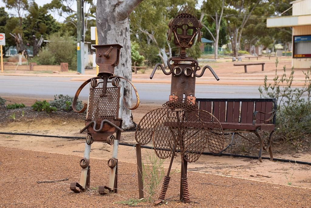
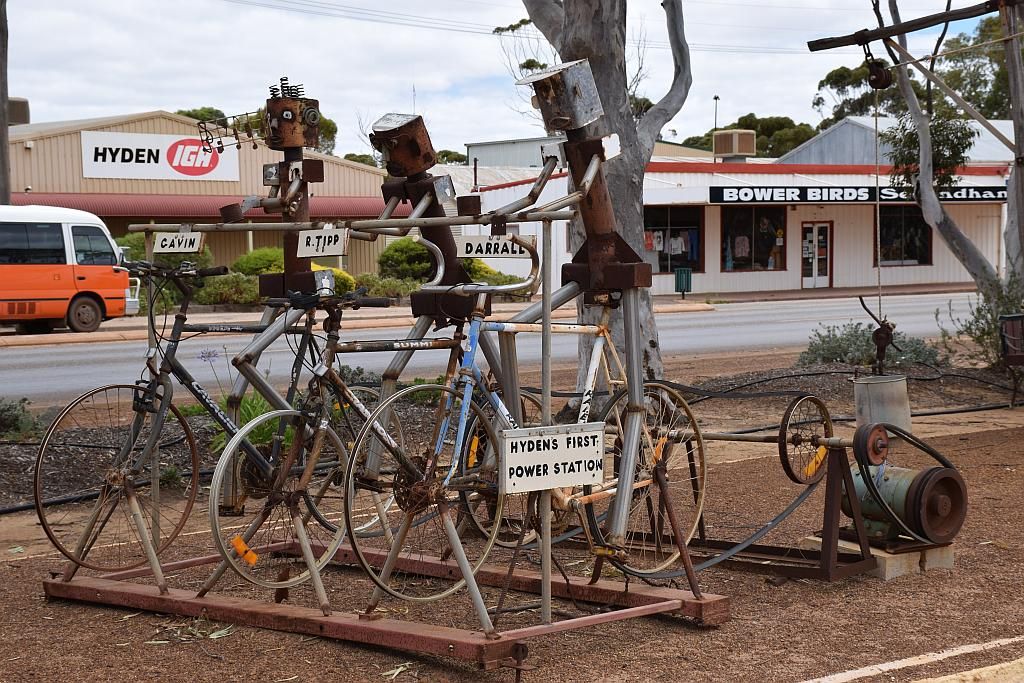
An early start on the 10th, I hit the road at 0600. Target base camp was some 850 Kilometres away at a place called Alexander Bay, slap bang in the middle of both Cape Le Grand and Cape Arid. The perfect central location for checking out both places. First up, some breakfast at Brookton followed by a wee stop at Hyden and check out some of the sculptures:
Next after that was lunch out of the car fridge at a rest area in Ravensthorpe, and a fuel stop in Esperance with a quick look by the foreshore. Pretty soon after that and I was on my way again for the last hour of driving base camp.
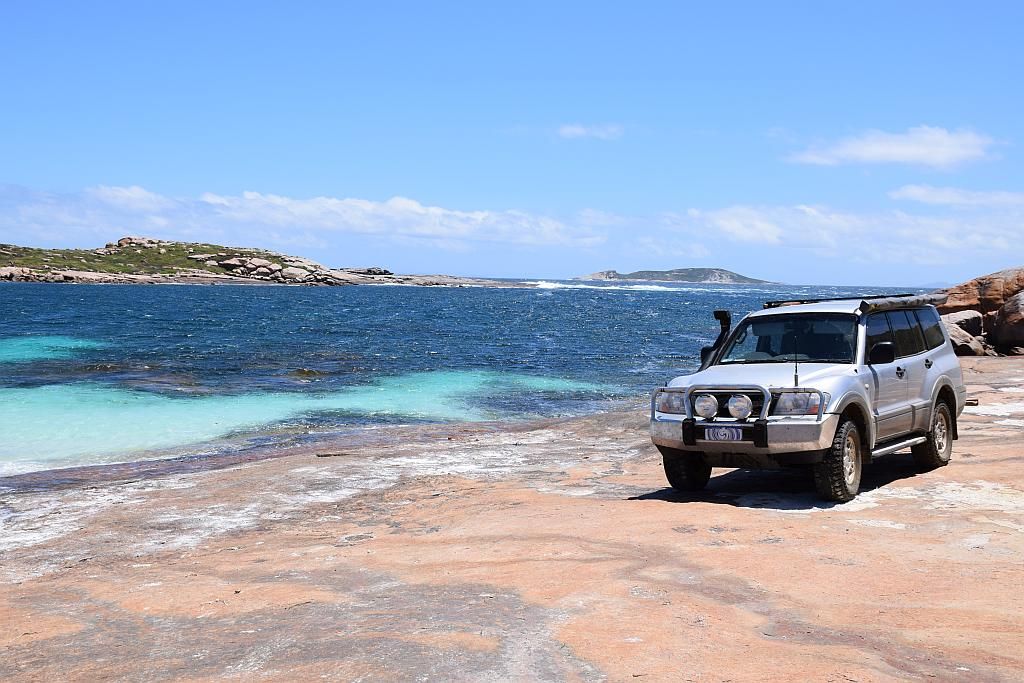
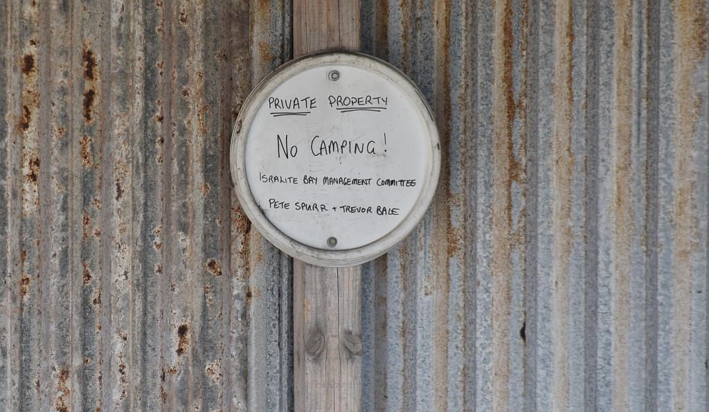
Destination, Alexander Bay. Although it was an untested site for me, I found an isolated place away from the main campsite. Hindsight would prove to me that this site was to my mind, the best on the whole South East coast. So it was a win from the start.
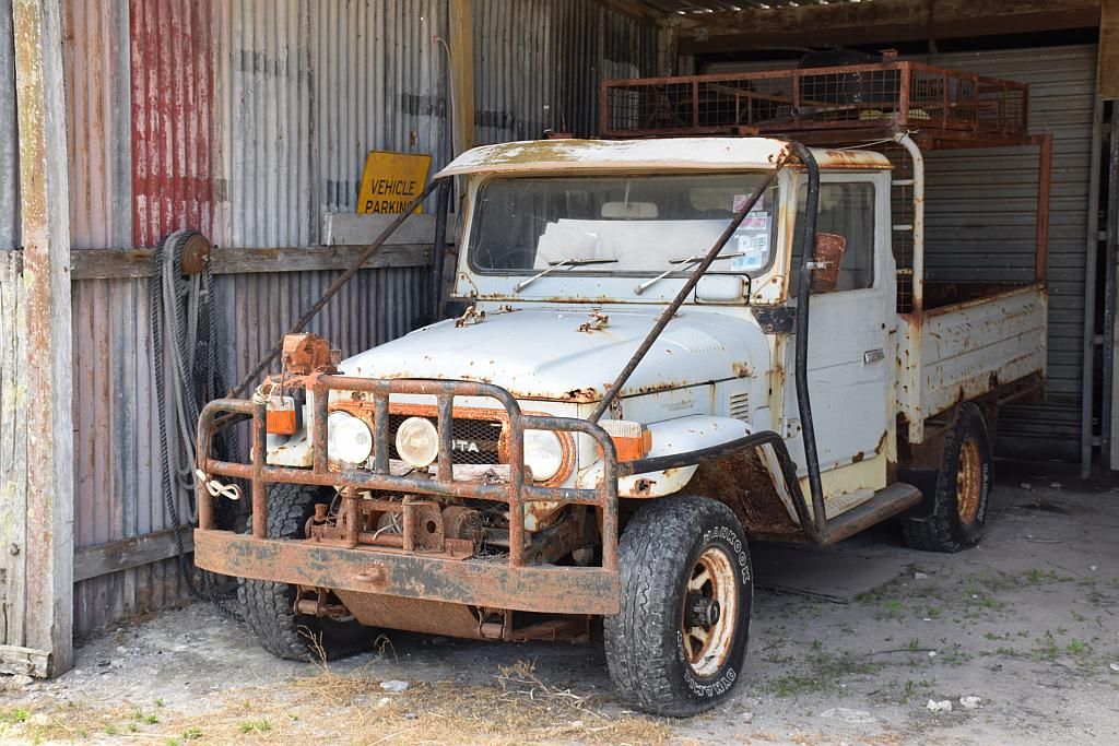
I didn't arrive to camp until 1630. So there wasn't much left in the day for anything. A basic set up of the camp, prep and cook dinner then relax for a couple of hours to some tunes and a glass or two of red. I recently acquired an android tab. Some pics in here are from that. It was the easiest way to get pics onto facebook to let the family back home know what I was up to. No doubt annoying those on my friends list that had to endure my daily upload. I have since my last posting, updated the trusty old Olympus UZ-770 to a Nikon D3300 DSLR. So I look forward to hearing of any improvements or otherwise of my pics from prior entries to this and latter posts. So much to learn with this new DSLR. I have mastered the art of "selfies". I ordered a remote with the new camera. This makes selfies a breeze. Pity the readers of this blog from now on.
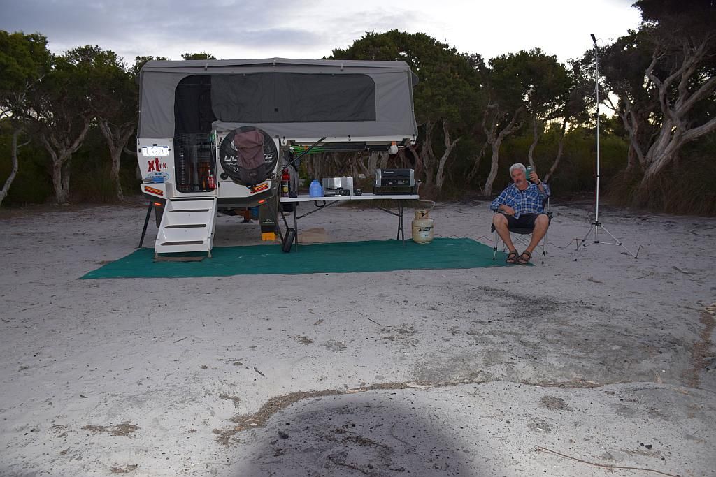
So day one was done. A long 10.5 hour drive. I decided to spend the second day in camp finalising my set up. So there is not much to report in the first two days of much substance. The beach was superb, but as time went on, I found just about every beach on this coastline was the same if not better. A few shots of day 2 camp, set up for the better, and yet another breakfast selfie:
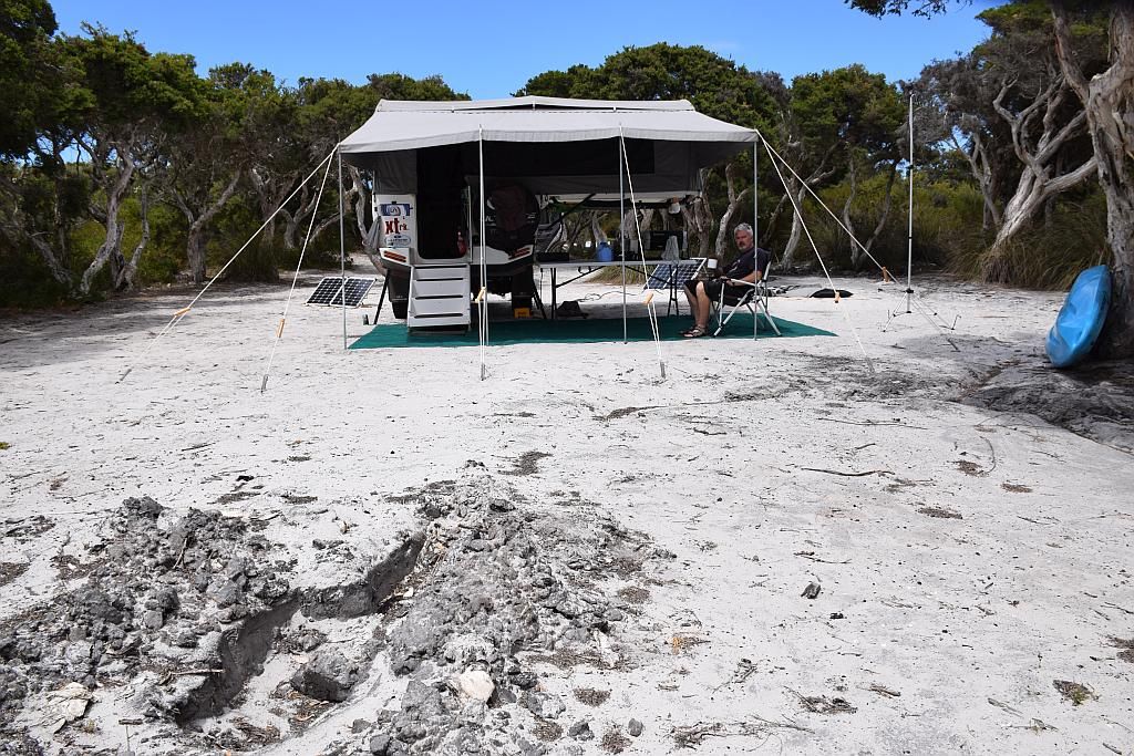

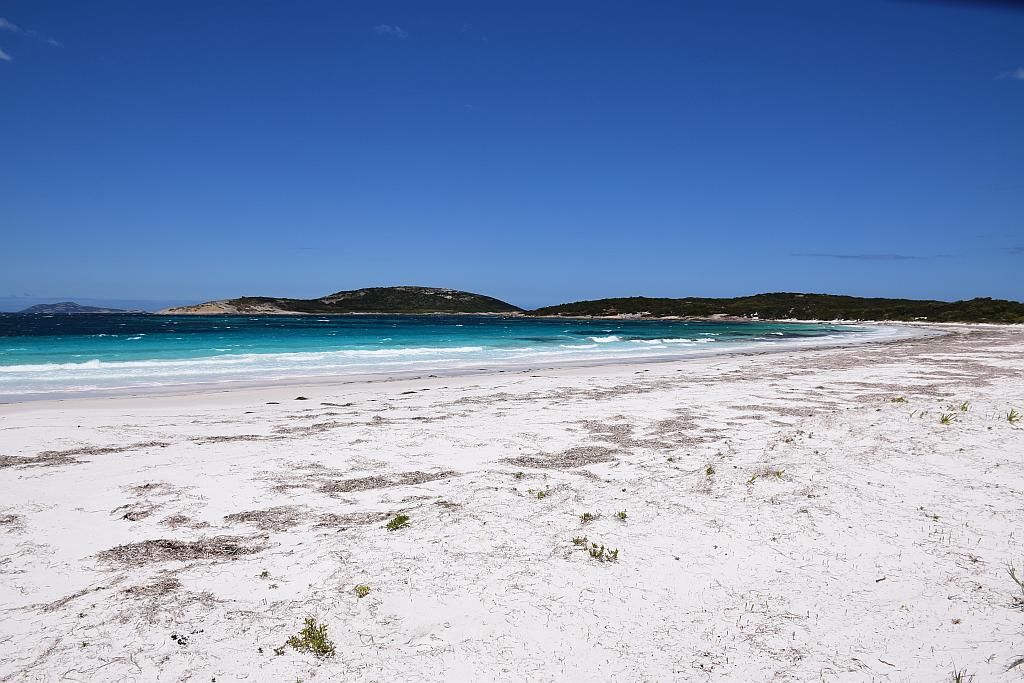
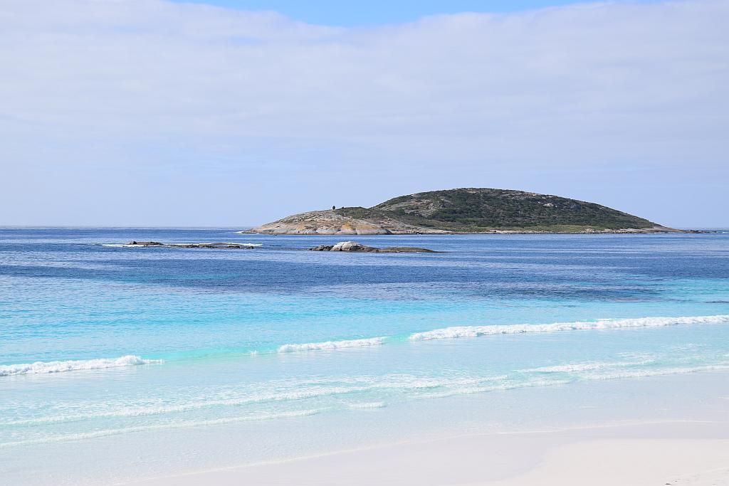
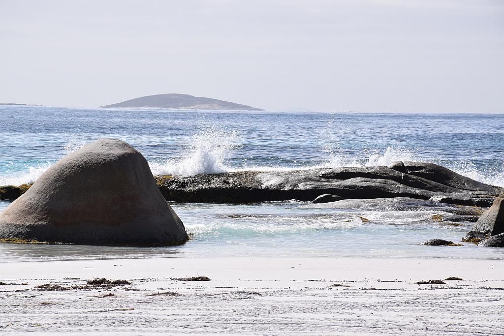
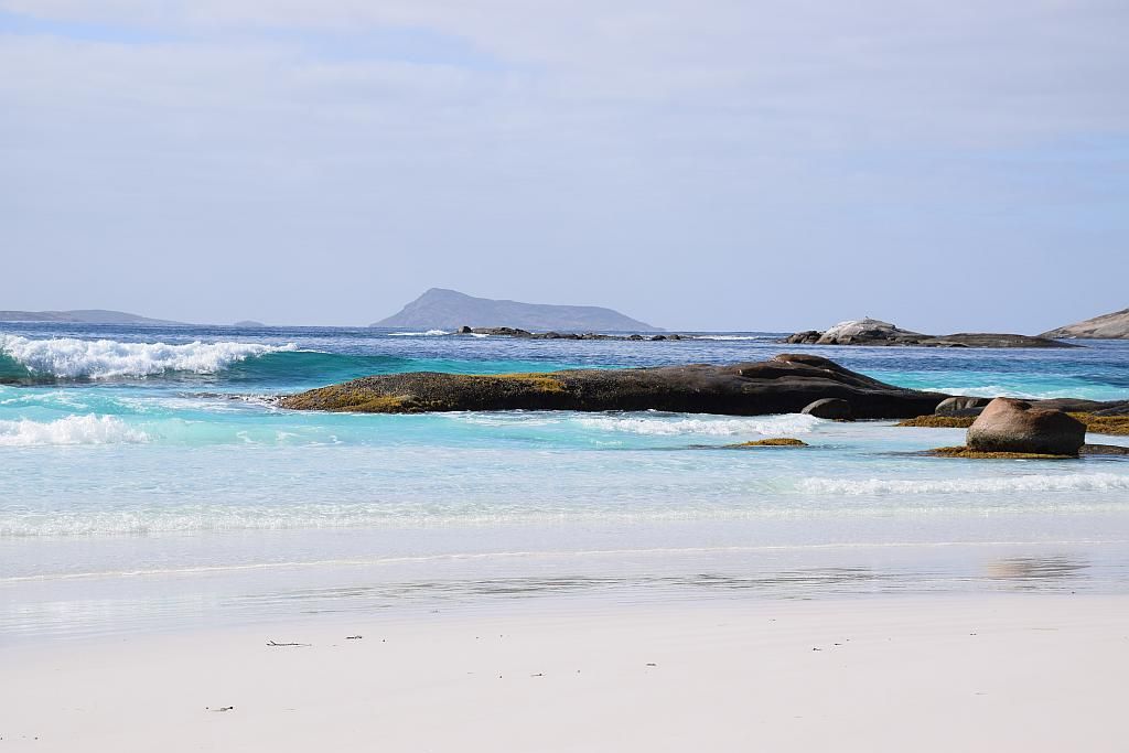
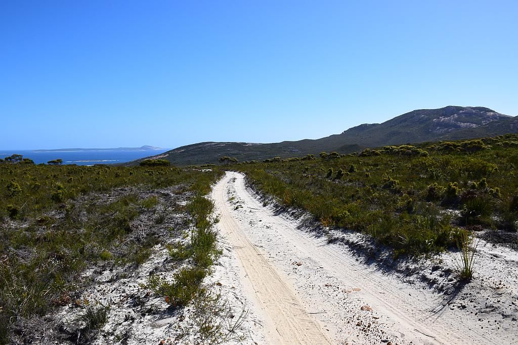
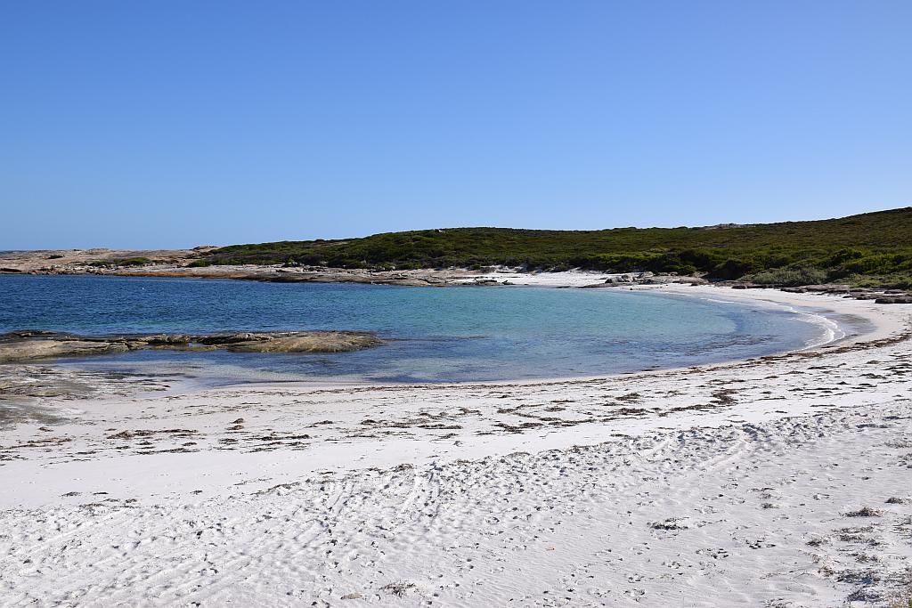
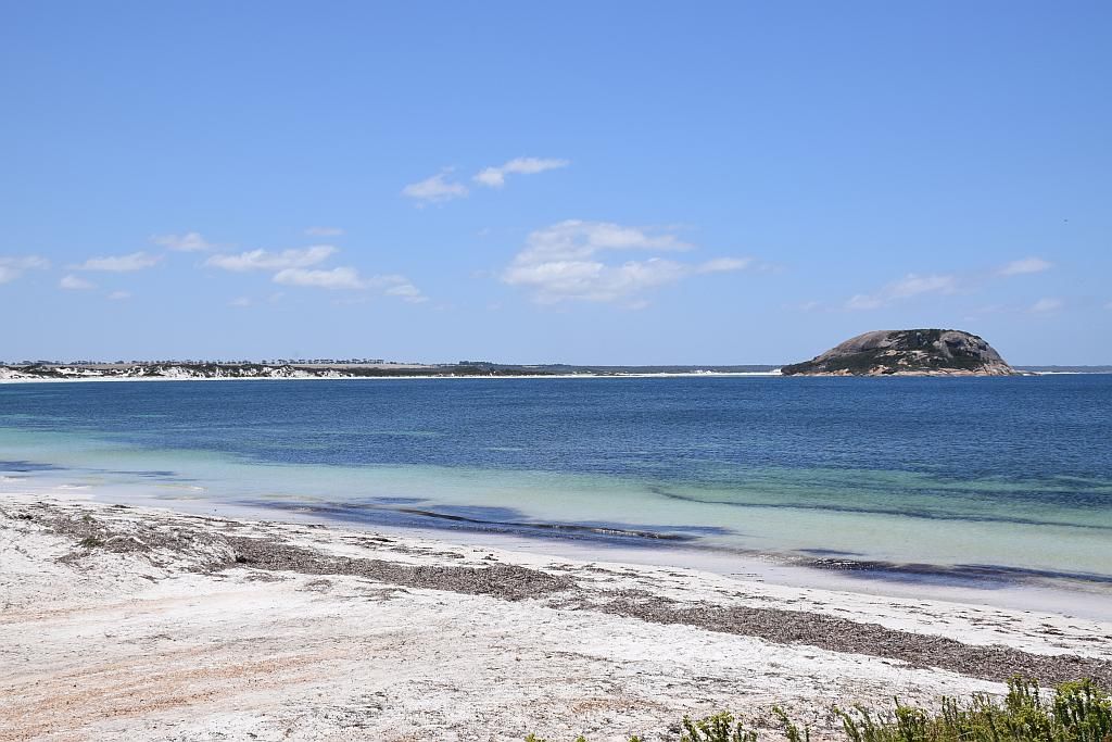
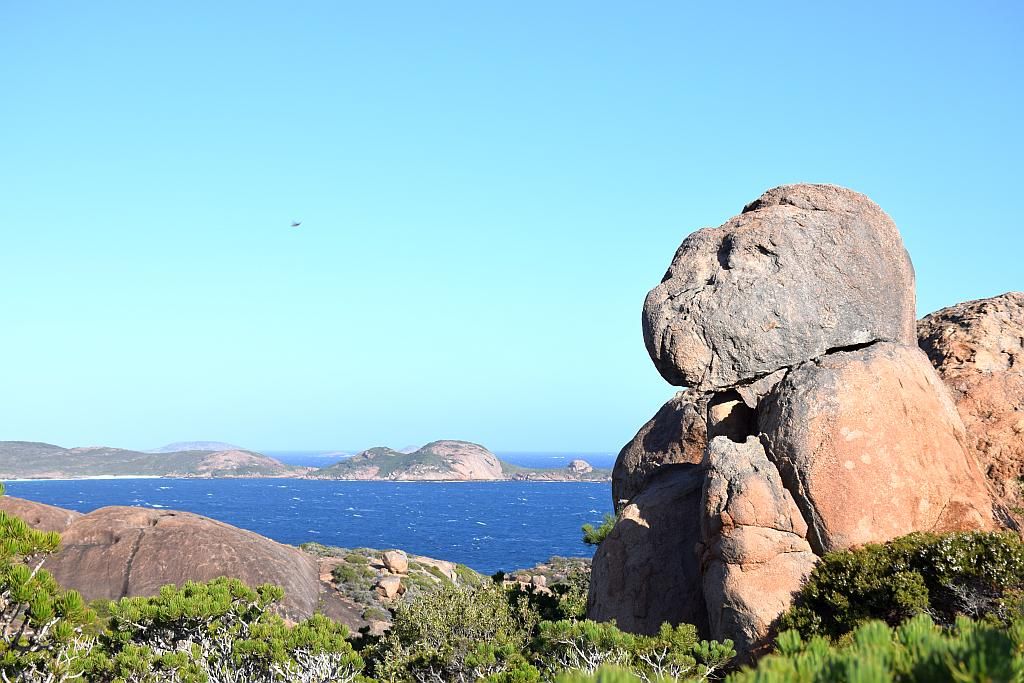
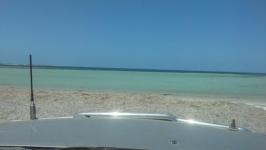
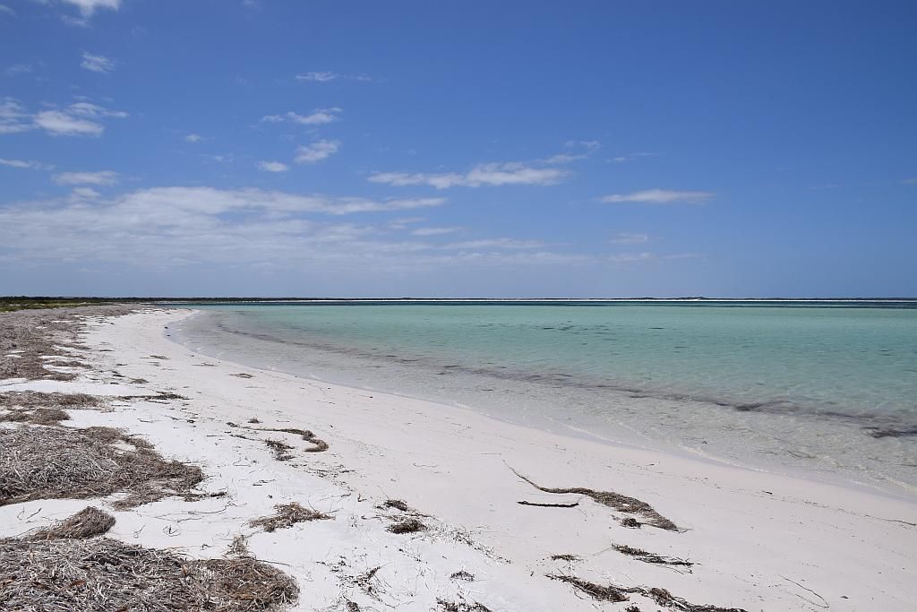
And some selected shots from Alexander Bay itself. The beach about 100metres from my camp:


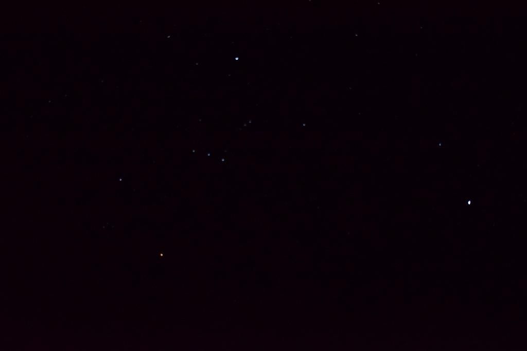
Some night shots from camp. The good old saucepan, part of the Orion constellation, on one of the less cloudless nights (just playing with the new camera -Its not like I had much to do anyway):

Two days down and tomorrow will be the start of explorations of the area.
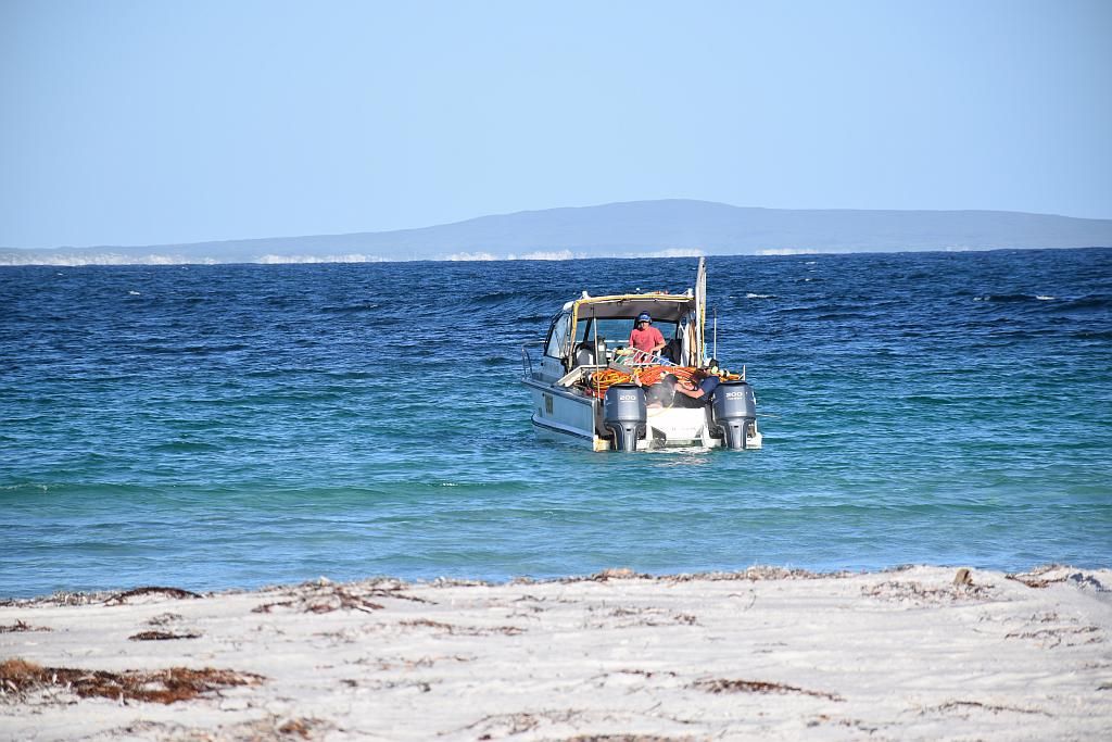
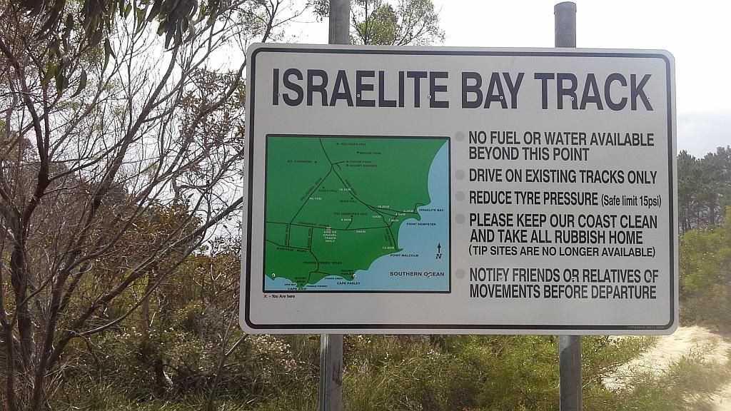
So I wake with the intention to head out to Deralinya Homestead, pick up my first cache and finish up with a second cache at Israelite Bay. But I am torn. The wind has finally dropped off and the ocean is ripe for me to yak to Ben Island (the reason I took the yak with me):
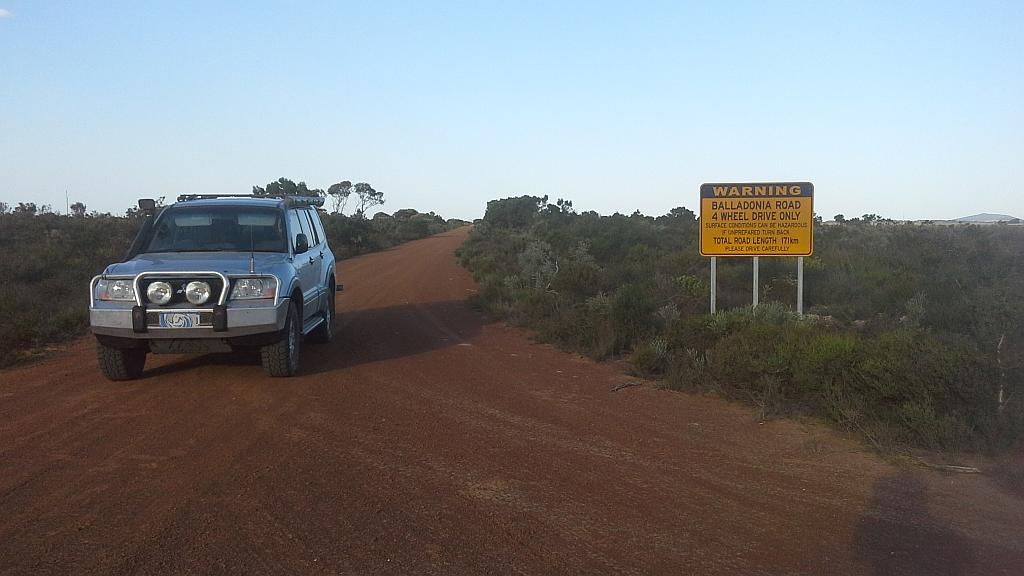
But I take the option to go inland over the yak to the Island. I have done no research before hand on what condition these tracks are in, so its a suck it and see moment. I decide to go up Parmango Rd to the Homestead, cut across to Balladonia Rd and turn off at Gora Rd for Israelite Bay, finally coming home by the Israelite Bay track.
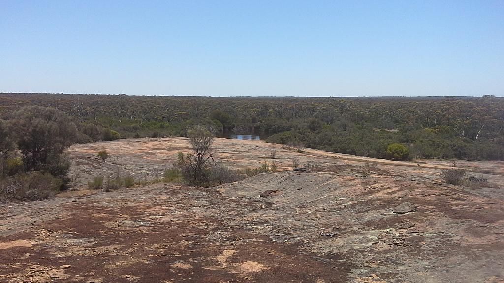
I leave camp about 1000. This seems to be the common time I tend to depart. Whilst I wake early enough (about 5am most days I'm here), I tend to struggle to get out of bed before 0800, cook breakfast and get going at any decent hour. I am on holidays after all. And it is a good 5 minute walk to the dunny every morning in the main campsite. The Parmango Rd is excellent. However, you can see where Esperance Shire boundary finishes as the road deteriorates from that point on. Just a bit rough, but still able to maintain 80odd Kilometres/hour on the rougher section. I spot a marked rock on my map and look for track access. I find an amazing camp site among the Salmon gums. Lots of fresh water as well in a swampy depression. It has the hallmarks of being very snakey country though. I climb the rock and am amazed at the sight of distant ranges.

Also on top, I find a benchmark. Not far from the bench mark is an old carved post with the markings R/V 122. Taking that to be a mile marker for something. I leave the rock, wondering how old it may be, what its directing to and why it is there. (P.S. - I check maps once home and see its about 192 Km's by track back to Esperance, which incidentally converts to 122 miles. So I guess I know where its referring to. But what does the R/V mean? Was Esperance known by another name in the early years? One part of the mystery solved, a couple to go.)

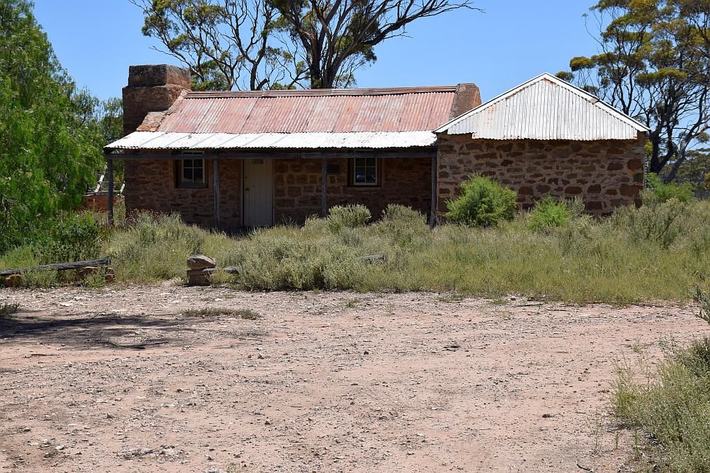
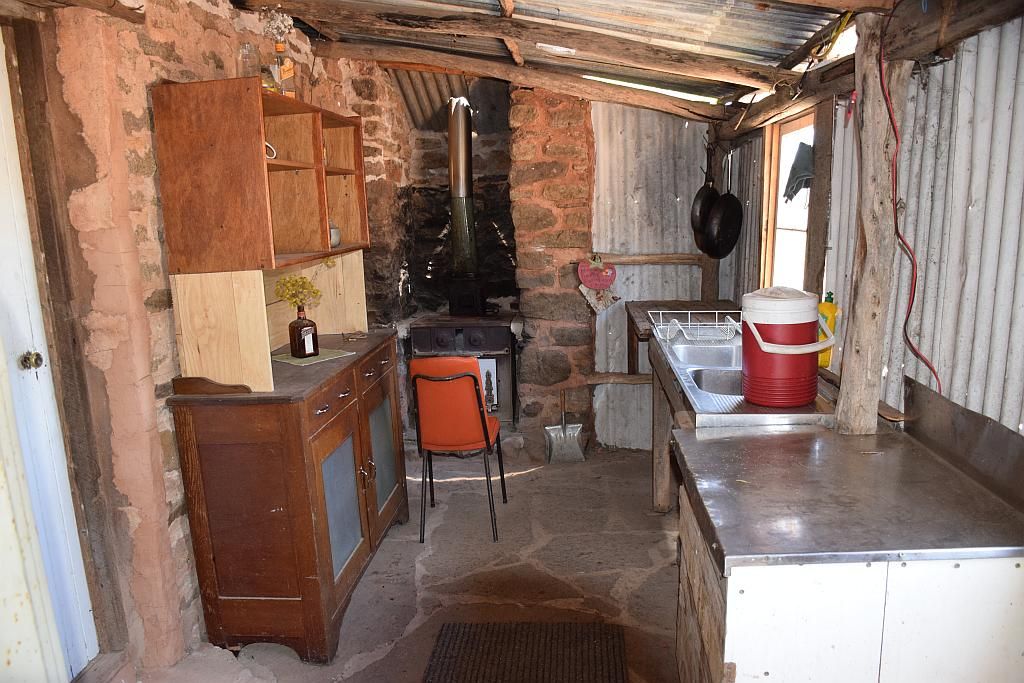
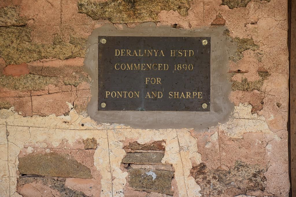
From there its a short 7Km hop onto the Homestead. That turns out to be about 80 Km's from Balladonia. So at this point, I am well out in the boonies. Its turned out to be quite a hot day, the Paj telling me it's in the vicinity of 35 degrees. The flies are getting friendlier as the temperature rises. The march flies were biting hard and often as well (the March flies were certainly troublesome for the whole trip, wherever I went). It has taken me about an hour and a half to get here from camp. The homestead from the outside was extraordinary, internally, it was even better, fully furnished even. 12V lighting throughout. All outside doorways were buzzing quite loudly with the swarm of blowflies gathered in the coolness. I'm surprised by how cool it is inside. The tin roof certainly isn't high nor insulated. It can only be due to thick stone walls and floor. A few days later I learn that there was a python that called the kitchen home. Unfortunately, I didn't know about that at the time and I missed him. Lots of pics here of the site. There is plenty more I haven't published. Guess you have to be happy about that!


So I bag the cache, make a roadside lunch and hit the trails again, the goal - Israelite Bay. I have not seen a soul since I arrived in camp 2 1/2 days ago (although there were a few people camped in the main camp site, I hadn't seen any. The only trip I made to the main campsite was for the morning constitutional). So I take a station track from Parmango Rd to Balladonia Rd. A distance of about 7 Km's. Half way down this track I spy dust in the distance between the trees as its fairly wooded with salmon gums here. So I wonder, is it someone up ahead or is it the wind. But the wind was light today (for a pleasant change). I gradually creep closer to the intermittent dust and discover I have company. A couple in a Colorado towing a Wandering Star Bushmaster camper.
wandering star
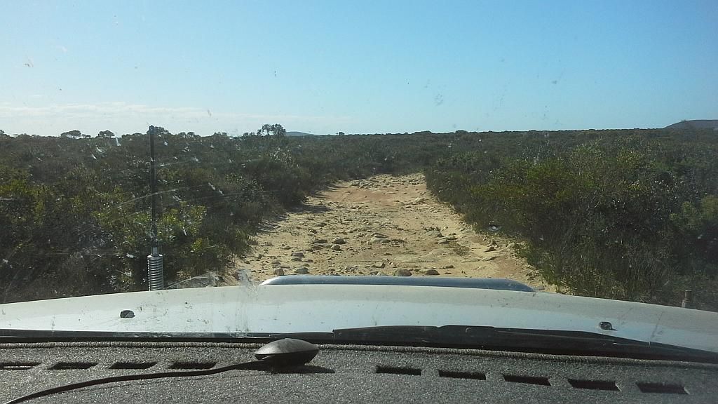
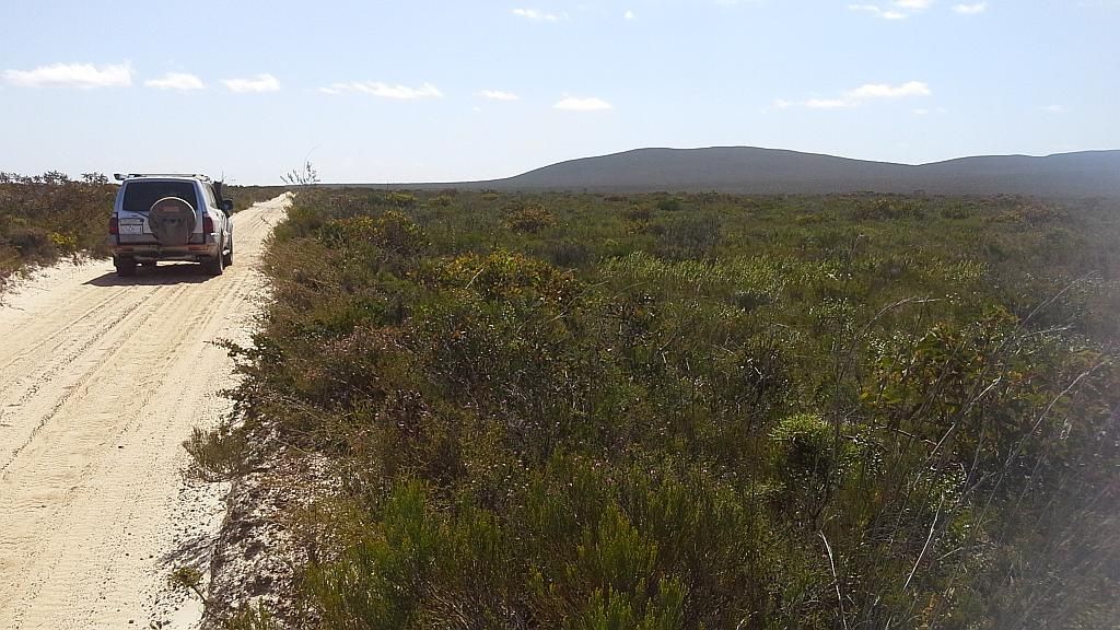
Eventually I close on him and now my speed is dictated by trying to avoid his dust. I hope at Balladonia Rd he turns left, because I'm going right. Unfortunately he turns right. I make an attempt to contact him via the radio to ask if I can get in front. There is no reply. So for the next 30Km's, I just have to suck it up. There is nowhere to pass. I stop off at Juranda rock hole to build a bit of a dust buffer between us. All I can hope for is he pulls over at some stage, which he finally does at Pine Hill. The road is certainly a little rough. Lots of limestone rocks, closed in vegetation (I bent my FM radio aerial on some vegetation), a few washouts and an average speed around 30 odd Km/h. So it was certainly was harder /slower going than Parmango Rd. But at least I can continue dust free now (dust free in front anyway, dust at the rear is another saga yet to unfold).
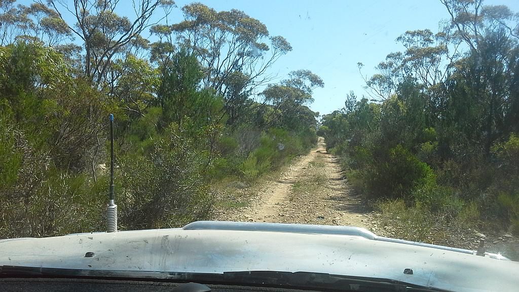
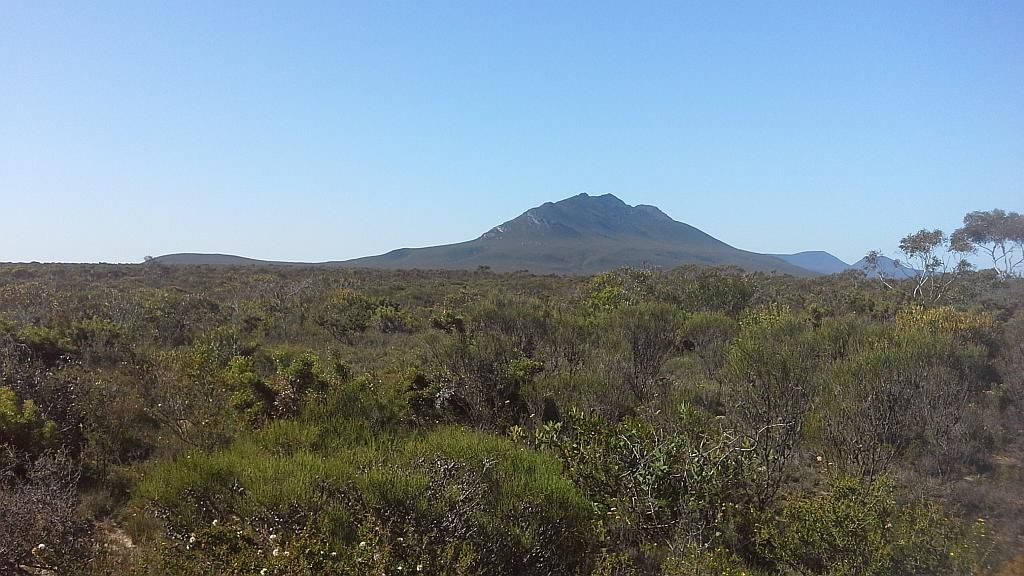
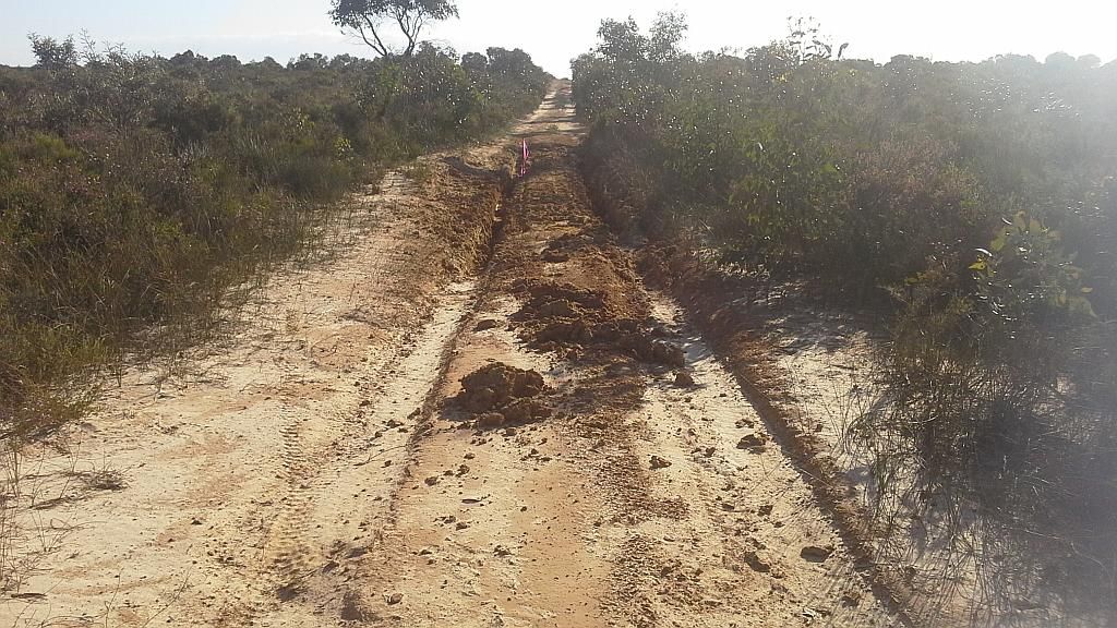
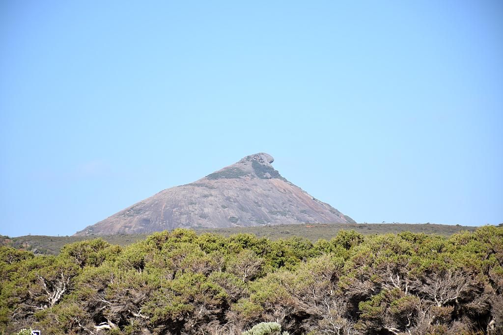
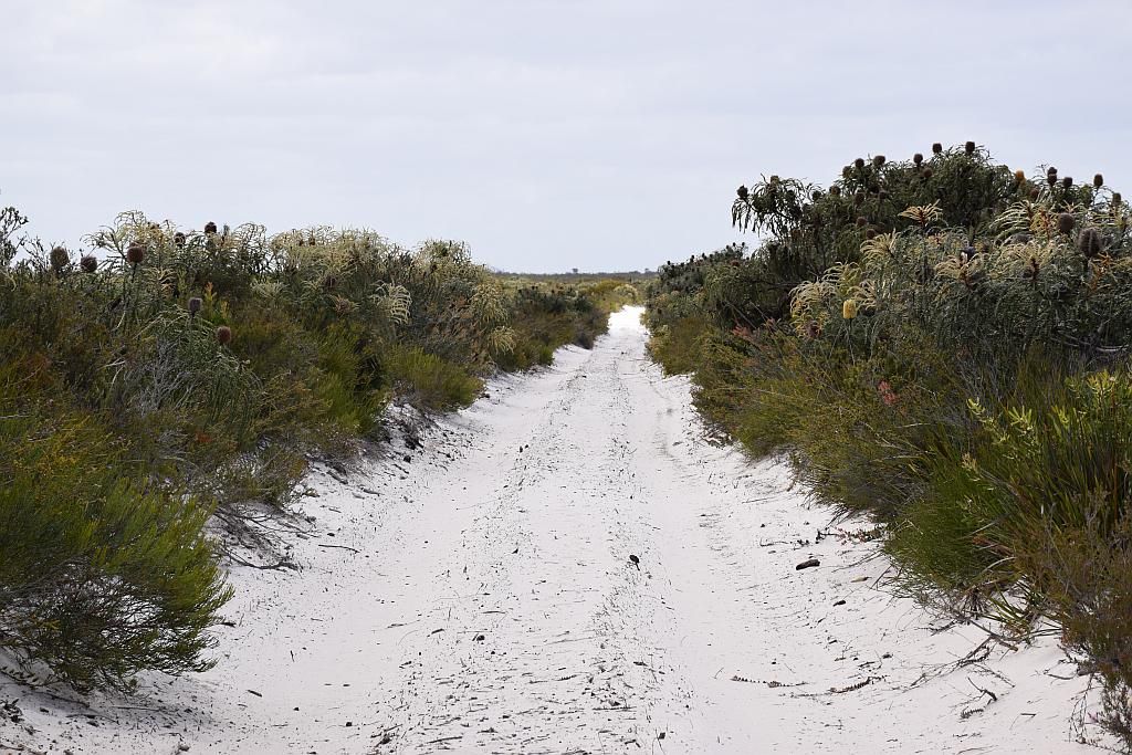
I have a lack of photos in this part, mainly due to the conditions of driving. The track pic above is not an example of the track as described below. Lots of gear changes between 3rd down to 2nd and the occasional 1st gear bits. It takes me another 40 minutes to get to Gora Rd (the track to Israelite Bay), a distance of 18 Km's. Mt Ragged looks spectacular from a distance:
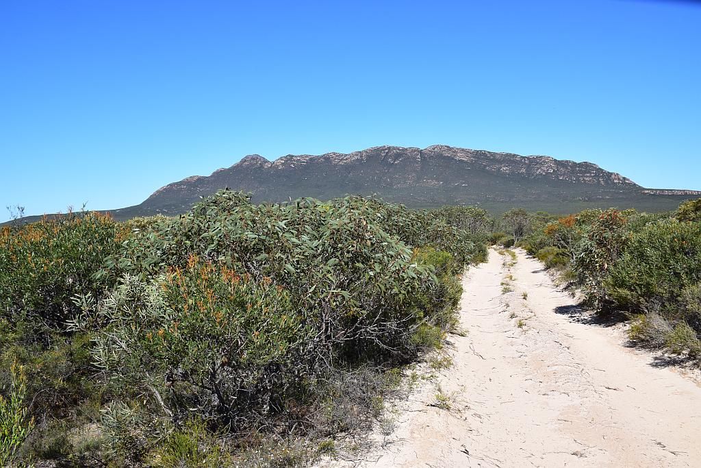
The Gora Rd looks good at the start. Spectacular too as its almost at the base of Mt Ragged. A sandy track in which the vegetation closes in not far from the beginning. It would be a major pain should one meet an oncoming vehicle, the Banksia lined track being impenetrable for a turnback. But it soon turns to limestone rock. And its mostly 1st gear stuff. Very slow going. I go down the track for 1/2 an hour before I decide on a turn around. I averaged about 20Km/h. I suspect the track will change at some point to sand and claypan, but its hot, the driving is fatiguing and I wont make Israelite by night fall at this rate. So I'll do Israelite another day, another way. Anyway, I was sort of over it by now and looking for base camp - in need of a cold beer and a beach. (seems I never did take any pics of those rocky sections, unfortunately)
Little did I know that the Balladonia Rd also makes a marked deterioration at this point. More 1st gear rock hopping to come and for some distance. I question myself in regards to lowering tyre pressures. Whilst it may improve comfort levels, it also exposes more sidewall to the sharp edges of limestone. But less sidewall pressure encourages flexibility over penetration. Oh the conundrum. As it's now 4pm and I'm still quite some distance from home, I decide to leave them alone. Its stop and go stuff, short sections where you can build some speed, but then back to 1st gear rock hopping. Eventually it turns to claypan and its associated bog holes with chicken tracks around them.
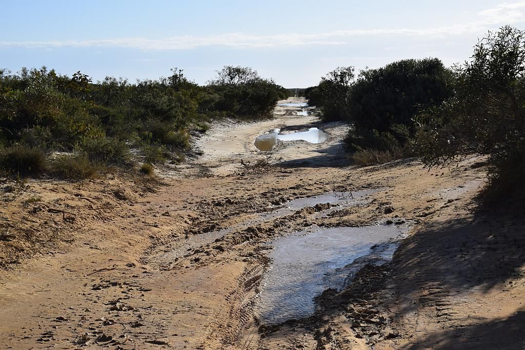
It finishes up being just a sandy track. Its now late afternoon. A few times I stop, I spy some big boomers not far off in the scrub. The track being below the level of the very dense vegetation, driving into a setting sun, with known hoppers floating about, I am concerned about putting the skippy flicker to use. But uneventfully I complete the Balladonia Rd. At last I am outa there. The last 47 Km's has taken me another 1Hr 40 Mins. Glad its not me towing that Wandering Star. So It took me 1.5 hours to get to "Deralinya", but 5 hours to get back to camp via Balladonia Rd. From "Deralinya" to the end of Balladonia road, a mere 4 hours to traverse 115 Km's, an average of 29 Km/h. At the end of the day, it was still an enjoyable drive, just slow, tiring and hot - (apart from damaged aerials and bush stripes, a dented roof from a tree branch that my roof bar deflected and a small dent in a guard due to the closed in vegetation).
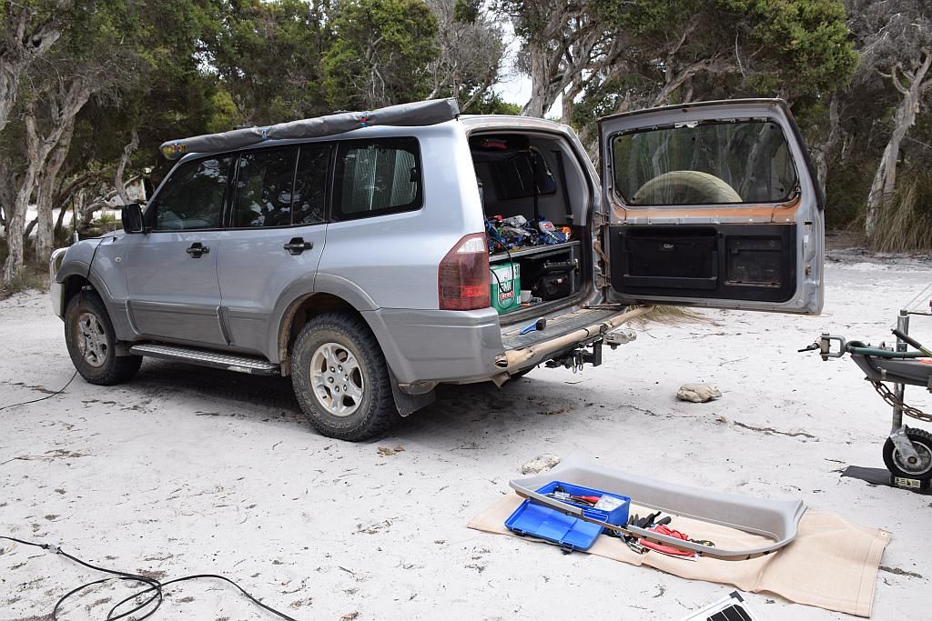
I eventually make camp at 1830. Only 300Km's for the day but worn out, I cant be stuffed cooking dinner, but no one is going to do it for me. I crack that beer with about 1/2 hour of daylight left. But the day 3 hits just keep on coming. I have suffered the dreaded Pajero - "rear door wont open due to dust ingress" ailment - And I cant be stuffed tonight to be honest, tomorrow is another day. But it does highlight an issue. Had I staked a tyre out there, all my tools are behind said door. With a cargo barrier and a rear storage shelf fitted, I'm pretty well stuffed at that point in time. Also behind said door, a can of lube which would/could solve the problem. Oh the irony. So I pull a can of lube from the camper, lube up the handle (which incidentally wasn't the problem) and leave it till the morn.
Morning comes around and again I'm awake at some ridiculous hour whilst on holidays. But this bloody rear door is playing on my mind. I don't want to get up, cause I don't want to know the implications should I not be able to free it. I lie in bed thinking of different scenarios and what I can do should I not be able to solve said stucko door. I snooze on and off and eventually face the music around 1000. I have made a decision in my bedtime thinking pit that today is going to be maintenance day. I make a coffee, have some breakfast and try to de-stress before tackling the inevitable. At this point I spy the rear end of a fat snake about 10 meters away. The front section hidden from view in the undergrowth. Black as the ace of spades on top, with a cream and orange striped undercarriage. I believe it is a Tiger. Its girth suggests to me its pretty big. I grab the camera and it slithers off away from view. I wait for a bit at the clearing in which direction it was heading, but I was never to see said beast again. Of interest was the wagtails in camp. It was a great way to just sit and relax with a cuppa watching their antics in the mornings. In this incident, one flew down and landed about 3 meters from the snake. It just sat there, staring at the thing. In fact, it was the wagtail that brought my attention to it. It was a memorable moment that one.
Coffee/breakfast down and courage levels up, I try the door handle and with a bit of yanking, open comes the door. Now that is a relief. It wouldn't do that last night. So off to work I go.
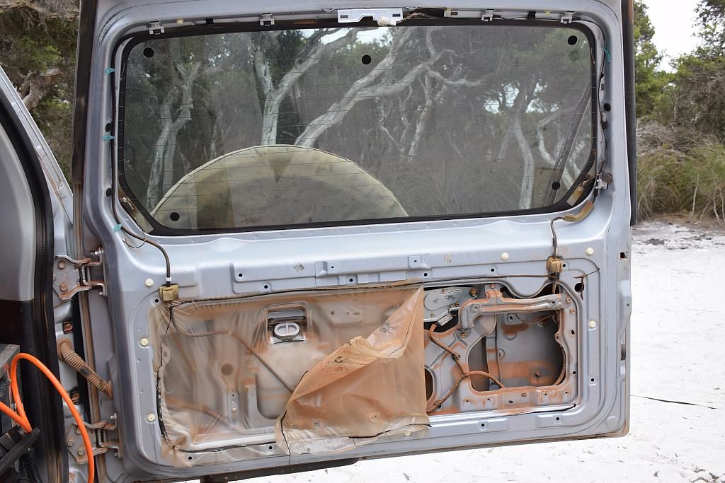
I find the internal mechanism, although thoroughly coated in dust, to be not too bad. Mind you a good de-dusting and lube up wont go astray. But mechanically, all the linkages are working fine. The problem is as always has been, namely the locking latch. This tends to get caked in dust to the point it is hard for it to rotate to unlock. There is no way in hell I can pull this out on site for a complete clean out. Its tucked away in a far corner, linkages galore all over the place, remote locking motors in the way and to top it off, in a confined space where you just cant see. So I de dust the internals and lube the latch as best I can. I only have a dry lube on board. It really needs a wet lube re wd40, crc5.56 etc. So I make do with what I have and start the reassembly process. I have a bush mechanics moment and decide I don't want the issue of removing door trims again, so I'll cut an access hole and cover this with a panel when I get home. That way, next time I need to get access internally, its going to be a relatively simple matter to do so. Once I get the door open that is.

So by now, its late afternoon. I take a stroll on the beach then I come back to looking at the FM aerial. I bent it back straight, but now there is a distinct crease that wont allow that section to slide in on its mating part. So I waste some time manipulating said crease with a pair of pliers. I get it as best as I can, then finish off by filing the crease. Eventually I get a working aerial again. Note to self: when in tight country, turn the bloody radio off.
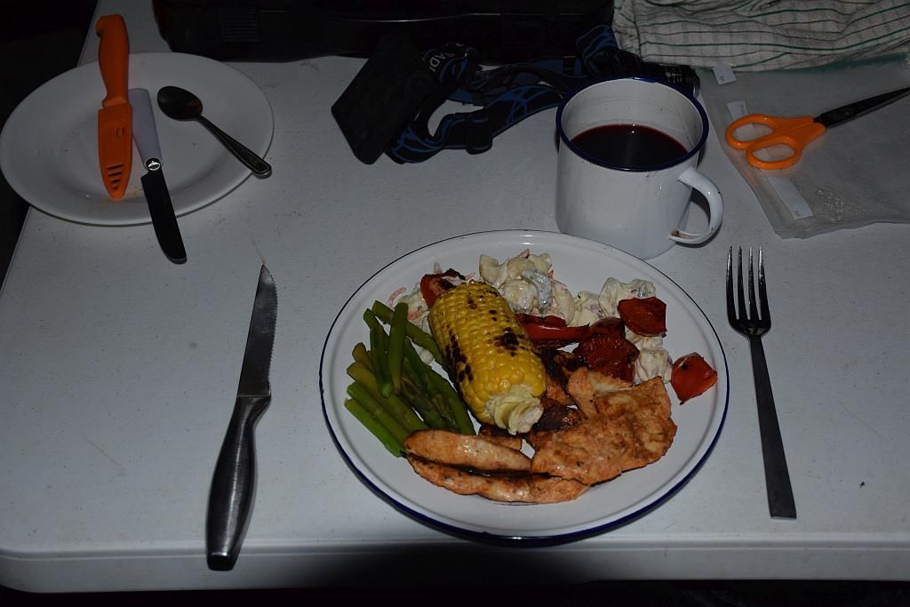
So whilst I have sort of wasted a day in camp, Its been productive too. I finish off with a well cooked meal: Peri-peri chicken, potato and pasta salads, corn, char grilled capsicum and asparagus. I might be camping, but one doesn't have to rough it.
In the night time light, I catch something hopping across the sand. I get up to investigate and find its a Western Pygmy Possum, all 3 inches of it. It makes its way to some grass tree (exactly where said Tiger Snake was earlier in the day). I grab the camera and try to get some shots. But I struggle to get focus, both in auto and manual. The little bugger was hyperactive, which didn't help. Anyway I managed to get a fuzzy shot off before it disappeared into the ether.
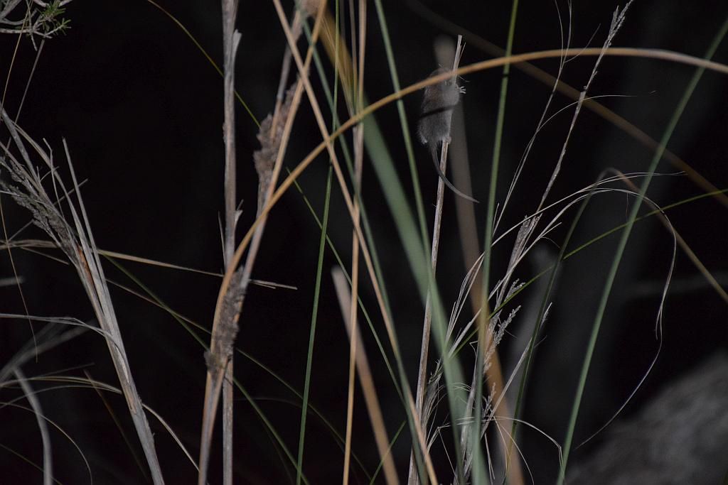
An hour or so later, once the camera had been put away again, said Possum runs straight through my camp, about a metre away from my feet. Never to be seen again. It was another special moment.
Day 5 and I decide to head West to check out Cape Arid. But before I do, in between coffee and cooking up a breakfast feast, I head down to Alexander beach for a play with the new DSLR
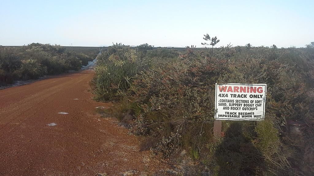
So 1030 comes around and I hit the road. Entering the park, I check out the information hut and pay my dues. I then head off for the Thomas River campsite and another cache. I stop in and have a chat to the Rangers re track conditions and Israelite bay. They are very helpful and tell me the Israelite bay track is just soft sand and they have reopened the Telegraph track a few days prior. They re-iterate that If I go, let someone know. But they don't seem interested for me telling them - a nice handball. They asked me if I saw a grader whilst out on Balladonia Rd the other day - pulling the piss. I think the only grader this track has seen was by cattle hoof, many years ago when it was a stock route. The campsite has about 15 places, some reasonably large, nestled in among the coastal heath with a nice camp kitchen. Its reasonably elevated from the coast and I wonder how much protection the vegetation provides from the wind.
I grab the cache, absorb the scenery and then head off for the Eastern side of the park, designated 4WD only. I find Merivale Rd closes in on me a couple of Km's from the park access at Poison Ck Rd, so I detour via gravel roads around this section and head on down to Thomas Fishery. For the most part, the track is just sandy. Near the end a few non technical washouts and rock faces have to be traversed to get down to the site.
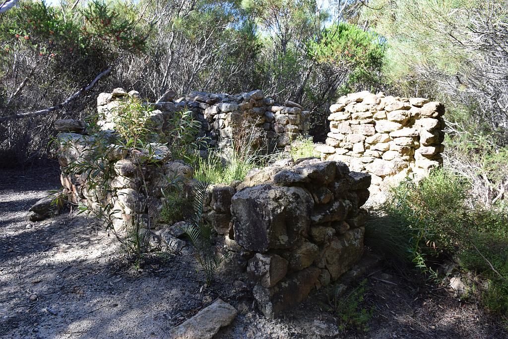
I stop off at a set of ruins on the way "Hill Springs" circa 1905. Down a very overgrown walk track, I make the ruins and marvel at the difference to what I can see now and how an old painting has shown the place it in its heyday in the shadow of Mt Arid. Just imagine from the following pics of the overgrown vegetation, the work that must have been involved in clearing this parcel of land by hand. Pick, shovel and crowbar being the only tools. The property was left abandoned in 1910. That's a lot of work for a mere 5 years of occupancy. Unfortunately only a little remains of the original dwelling. It was consumed by bushfire in 1920.
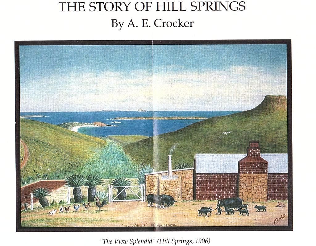
Note the palms in the above painting and what I found on the walk track in, about 50 meters from the ruins. I didn't realise the significance of this until I uploaded the painting pic above.

From the ruins, its just a short hike down to Thomas Fishery. It has a whole 2 small camping spots crammed among the vegetation and a long drop. It's a long way to travel to find its fully occupied. Thomas Fishery was the site of an old whaling station circa 1870. It is here the track changes from sand to a bit of rock hopping. Nothing too drastic.
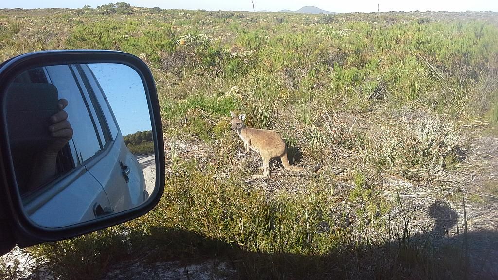
Its now 1630 and the wildlife is coming out to play. The Roo's don't seem very concerned in regards to vehicular traffic, which makes driving conditions a bit more "interesting" Luckily, the speed on this track is only about 40Km/h in sand, so plenty of time to avoid the use of the skippy flicker. Not so on the return trip home. Highway speeds, gravel roads and lots of vigilance required.
I then head East out to Jorndee Creek and Seal Creek camps. A good access road to the area, followed by a sandy track into the individual sites. Jorndee has about 5 places for tent/car camping. I didn't go into the Seal Creek campsite, but from reading I've done since, this is the pick of the bunch. Doesn't that just figure hey.

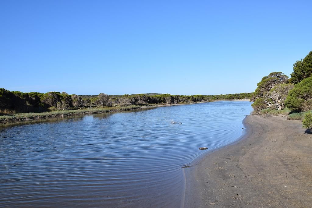
From there it was onto the beach, of which I can not find a name. A large creek exits here at the beach. Maps I have indicate this place name is Sandy Bight, but I suspect this is Poison Creek, the namesake of the road access into the place. A commercial fishing boat has come into shore. I believe its an Abalone vessel due to the hookah hose at the stern. I was taken back a bit when I discovered commercials out here. I wasn't expecting that.
As its now about 1715, its time for the hour long trip back to camp trying to avoid the skippy's. Once out of the National Park and onto the farmland, there is quite a lot of Bunnies running all over the place. One runs directly under the car and somehow misses all four of the Coopers. I think he needs to buy a lotto ticket. Back to camp by 1840, and 250Km's down for the day, its time yet again for dinner, a red and some tunes.
Day 6 and I head out for Cape Le Grand. First stop of the day is Duke of Orleans bay. It has a caravan park which incidentally also supplies fuel. I have been thinking of getting a refuel at Condingup today in preparation for my second attempt at Israelite. But I suspect the fuel price here will be a bit over the top, so I stay with the original plan.
A big bay and obviously another place for beach launching of the commercials:

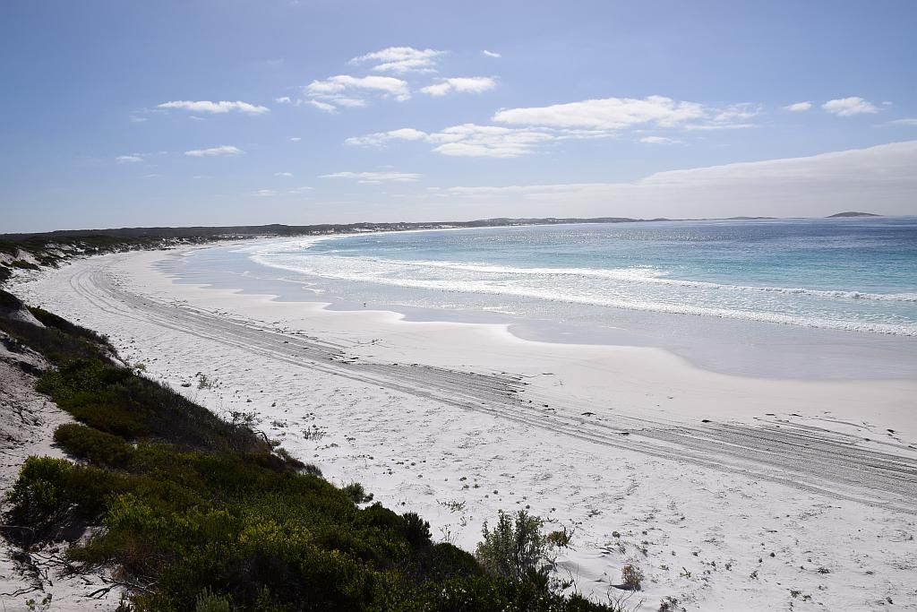
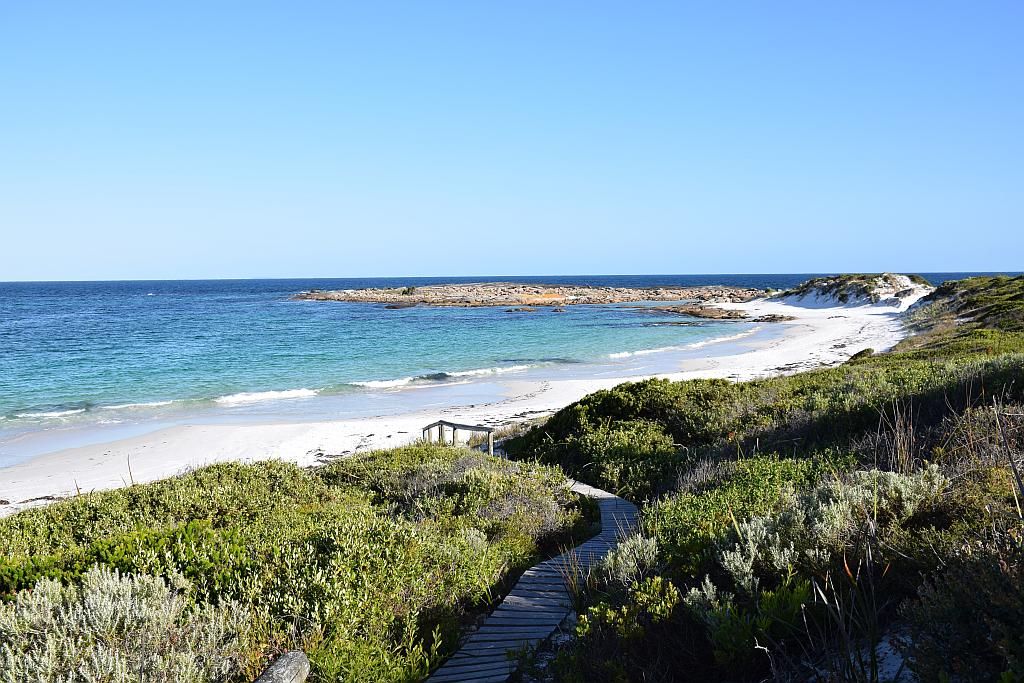
I then head off to Wharton Beach. An impressive white sand beach with good looking surf. At this stage, its probably been the most impressive beach of the lot.

I park up, climb the granite peak for another cache and marvel at the scenery, looking towards Little Wharton, the site of another cache.
Far less white sand scenery, but the contrasting colours of sea, rock, sand and vegetation is just a picture postcard. So impressive, even the locals come down to visit:
Log now signed in the second cache, I leave with a respect for the beauty of the place here at Wharton. I head for the Condingup Tavern for fuel. Only 65L's from Esperance via sealed road, I am shocked to find the price of fuel is 30CPL greater than in town. A rort? May be. I should have checked the fuel price at Wharton Caravan park. I take on 95L and think I might just lash out on a burger. However the menu board confirms my suspicion of being gouged. When I read a burger with the lot was the measly sum of only $19.90, In my head I told them to stick it and walked out with an ice cream instead. I dont mind supporting local economies, but come on, your having a laugh.
I now shoot off to Dunn's Rocks. What a spectacular, isolated place this is. The only thing missing is some camping spots. You could camp on the beach easy enough, but that bloody Southern Ocean wind wont be nice when she blows. I take off on hoof, climbing the granite for yet another cache. A labyrinth of dead end tracks leads me nowhere. Eventually I find a steep un-vegetated path to ground zero. But I search in vain for the prize. About to set a time to declare a did not find, I came across the prize and find when home logging it, I have scored another first to find :) A couple of Japanese tourists have arrived and join me on the granite. I try to exchange pleasantries with them, but in true to form fashion, they are not very accommodating. They ask me "is this Lucky Bay". So I Just tell them its not, go thata way.


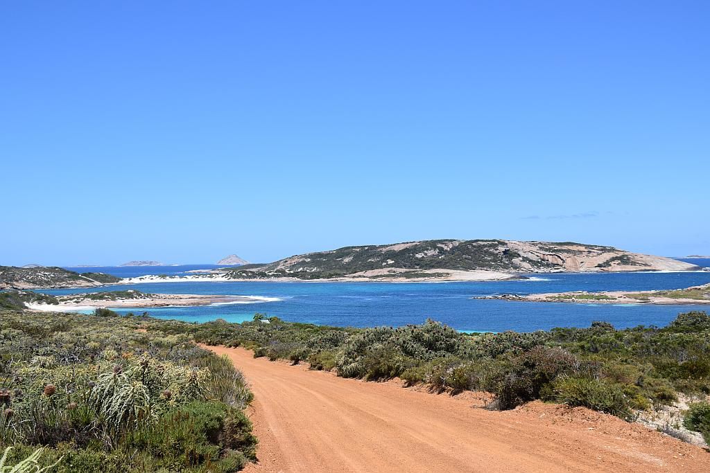
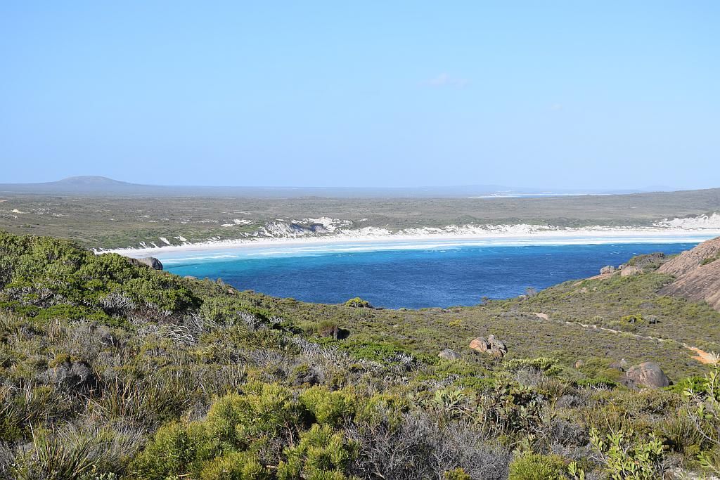
Its now 1515, so I had better get a move on as I still hadn't got to Cape Le Grand National Park, the goal for the day. This takes me another 45 minutes. I check out the Le Grand camp site first up. 15 spots, nestled in cut outs in the vegetation. Looks like an ok spot, but its full - And it's mid week, 2 weeks prior to Christmas and not in school holidays. It has a reputation of being popular and after visiting, I don't know why. That said, the wind was just howling. Everyone was tucked up in their little fox hole, trying to escape the elements. In fact, it was blowing that bad, I have spared you yet another coastal picture. So glad I was at Alexander bay. I climb the rocks and bag another cache, then head over to Lucky Bay. I have no time to climb Frenchman's peak on the way, so you'll have to put up with another photo:
Lucky Bay, fabled as one of the best white sand beaches in the nation, certainly looks the good from a distance. But I wouldn't want to camp there. Admittedly, the campground was full, but they were tucked in tighter than sardines. I'm sure you would hear every snore and fart of a grey nomad from 10 vans away. I climbed the trail and after a bit of searching, I found the cache.
Its now 1700 and I still have two more caches to collect, so I had better get a wriggle on. Stopping in at Hellfire bay, I quickly find the first. Then a short drive and a 40 minute return hike to Little Hellfire, I have my last one in hand. Both of these contained pathtags, so that was a nice souvenir to take home with me.
What's a pathtag you ask?
So its now 1715 and time to head back home. Arriving at 1900, its my latest day yet. Cooking in the dark no doubt.I decide my last day here would be to get out to Israelite Bay, the place I failed to get to on my first expedition.
So I make a conscious decision to get underway early. 0800 in fact. The Rangers at Cape Arid had warned me it was soft sand. Finer than anything I had seen and to allow time to get there and back. I viewed this with some scepticism. The first half of the track consisted of mainly claypans and some harder gravel with crappy corrugations. Numerous chicken tracks avoided the bog holes. Some even had chicken tracks, on chicken tracks around the obstacles. And every now and then you would get a clean run on sand....Bliss!
Once past Price Hill, and down Wylie Scarp, the track became predominantly sand.
Then on past Lake Daringdella (a salt lake), navigation became a bit harder. Tracks seem to lead everywhere. The Rangers told me just to follow my nose.

Crossing salt lakes is always a bit of a worry. The tyre tracks here were a good sign I would be ok:

And then I made my goal. 60Km's of track and two hours later. I found an interesting snippet on the net:
Norman Tindale's book, Aboriginal Tribes of Australia, states "...the European name of Israelite Bay is a geographic label witness to this being the boundary between those who did and did not practice circumcision at the time of the naming of the country by Westerners."
Ouch.
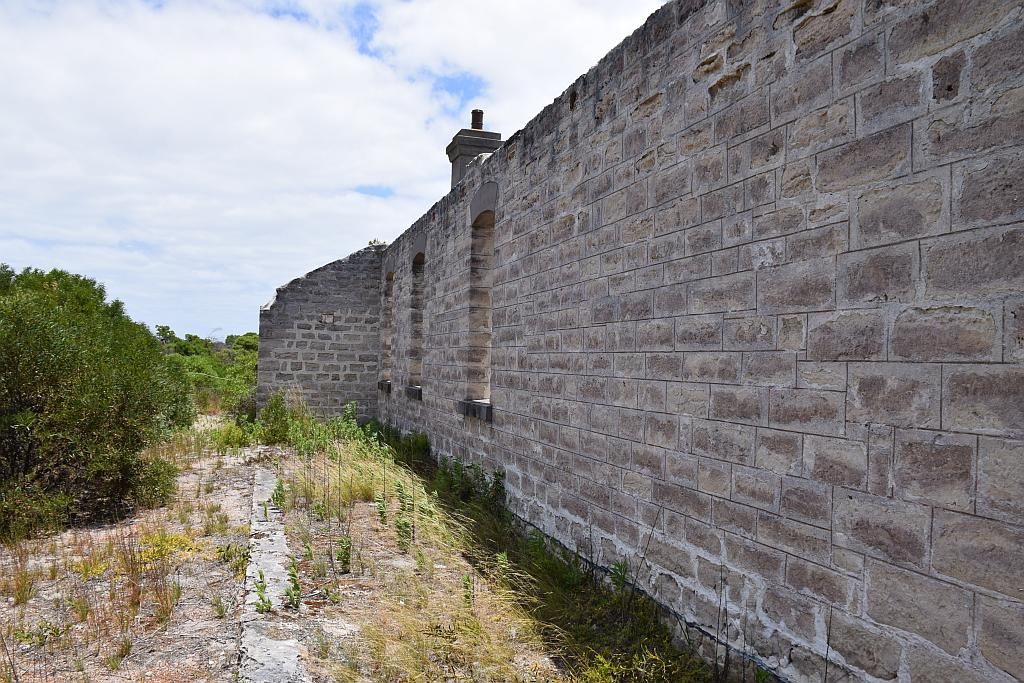
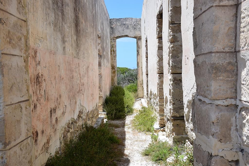
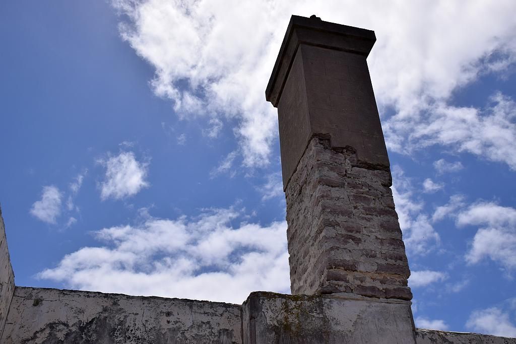
First stop, the old telegraph station circa 1896. This building was remarkable. Such a massive structure, 3 chimney stacks, so many rooms, rendered walls, and of course, it contained a cache. I just marvel at the logistics and skills of constructing such a building back then. No 4wd back then to cart stuff in on. It was all landed by sea. Up to 150 people called this place home at its peak. There is not much evidence of that anymore. Its importance was huge. It was one of the links keeping the chains of communications open between the colonies of Perth and the Eastern States. How I would have loved to see it in its prime.

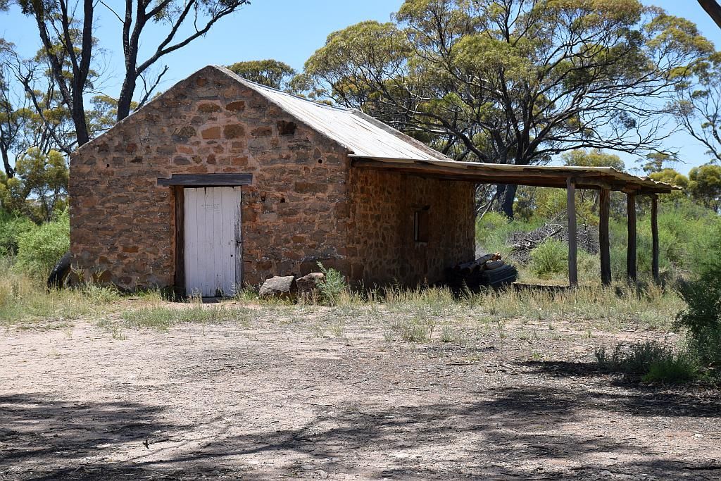
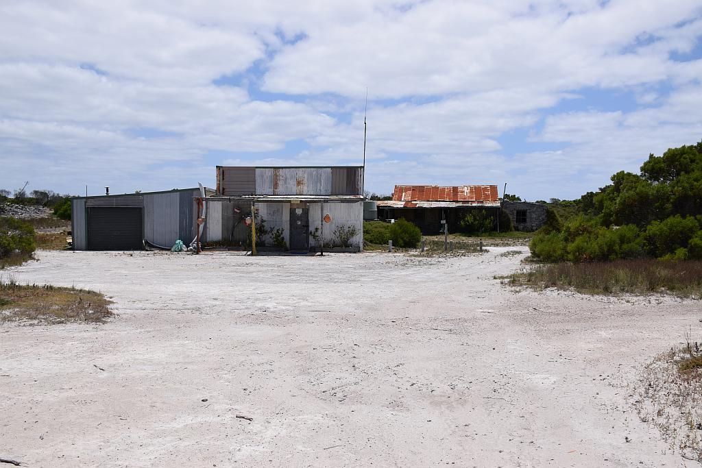
From there, I "followed my nose" and came across an old fishing shack. Part of the structure still used occasionally as evidenced by the car and tinny in the shed and appropriate sign-age:


Of more intrigue though, was what the hell did this trailer hit to bend a 40mm round axle like this?

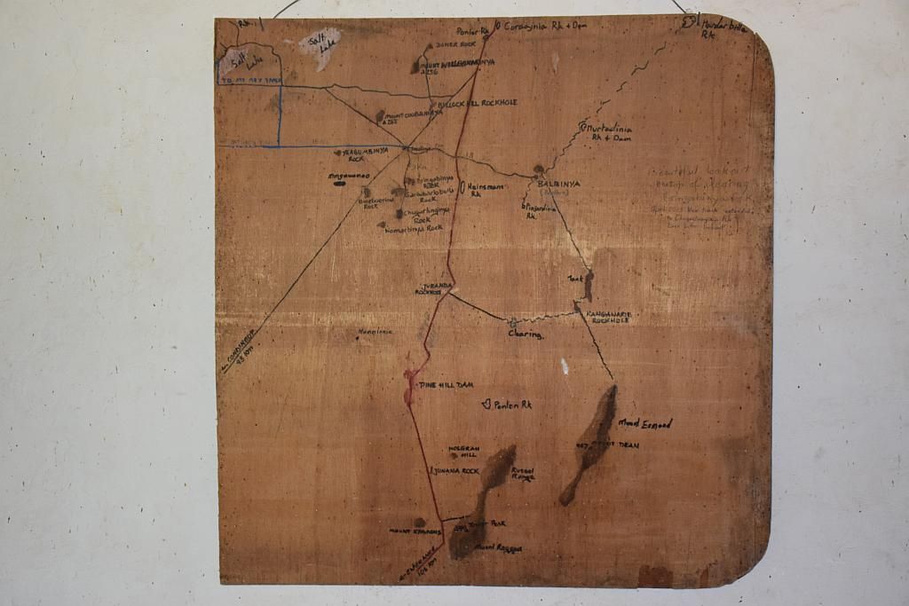
The place just seemed to be full of tracks everywhere. It was only until searching my map folder, I came across my home made photo maps that gave me some idea on track detail.
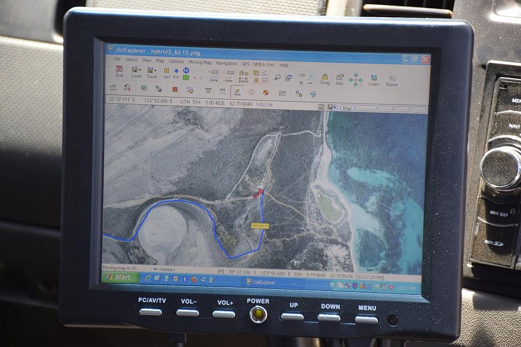
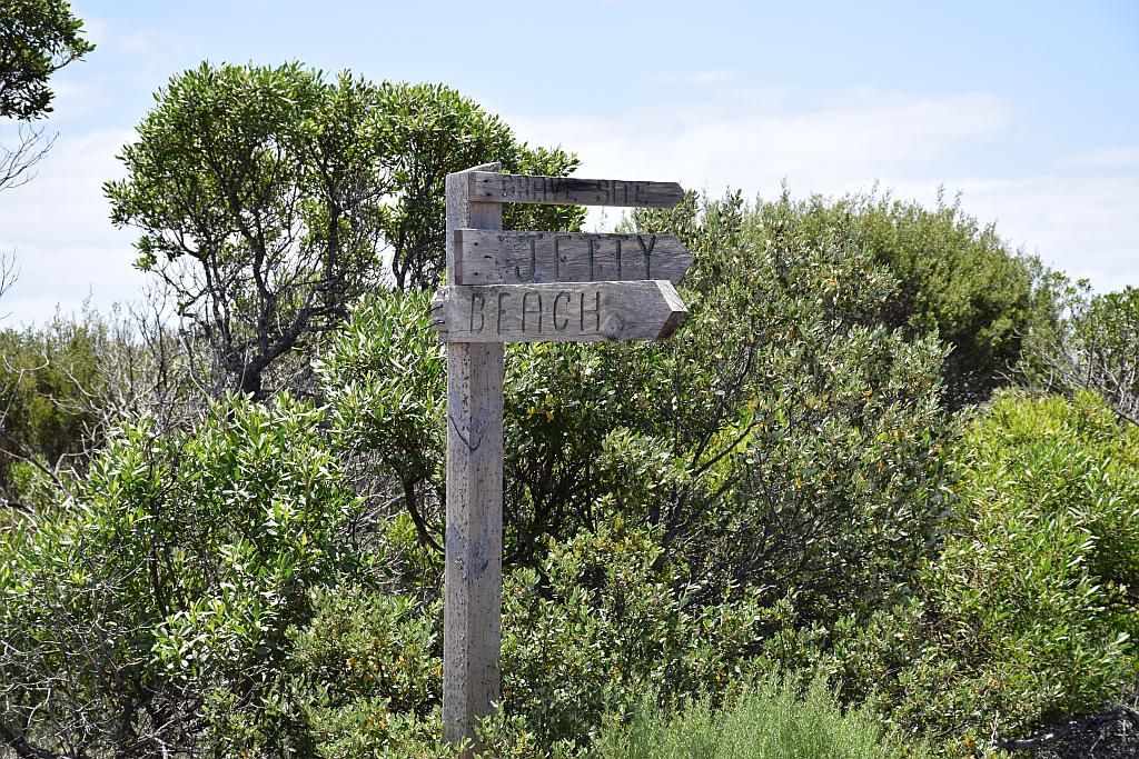
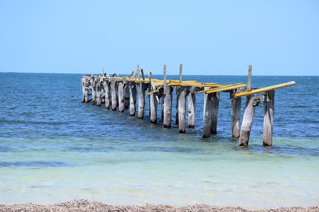
From there I could then navigate to beach, jetty and find my way back home:
I have been told since, some think the trek out to here is a bit ho hum. For me personally, I actually thoroughly enjoyed the day. Horses for courses I guess.
A spot of lunch and it was time to head for home. Sand tracks up to Price Hill, then a combination of crappy corrugations, claypans with chicken tracks and the occasional bit of sand. Some of the chicken tracks took you over dry bog holes and these were fine when I was there. I missed one track and came to a halt at a dry bog hole. I couldn't be stuffed reversing back so I drove into the cracked clay. My front wheels broke the crust, the car was heading for China, I crapped myself and put the power down. Somehow I made it out the other side. I reckon I just slid on my belly plates, cause my wheels had nothing under them. The car got literally covered in mud. Roof, sides and underfloor. So a lucky escape as I would not have been able to self recover in that.
Back to the start of the track and I aired up again. I confirm my suspicions the Rangers gave me about soft sand. Either track conditions were very different when I went, or they don't know what soft sand is. I think I know the answer to that question. Apart from track damage minimisation, I wouldn't have even required deflation.

I get back to camp at 1630. My earliest return to camp the whole time I'm here. This serves two major advantages:
1. Its beer o'clock
2. It allows me time to start de constructing camp to allow me an earlier departure in the morning. This was my last day at Alexander unfortunately.
So now its time for home. I plan to do this in two stages. I will go to Albany overnight and visit some friends and have dinner at the pub. Its still a fair haul to Albany, near 600Km's. But pre packing the previous night saves me a lot of time. I hit the road at 0900.
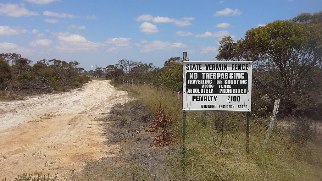
More fuel in Esperance and a bite to eat I head East. I pick up a cache at Munglinup a couple of hours down the road. The flies are friendly and its a bit warm again today. The car seems to be lacking a bit of hill climbing performance on the highway. Another hour down the road and I cross the vermin proof fence. The site of another cache. Temps very much climbing and flies very more friendly. The Garmin Vista HCx leads me straight to the prize. But I come away disappointed. The log book is floating in water in its plastic bag, much like when you bring a goldfish home from the pet shop. Nothing to sign here. I note when I log the find that it has been recorded as such for the last 6 months. A bit disappointing in regards to owner maintenance. However, the sign next to the fence is interesting. 100 Pounds fine? Is this just a historical reproduction or is someone pulling the piss I wonder.
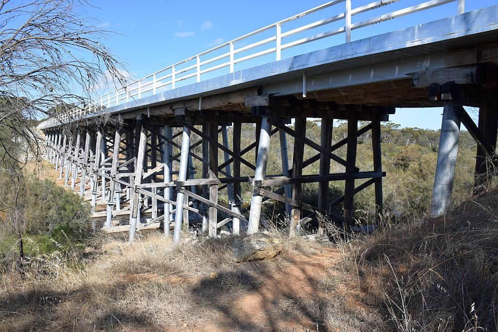
30 Km's prior to Ravensthorpe, I venture off the highway for another cache at the top of a lookout. the youngish vegetation is growing up and has blocked most of the 360 degree view. If not for that, it would offer the most spectacular scenery. Its now 1330 and I still have near 400Km's to go, so I make a conscious decision to back off on the caches as I want to be in Albany pre 1730. But I stop at the Pallinup River for my last one. What I hadn't planned on though, was that this cache is owned by a fellow from a forum I frequent where we share our camping adventures, so that was a nice surprise. I marvel at the bridge across the river, now some 50 years old. Where once Jarrah logs had been the main technical support, now some of this has been replaced with galvanised steel. Whilst the pic below doesn't show this in great detail, some of the supports are galvanised steel bottoms joining the original jarrah tops.
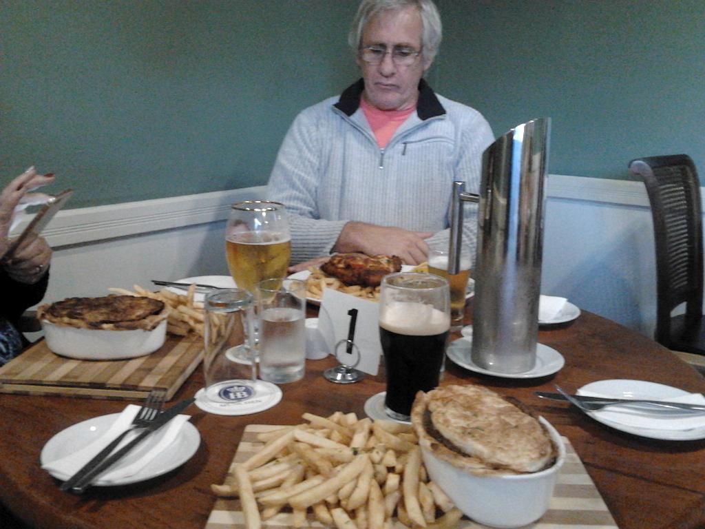
Its now express to Albany and I get into town right on my target time. Meet and greet my friends, then we head off to the Earl of Spencer for the famous pie and Pint. The meals here are huge (but you pay for it too). It was a nice way to finish up - good friends and beer in glass. They have built their home in Albany by themselves. I am blown away with their effort, they have done such a good job.
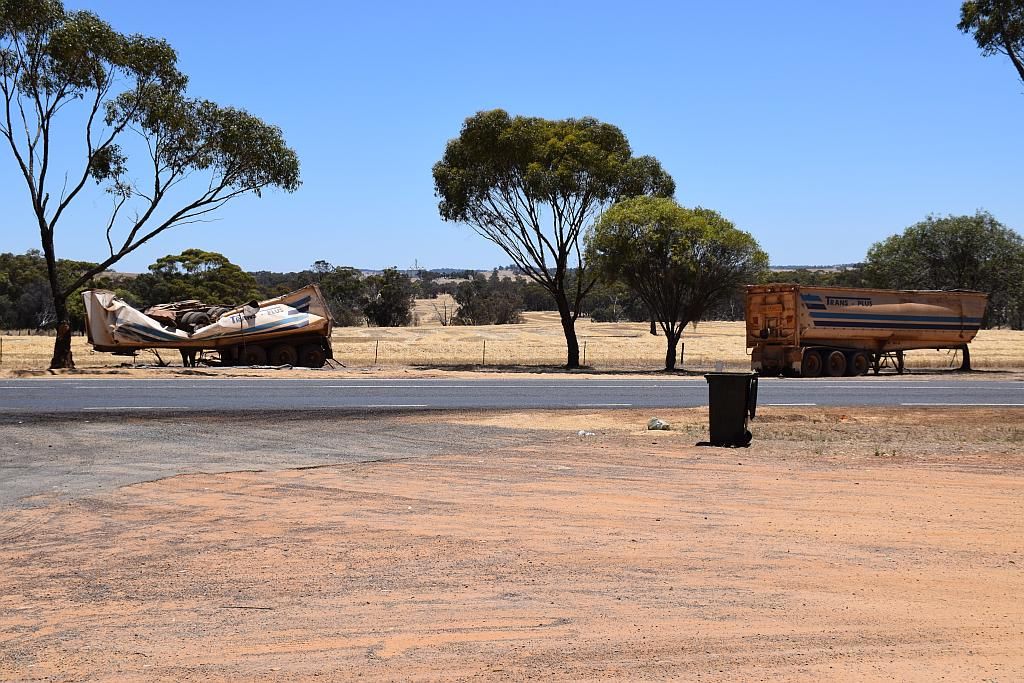
So the last day, and its just a mundane 450Km's on the blacktop. I refuel again at Mt Barker. About the only think of interest was the lunch stop at Arthur River. It had been the scene of a road train accident a few days prior. A truck had pulled out in front of the road train and the driver went off the road in avoidance. He took out a power pole and put it on its side. Luckily, neither he, nor the second driver asleep in the back were hurt. But it does highlight that one the road one should remain vigillant.
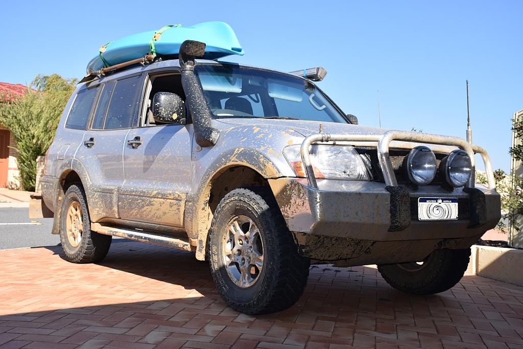
I get home about 1600, one very dirty, scratched and dusty vehicle and camper. It takes me the next 3 days in remedial actions: De mudding, washing, polishing out pin stripes and packing everything away. I have 3" deep mud sitting on top of my bash plates. The intercooler choked. That probably accounts for some of the lack of performance I noted. But now, its all like new again, ready for the next adventure, which should be in April 2015, back to Kalbarri just as I did last April.
So to wrap up, I spent 9 days away. I notched up 3000 Km's, used 420L of diesel at a cost of $630. Spent $70 on camp fees and found 13 caches, some of those in some out of the way places. But most of all, I just simply had a ball. I cant wait to do it again.
