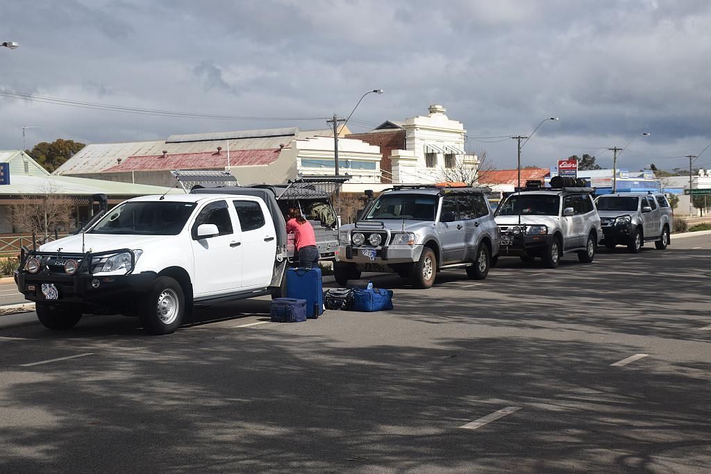
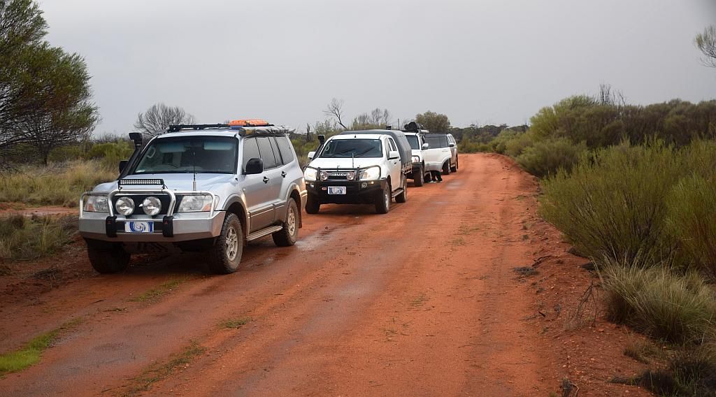
So I scored another 6 day break from work and decided the duration and time of year was ripe for another Goldfields exploration. Also coming along was workmates Bruce and Trevor with his wife and young bub (herein known as Team Ellie - TE). But being as there was now an in balance, IE both Bruce and TE having Dmax's, I thought the chore of the Paj having to extract both was a bit unfair on the old girl, so I also invited Matt and his boy along. That makes for 2 Paj's and 2 D Max's. Matt and myself can share the D Max extractions :)
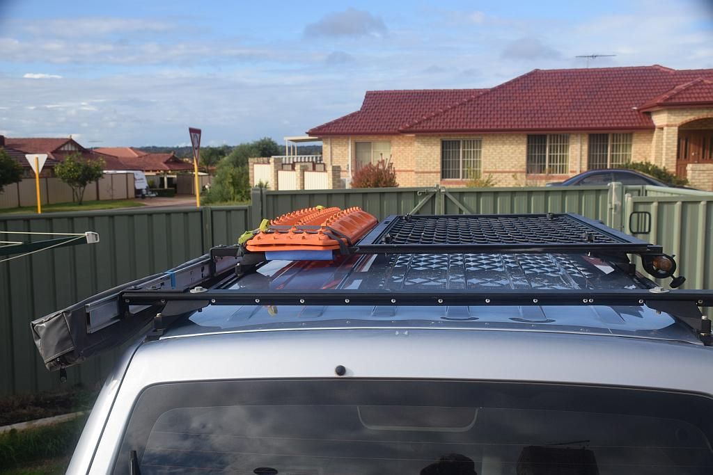
Meeting in Mundaring at 0900 for a coffee and muffin, we hit the road. A big day ahead, 600 odd Km's for myself and Matt. About 650 for Bruce and 700 or so for TE. The target for night one being my old favourite, Jaurdi Station. Some appreciable rain had fallen in the Southern Cross area the week before hand, which had me a little concerned. The further North one ventured, the lesser the falls had been. Rain had also been predicted for the Coastal belt on departure day, but the risk diminished the further inland you went. I had made a mod for this trip. A security screen door cut down to size to form a fire wood carrier. And it worked bloody brilliantly too.
First stop was in Kellerberrin as TE needed to feed the little one. I bought myself a sweet potato for the camp oven which I had forgot about prior to departure. Apart from that, I don't think I left anything else behind. Pulling the Dmax apart for feeding and changing duties must be a real pain and I take my hat off to TE for having the courage to do so. Prior to departing Kellerberrin, I put a chicko roll and some sweet chilli chicken strips in the DS oven for lunch a bit later on.
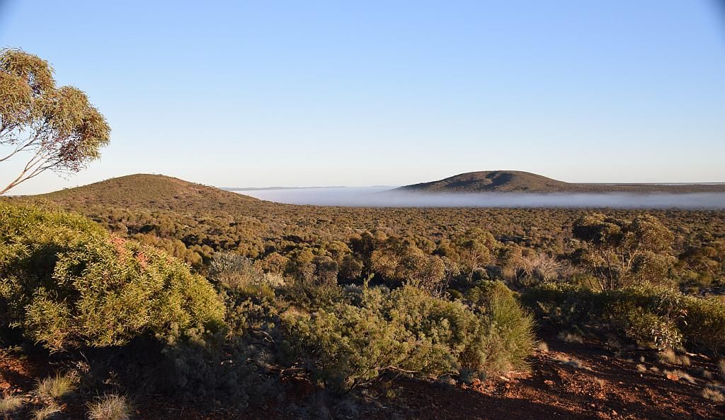
From there we made our way to the refuel point at Southern Cross. An hour and a half after leaving Kellerberrin, I pulled over in a roadside lay by to pull the lunch from the oven. I told the others to continue on, as there will only be a bottle neck at the diesel dispenser if we all arrived at once anyway. Shortly afterwards and once under way again, the weather certainly looked a bit dicey as noted by the pic I took across a crop near Bodallin:

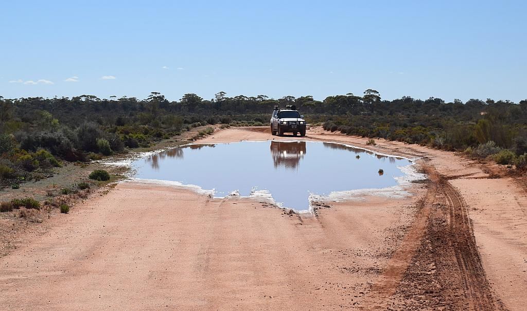
Coming into Moorine Rock, the road was absolutely soaked. I subsequently learned TE and Matt copped the inundation, and Bruce being a bit further behind also experienced hail. By the time I came through, the weather had passed to the South. On arrival at Southern Cross, we all refuelled and TE went about feeding duties. We hit the road again about 1500 for the leisurely 150 Km's to go for the nights camp.
An hour later, we turned off onto the track to the Station. Fearing the worst, but hoping for the best, I confirmed my thoughts about the track being fairly sand based and proving not too difficult to navigate came true. It was drizzling most of the way.
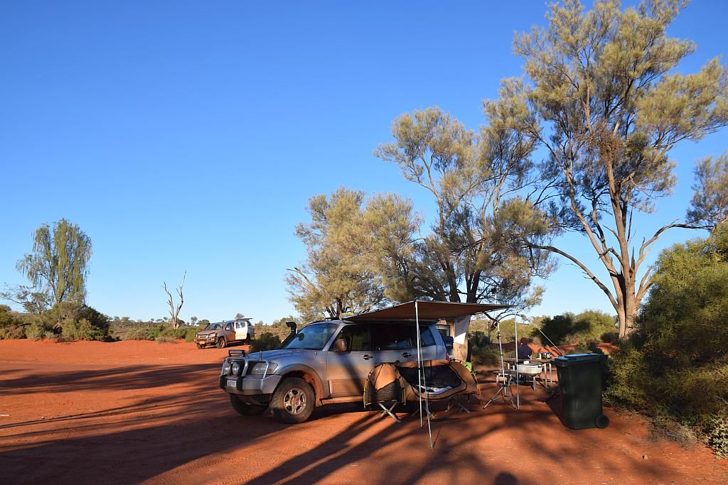
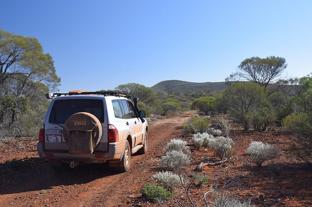
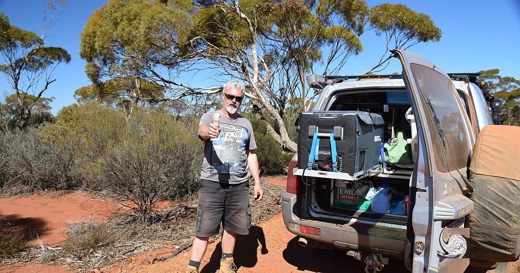
We arrived at the station around 1700 and found it in a surprisingly clean state - unlike the last time I visited. The party decided to use the facilities rather than tenting it on the first night with the looming weather. And then the question arose: Is swagging it in a homestead considered a night under canvas?.....My answer, Yup. After a guided tour, Myself and Bruce shot off to put the fire wood carrier to its first use. We returned 1/2 hour later with the supplies for cooking dinner and socialisation.

Trev seemed to think the pot of gold at the end was an omen. I just knew it was trick photography:
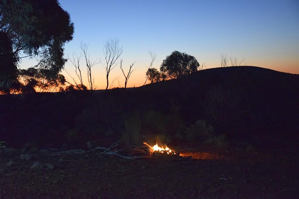
The party noted the impending weather and I assured them it was not going to last long. Famous last words, as we must have had a good 25mm's come down. The firewood now being soaked, we reverted to gas for dinner and 12V led lighting for socialisation. Tomorrow was concerning for me, what with the rain and partially unknown tracks to me. We all retired to our quarters for a well earned rest.
Morning came around with the sun shining. The task for the day was to make Lake Ballard, a 220Km journey over country unknown. A leisurely breakfast done and packed for the unknown, I noted the start of the Paj Poo which tended to last the whole trip:
I had travelled as far as Wallangie Soak previously and knew the track to there was fine. From there to Kurrajong Rock and onwards to Yowie Rocks was an unknown. I led the group to my old favourite, The abandoned Breakaway Mine. The track on the way was certainly soft on top, but the base was fine.

Bruce decided to try the thing I was unwilling to do when I was out here solo in 2013:
And after a bit of an explore, we headed North. Passing Wallangie, the passage was nothing too serious, except a bit of Paj Poo everywhere I stopped.
Until about 25Km's North of the soak. There we hit our first bog hole:
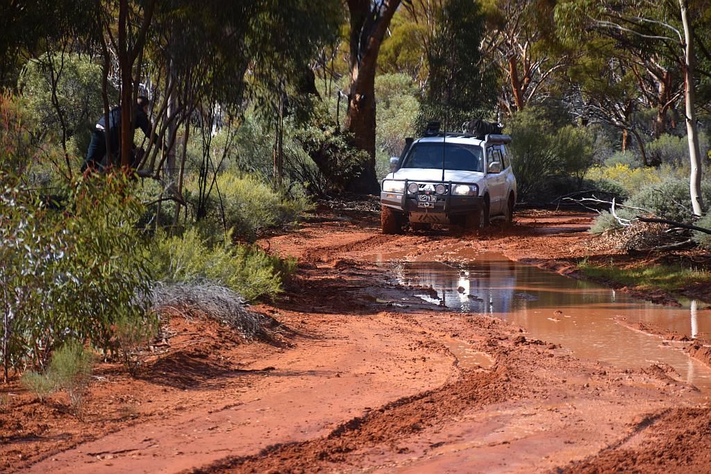
Note Trevor in the tree :)
Trevor in the tree
It was Bruce's first experience of mud and he loved it:
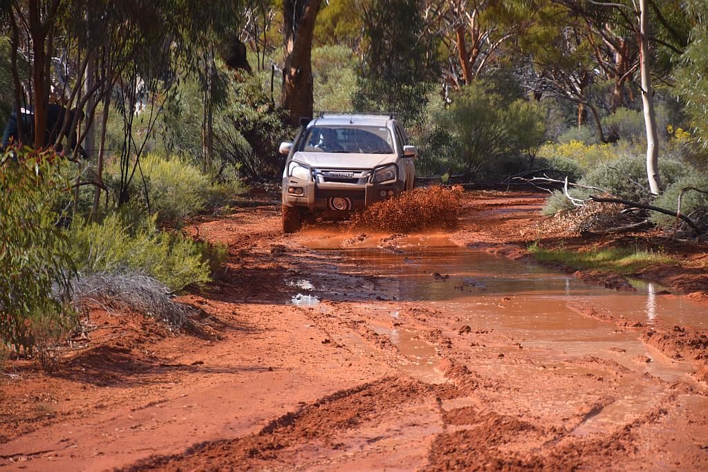
But photo of the day goes to the ear to ear grin of young Trev. He obviously enjoyed it far more than Bruce:
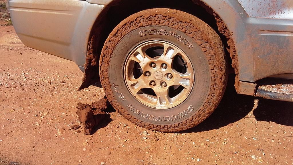
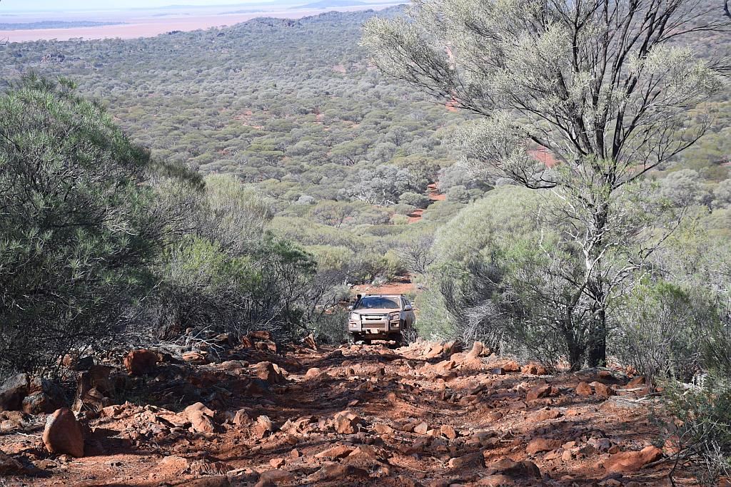
Apart from filling our guards and underfloor with the red squishy stuff, it was a non event. But not too far up the track, the disadvantage of being trip leader reared its ugly head. Another bog hole, very definitely worse on the right hand side. So I veered left. Entering the slush, I was directed to the right. A bit more counter steering to the left was to no avail. The gods dictated I was to end up in the red pit of doom. Powering my way through, the Paj showed its prowess by spitting the ooze out the back whilst propelling the heavy bus forwards.....Until the log. A cut tree was aimed right for my right hand wheel. More compensation on the wheel was to no avail. I was going to run the log over. So I made the plan to bail and hit the skids. Unfortunately, the Paj momentum continued the journey until an earth shattering thud moved said log some 3 feet forward. It was a hard hit and I feared the worst. But the worst was the attempt to self extract from the sticky, sucking mess of red. Eventually I got there and surveyed the damage. It seems the wheel protector on the bar took the brunt and saved a tyre and rim. Turning the wheel to the right revealed a nice rumble as the wheel protector attempted to take 5000Km's of tread off the tyre. But we were now well behind schedule so I just turned the radio up a bit louder. Second attempt at the hole and the others kept their respective vehicles out of the trenches I had just dug and we ventured on, into the unknown.
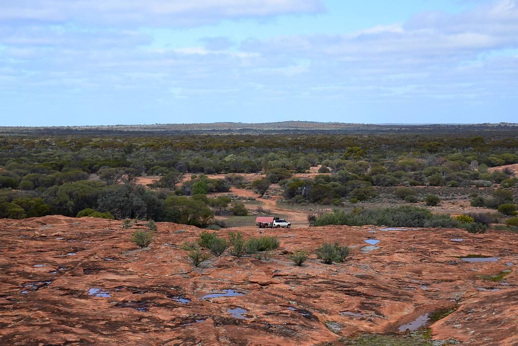
Finally making Kurrajong about 1430. This was about 1/3 of the journey to Lake Ballard, so time was getting away. I had hoped to make Ballard about 1500 so I could get a camp oven fired up. Best laid plans gone astray. But Kurrajong was impressive, seeing all the holes full of water.
Time being of the essence with still 2/3rds of today's journey to complete, the remainder of the day became a cannonball run. We crossed the new J4 Deposit haul road under construction. Not marked on the map:
Yet another piece of BIF to be lost to china thanks to Polaris:
J4
As luck would have it, the track from here was much drier and speeds improved we made Curara Soak and had a quick photo shoot:
And a view of the track from here to Yowie Rocks:

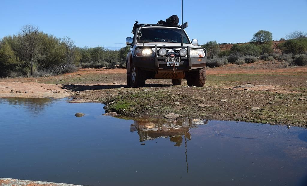
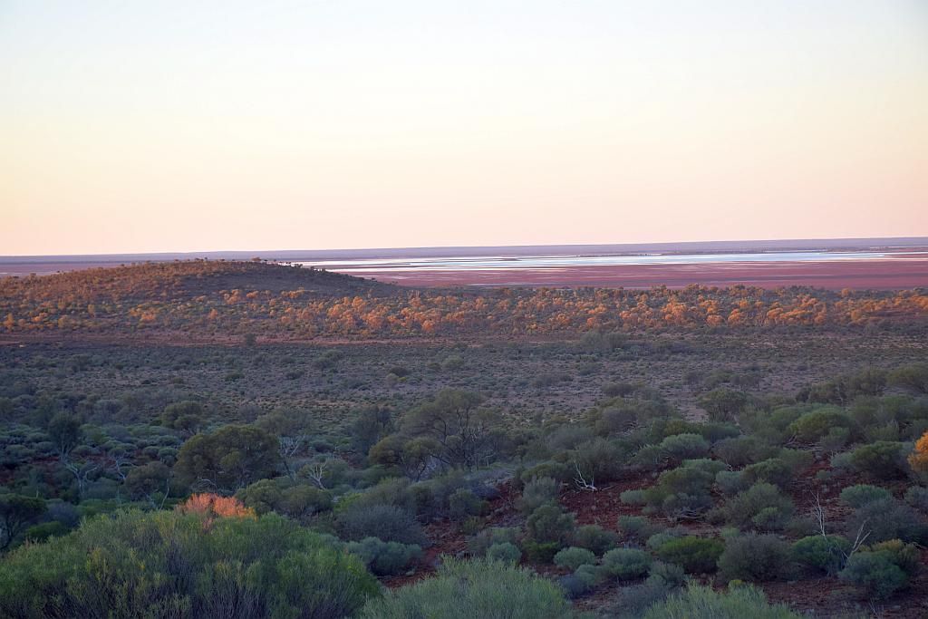
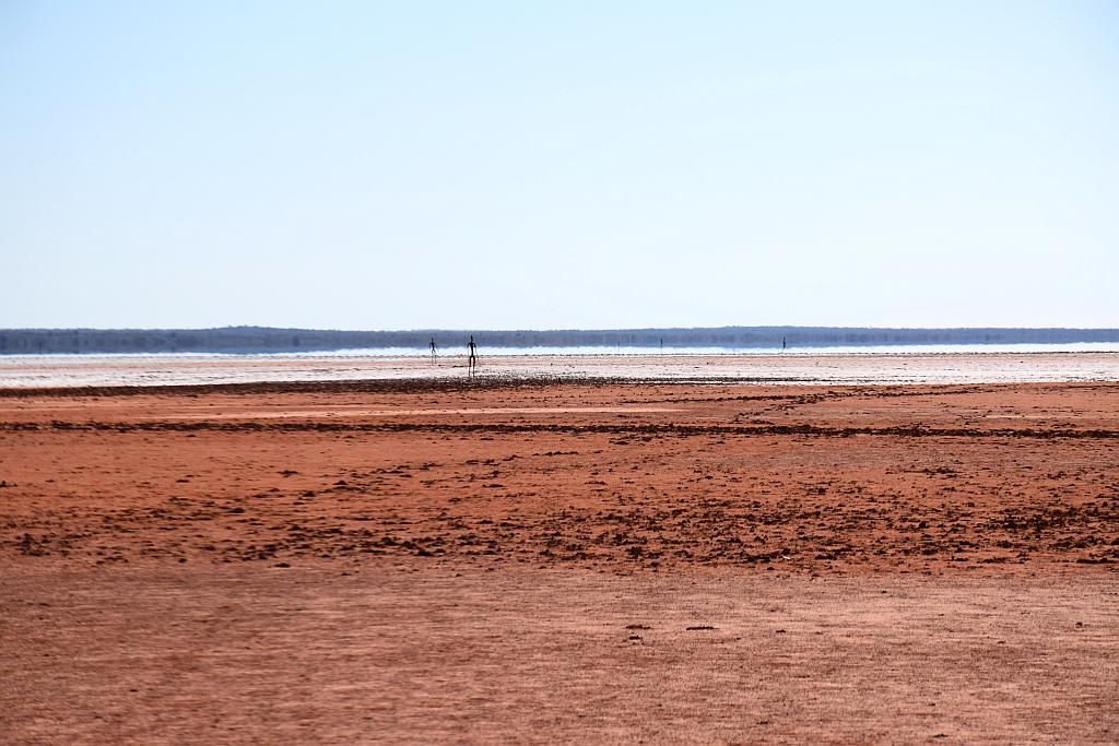
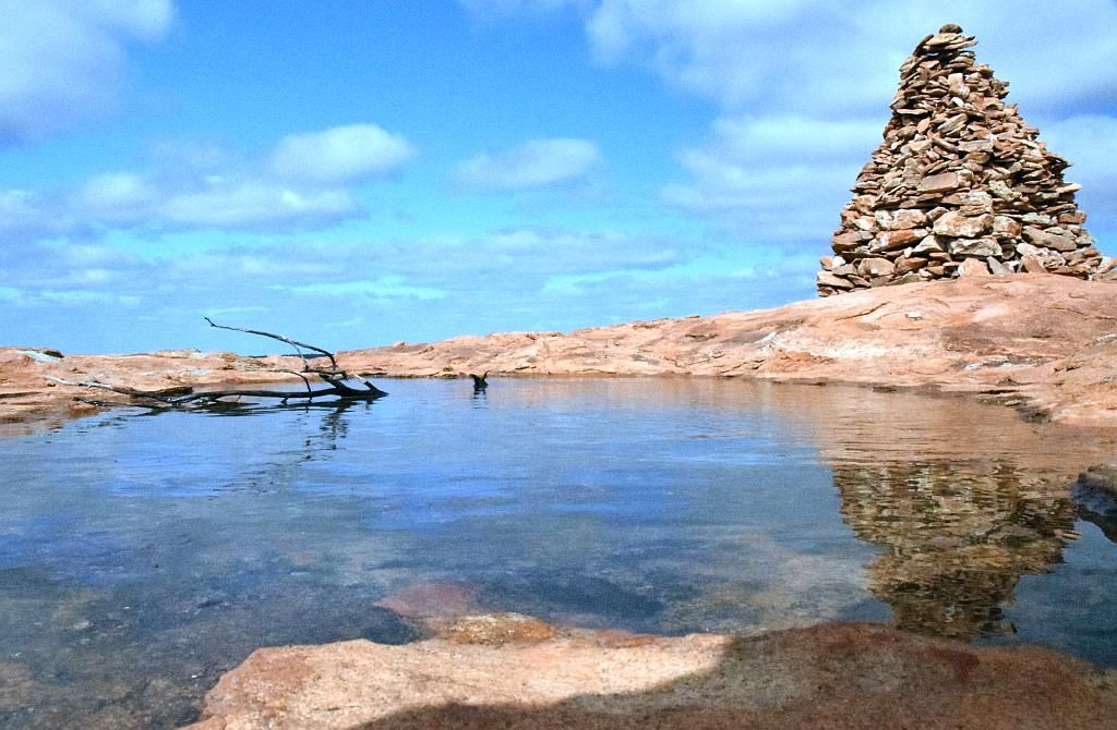
The fact we made Yowie around 1620 meant a photo shoot was out of the question. But at least from here we would be on gazetted roads and travel times will be much better. We eventually pulled into Snake Hill at 1730 and got a glimpse of water in Lake Ballard. A first for me.
Then quickly onto Lake Ballard camp so I could get some wood for the fire:

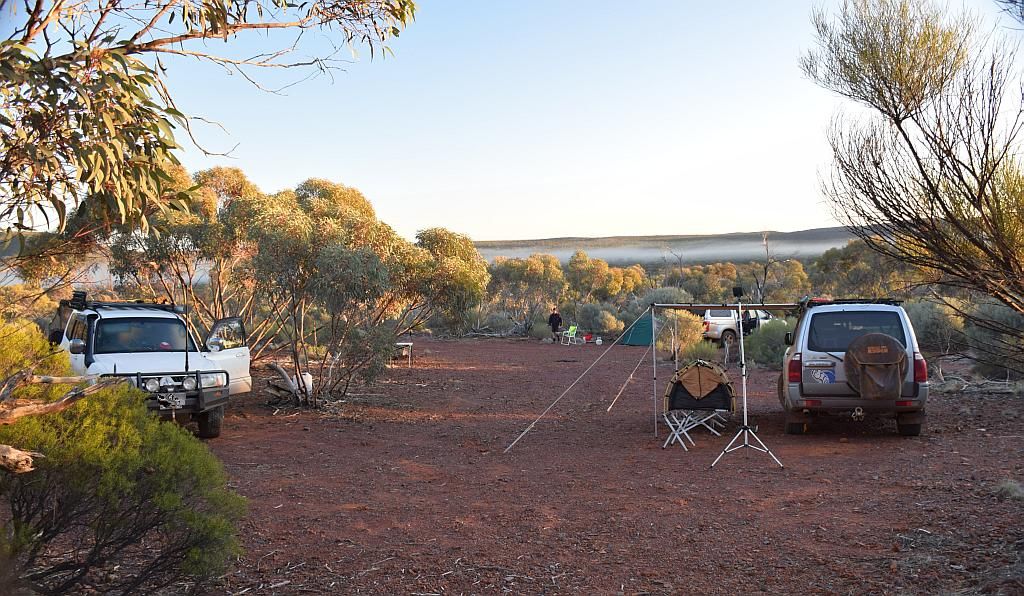
Bruce and TE did their own thing for dinner, whilst Matt and myself cooked on the fire. I attempted some night shots of both the stars and camp and they ended up being crap. Paula did some shots on the lake, which I am yet to see, but her star shots at camp later on seemed impressive on the small LCD of the camera. Although we had only done 200 odd Km's for the day, it had been long and hard. I think this was reflected in the sombre mood at camp that night.
Monday morning, we woke to the coldest temperature of the trip. I logged 2.5 Degrees inside the car, but I know it was less than that outside. Bruce had been suffering from intense pain from a shoulder injury this trip which put a downer on his mood at times, and rightly so. But today was supposed to be an easy day with about a hundred km's to drive (after a late plan change) and all on "roads", so hopefully that will help.
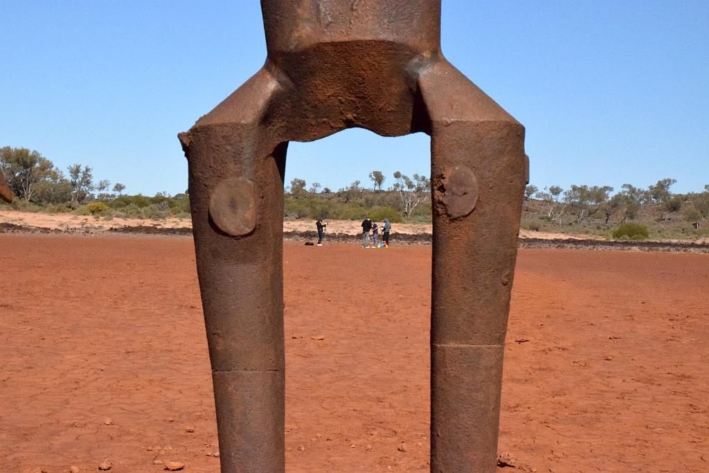
Over breakfast, Trev treated us to one of his espresso coffee's. It certainly made my earlier Moccona taste pretty average. Whilst enjoying the brew, I got some fuel consumption figures from the guys. I had planned to make a dash into Menzies for fuel, but after re-evaluating Trev's consumption, I calculated we could forego this 120Km detour and head straight for our main aim of the Ora Banda Inn for lunch. We then did the photo shoot on the Lake:
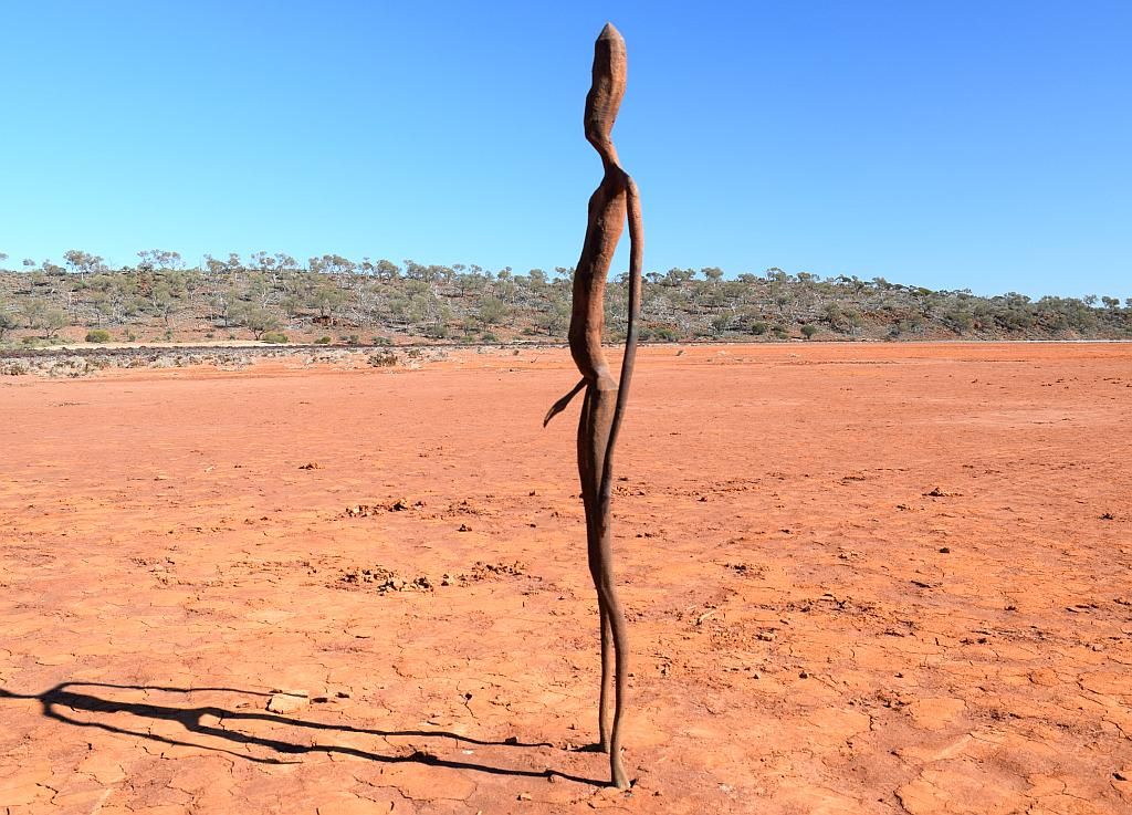
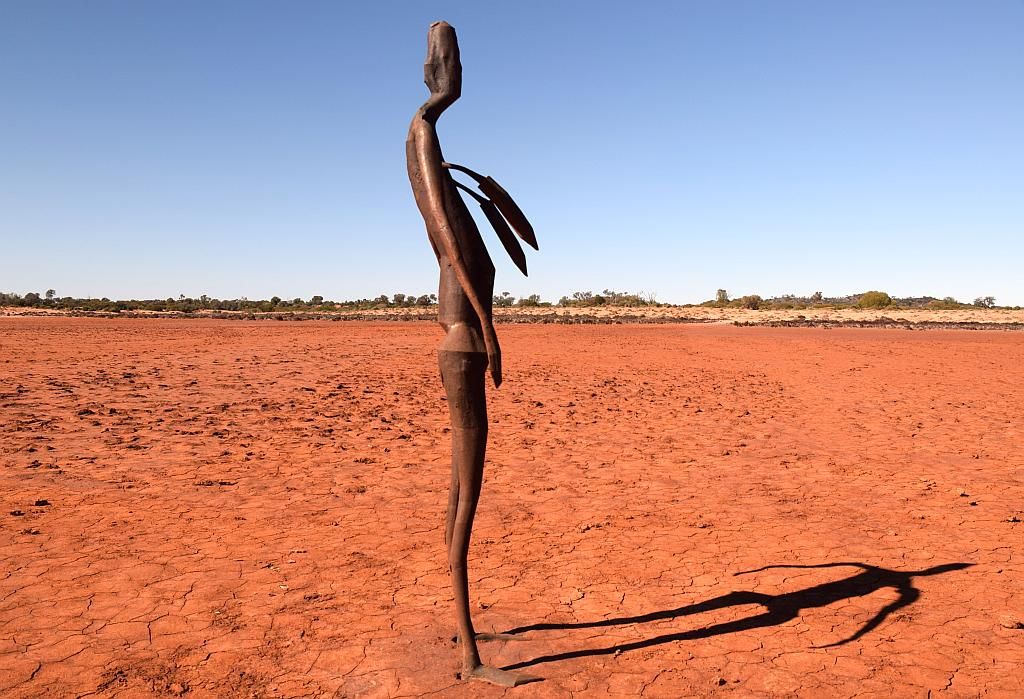
Whilst here I took the "womb with a view" picture:
And also managed to add to my Geocache tally:
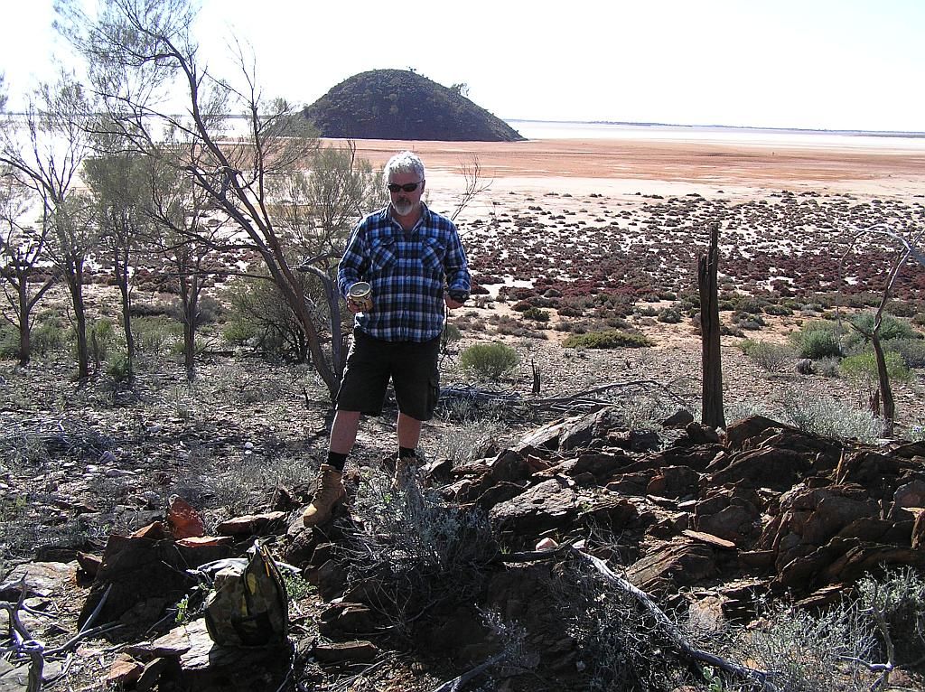
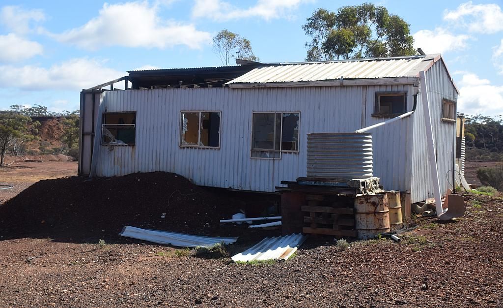
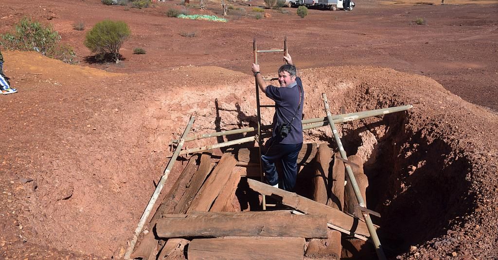
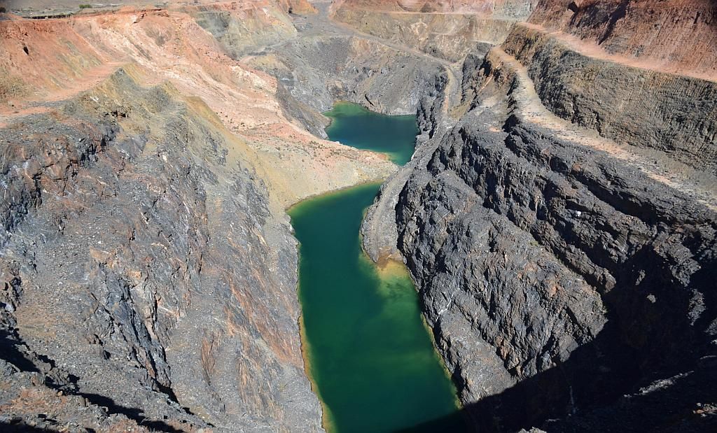
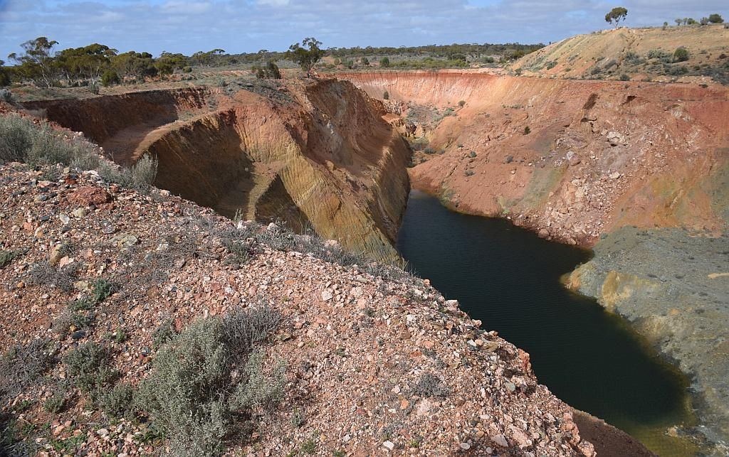
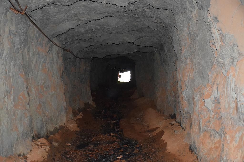
We eventually got under-way at 1100. As for much of this section of the trip, we had to double back on roads used prior, which was a bit of a waste of both time and fuel, but unavoidable if we wanted to visit the places planned. Travelling back down Snake Hill road, we veered off for Davyhurst making it at 1200 (the time I had planned to be at Ora Banda). TE was due to feed the little one, so we looked around the ruins. I had mentioned to Bruce, last time I was here I found a superb open pit. Whilst TE was feeding, I took him over and he was blown away by the operation. I then decided the others should also come have a look, so we walked back to the vehicles and made our way over. This time around, I found vehicular access, so that made life a bit easier.
Trevor spied a shed in the distance so we drove over to investigate where we found an old mining camp. Debate raged as to if the donga was still being used. through an open window, you could see it was set up for habitation with a bed and lounge and a grotty bag of clothes on the floor. Trev also spied a PC set up through another window.

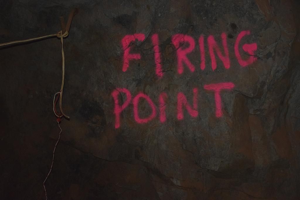
Interestingly, in the shed, with the half caved in roof flapping in the breeze, I found these old HF sets sitting on a shelf:
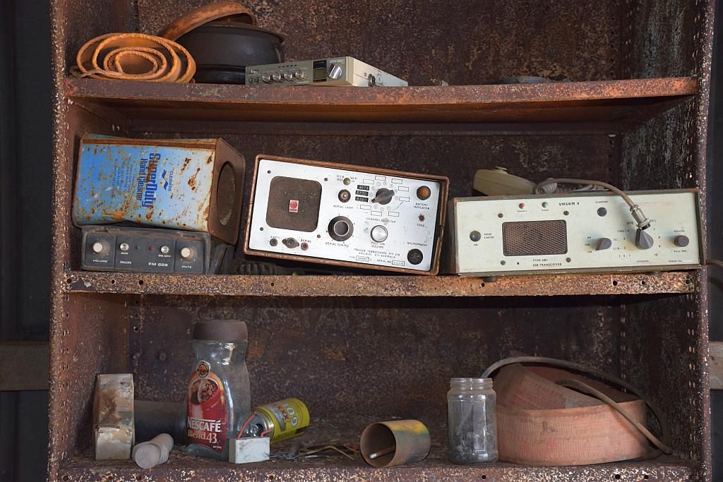
According to Wikipedia, it was due to re open in 2010. I guess that never happened then.
Davyhurst_Gold_Mine
We had consumed a good hour and a half here at Davyhurst and as per normal, we were pushing the time boundries once again. I had to abandon my plans to pick up a cache at Wangine Soak and head direct for Ora Banda, which we arrived at about 1445. So a late lunch was on the menu.
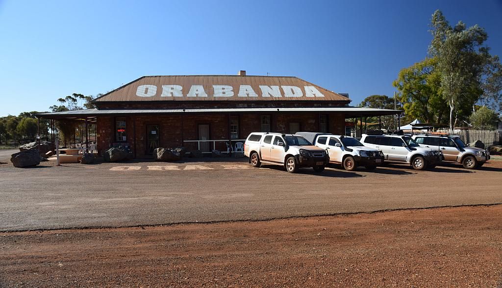
And what a lunch it was, well for me anyway. I ordered a beer and my lunch before the others arrived to help with que waiting times. I subsequently found out that I got the last piece of chicken and was the only one who got salad. Sorry Guys. But it was a plate filler. All the others had non chicken plate fillers too. It represented very good value for money in my opinion. Chicken in pyjama's only $21.50.

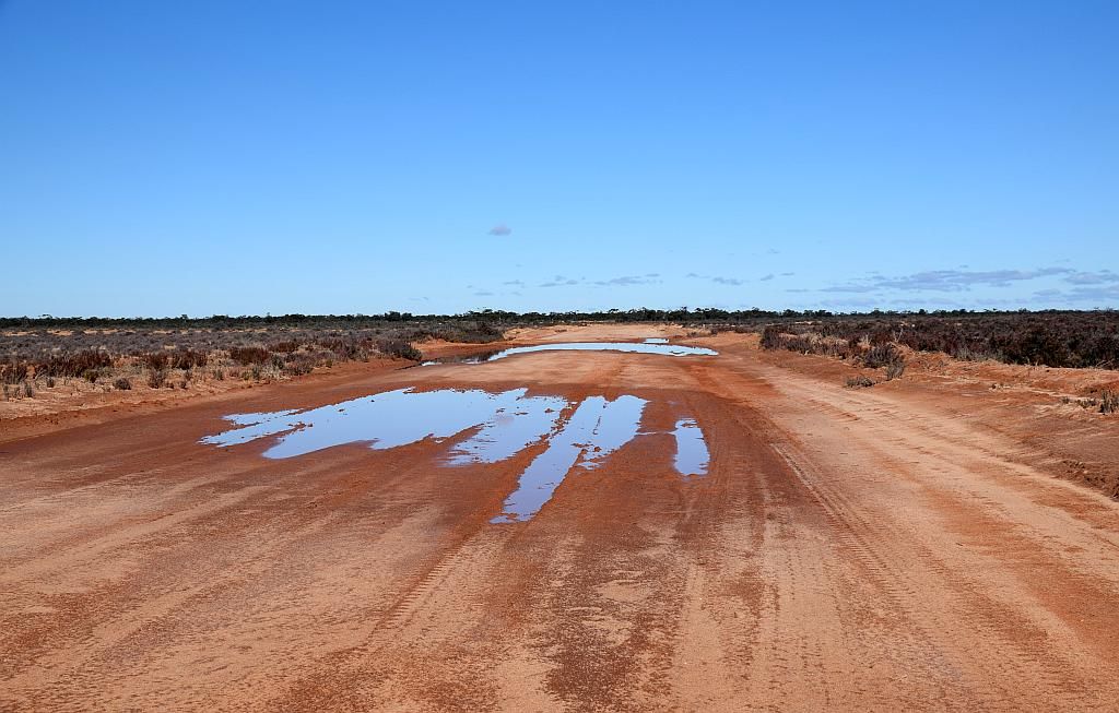
So an hour and a half later, we made our last 30km trek to camp at Rowles lagoon, arriving at 1630. My planned 100Km'sfor the day, turned out to be double that. The weather was now looking a bit sus, and I went to gather wood for the fire. Having such a late and large lunch, I passed on dinner that night. Trevor did make up some S'mores which went down a treat (chocolate and marshmallow between biscuit and melted on the fire...Yum), and we polished off a packet of Ginger nuts by the fire under the drizzle that had started to fall.
Tuesday and we woke to a fine day, if a bit coolish. The down doona I had bought for the swag this trip, worked a treat. So much so, I let TE use my new and unused winter sleeping bag as they got a bit cold at Ballard. Bruce dropped a bombshell. His pain was just too much to bear and he decided he was going to head home with TE who had to part company with us today. It was a sad moment, but one I could very well understand.
Trev got his coffee maker out once again and treated us to a real nice brew.

And a good thing that was too, because as the morning progressed, Bruce had a change of heart and decided to push on with myself and Matt. I think once the pain is a memory, he will be glad he pushed on with us. TE only had about 80Km's to go to get to Coolgardie for fuel, but was a little concerned. As it happens, they arrived with 10L still in the tank. I did forget to mention to them to watch that road for washouts, as will be shown below. Nothing was mentioned on our return, so I guess for them, all was good.
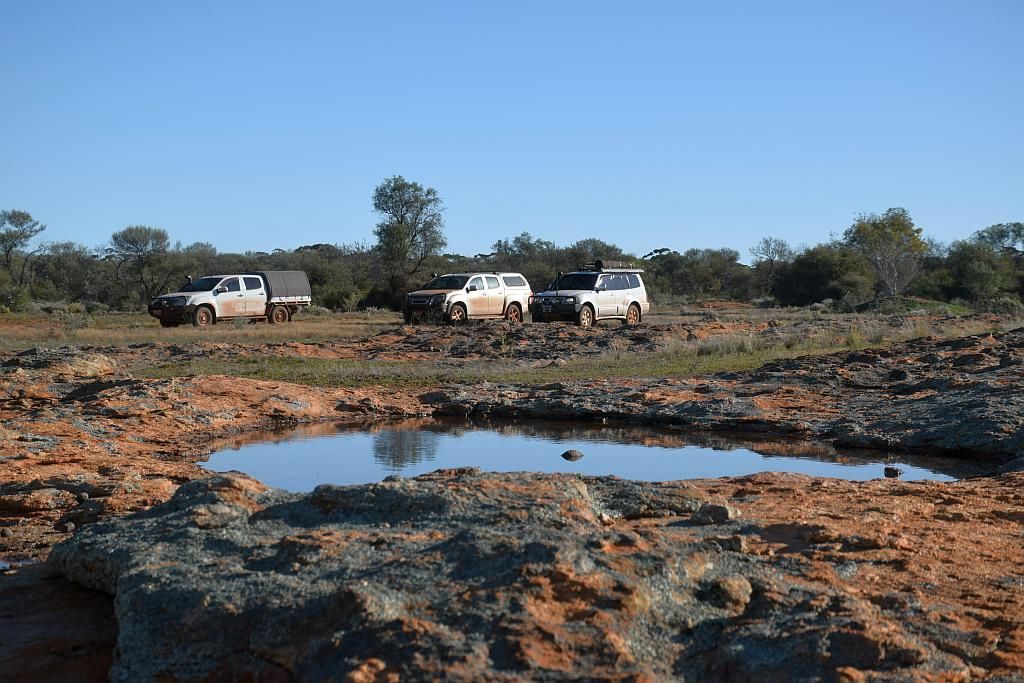
We packed and left camp early (about 0915 for us, the earliest of the trip) and had a photo shoot by the Lagoon. Twice I have been here, there had been cows grazing in the middle of the lake. Not this time around though:
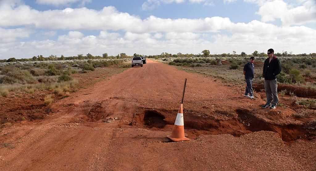
The plan today was to hit Menzies for fuel then travel up to Mt Elvire, a bigger day of about 350Km's. About 15Km's from Rowles, I rounded a corner at 100Km/H and was met with a witches hat in the road a 100 meters onwards. I knew this was a washout and hit the skids hard. But it was to no avail. Too much speed and too little distance and I estimate I hit the ditch at about 80-90Km/h.
The paj hit hard, was launched airborne, rattled the contents of all in the car and I came to rest about 150 meters onwards. Immediately grabbing the radio to warn the others. Fully expecting this time to have suffered some damage, I was amazed to find the toughness of the paj came through again. What was funny in hindsight though, was the little poo marbles the paj had dropped whilst it was in aerial bomber mode. unfortunately, the colour of the marbles is hard to distinguish from the road surface in the photo, but there was a clear blitzkrieg trail to be seen:
Walking back to the washout, I realised just how lucky I was. Had I been a little more to the right (closer to the witches hat), I would have hit that hole. Again the picture doesn't give perspective of its size. That would have ripped the front end off and no doubt put me into a high speed rollover and this blog would have come to a screaming halt. So I am very lucky. I still can not believe due to the proximity of the washout to the corner, a warning sign was not placed prior. Pity anyone traversing this stretch at night. So a word of advice for anyone travelling out this way - Expect the unexpected.
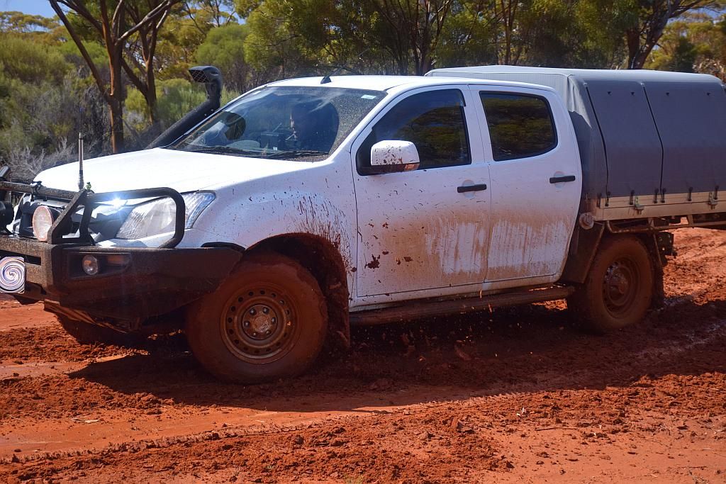
Dusted off and a bit spooked, we continued on. 15Km's shy of Callion, the GPS module dropped out. So at the pit, I did some rejiggling and managed to get it started up again. Also whilst here, I got sick of the wheel protector scraping the wheel, so did some bush mechanics to correct the issue.
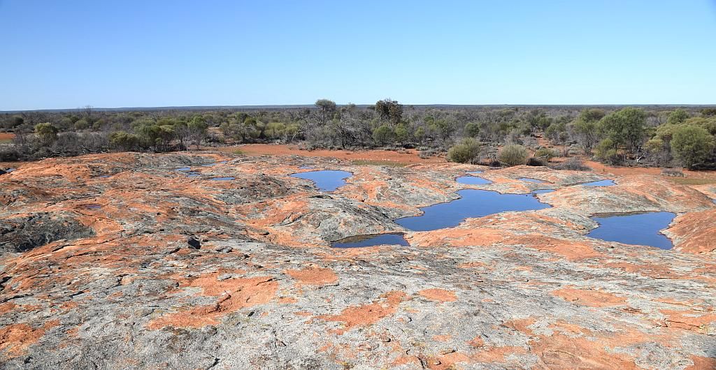
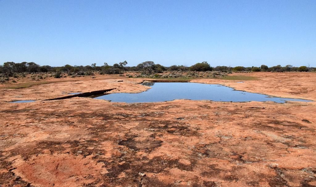
We shot across the road to a couple of old graves and I picked my second and last cache for the trip. Pushing on, we stopped and had a quick lunch at Ularring Rock. The amount of water on the rock was amazing:
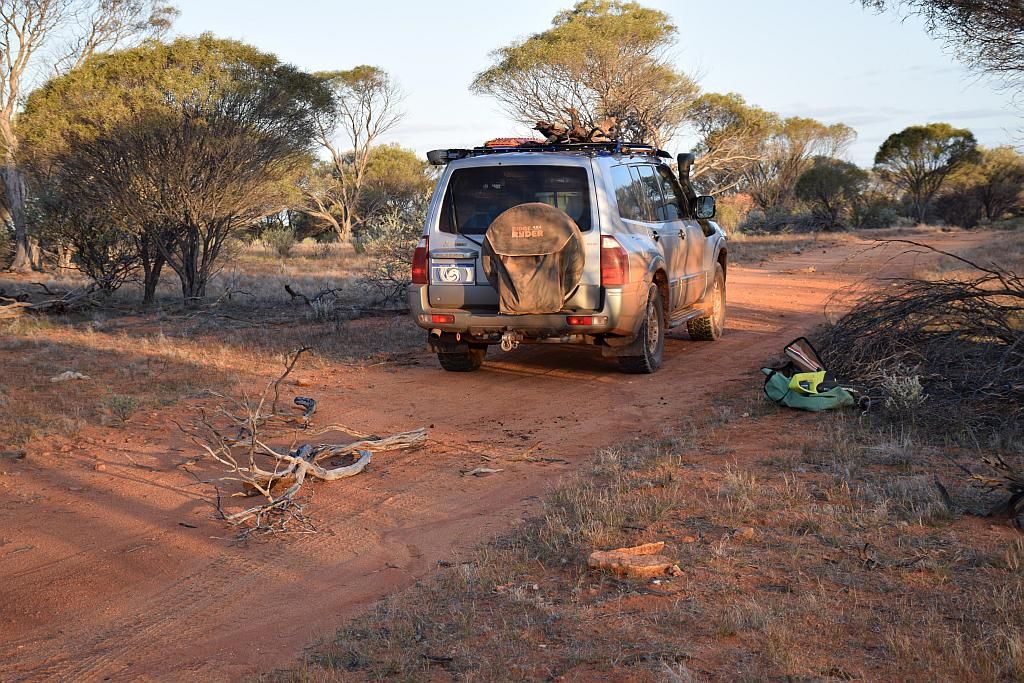
Then we pushed onto the Evanstone-Menzies road for the 60 odd Kilometers for fuel in Menzies. My low fuel light came on at this point, so I thought I would see if I could make Menzies without pumping from the auxiliary tank. And I managed to put 90L into a 90L tank, so I was on fumes coming in. I had done 724Km's since Southern Cross, making my consumption about 12.5L/100. A bit higher than expected, but not surprising, considering the low speed work from Jaurdi to Ballard. But Bruces Dmax surprised me. He used 24L less or 2l/100. That said, he is much lighter, has HT tyres and far, far less mods.

A quick lunch and its back to to the 60Km of road we just traversed to get to our next destination further eastwards. The price to pay for remoteness and a lack of refuelling points I guess.
Near our turn off for Mt Elvire, I crossed another off the bucket list, namely Johnson's Soak. But its now 1530, so investigations of the place will have to be done at a later date. I would love to know the depth, as it looks to contain a considerable amount of water:

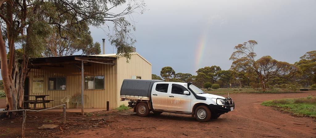
Pushing onwards, we turn North and reach Mt Elvire at 1600. The first time we arrive in camp at what I consider a decent hour.
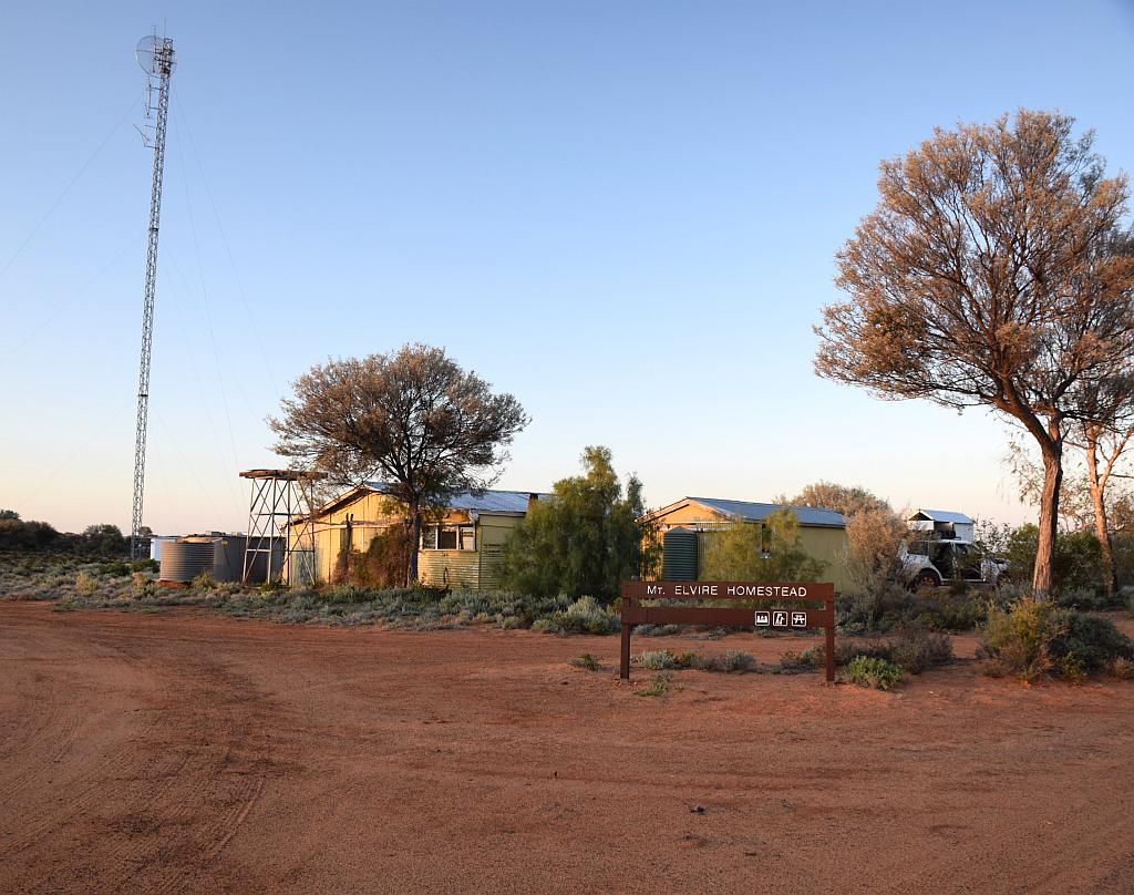
Having completed our 350 Km day, I had a beer before checking out how the place had changed and the gathering of firewood for the nights camp. I note the fly swatter that was here last time has disappeared now :(
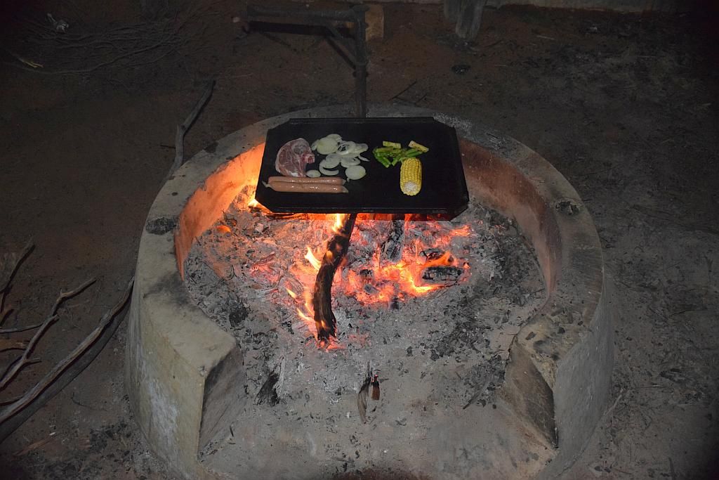
Back at camp, and with the fire going, the question was "are we doing the camp oven tonight?" The plan had been to do this either at Ballard or Rowles, but due to late running, it didn't happen. As I had a roast to feed 5 of us, it had to be consensus or I wasn't going to bother. Consensus was not obtained, so we cleaned the rusty fire pit plate and cooked individually. I think our iron intake improved dramatically tonight.
Another pleasurable night done, I retired about 2145. A bit early, but also a bit weary. Waking up on Wednesday to a cooked breakfast, I decided that as we have our lightest day yet (only about 100Km's less any unplanned side trips, such as the one up the Mount), we need to venture up Mt Elvire. I have read somewhere this can be done, but have never had the time to venture about on the ex pastoral lease. Unfortunately the GPS threw a whammy again this morning, so track navigation was non existant and I just followed my nose. I dread to think how many hours its logged in the last 6 years, so it maybe time to consider replacing it? Its position was only out by about 2.5Km's to the South West. Makes it bloody hard to follow a route in that state.
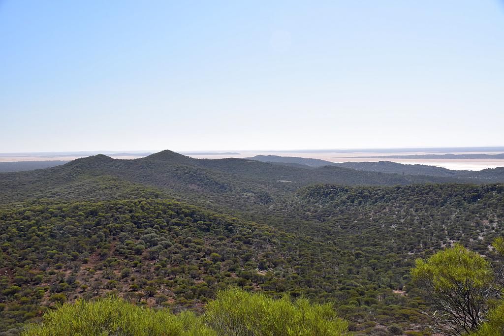
So onwards to the Mount we go. The countryside and vegetation so much different to the surrounding areas:
And then we get into the Hilly rocky stuff for the climb to the top:
At this point, Bruce is sort of well can I say, shitting himself. It was not a difficult technical climb, Just a bit rocky and loose, but to Bruce, a low range virgin, it was a task. We gave him guidance over the radio and came down to help. The Dmax actually climbed the hill far better than the two Paj's that were spitting boulders left, right and center.
The look of sheer terror and jubilation on Bruce's face at the same time once at the top told the story. He was a happy man. And the view was certainly worth it:
But what goes up, must come down and Bruce still has some brown undie moments to get through.
We guided him down over the radio and he did a splendid job.


At the bottom, brown undie moment dispensed with, Bruce with the winners grin, came and shook both Mat and my hand and thanked us for leading him through what his vehicle is capable of.

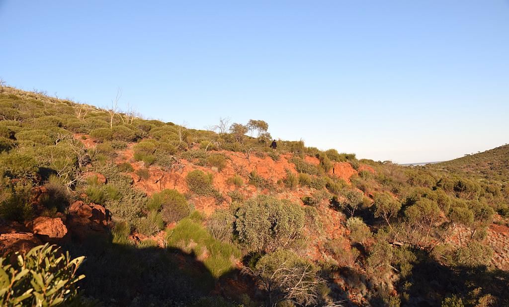
We got back to the Homestead about midday. So time to push on. We checked out the sights on the way out that we passed yesterday in out attempt to make camp at a decent hour. The deep red of the sand making magnificent contrast to the green vegetation. I so love that stuff.

Elvire rocks, just like the others, contained lots of water:
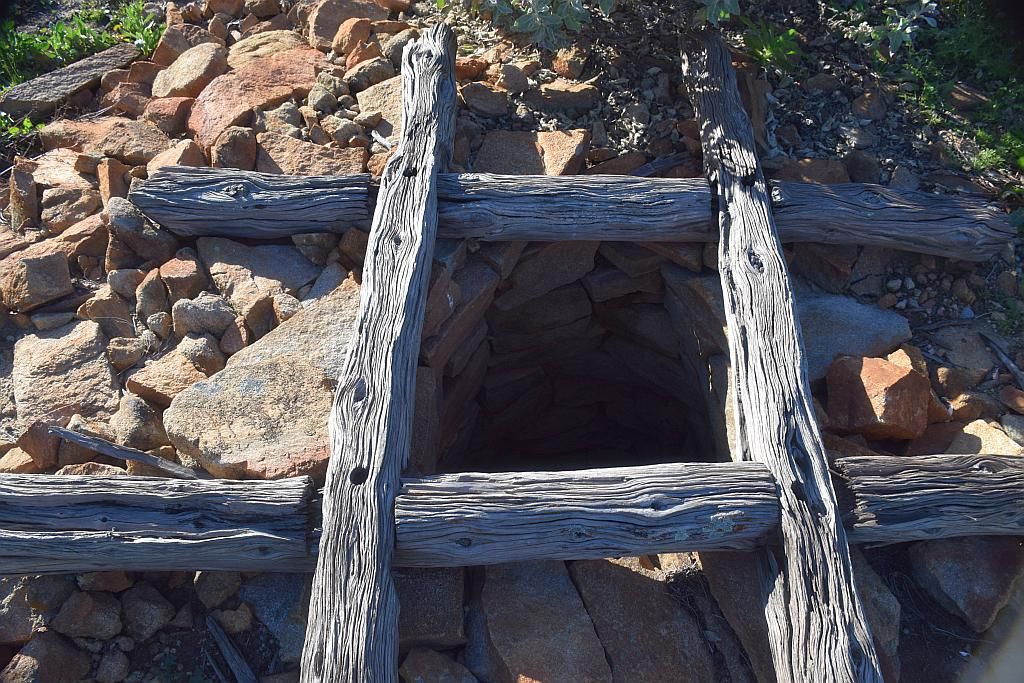
Interestingly, the visitors book has been moved from the homestead to the side of the road, 30Km's to the South. I wonder if this for DPAW to stop making trips to the homestead if there has been a lack of visitors? Anyway, a good time to grab some lunch I reckon whilst filling out the book. I threatened in my DS Oven post, prior to this one, I would probably bore you with chicko roll pictures at nearby Gnamma holes. Well, here is the first. Whilst not specifically at a Gnamma hole, it maintains the context of my point. And what a magnificent lunch it was too:
The temperature had risen slightly today and it was noted by the wafting smells of 4 days of unwashed bodies trapped in a vehicle. Upon arrival at Mt Geraldine, I had to make a call. Push onto camp or detour to Pigeon Rocks. Time being 1345. Whilst it was only a short trip in to Pigeon, I had unknown territory to cover. Both towards Pigeon and the days target: A plaque left by George and Rod, marking a small meteorite crater. The meteorite was discovered in 1979 and subsequently removed. I have been conversing with these fine examples of modern day explorers for a bit now. They are remarkable fellows and an inspiration to me.
But the lure of Pigeon was too much. I note from a trip I did, I supposedly went there back in 2010. I cant recall the place, but I do recall an old bore. So time to see if that's the place I'm thinking of.
What was supposed to be a quick 12Km or so trip in, became 45 minutes. But I was rewarded in the fact that it was the bore I was thinking of. Bruce's shoulder must have been a bit better today because he climed the rock for the vantage point that both Matt and Myself declined to do.
Finally back at the Mt Manning fire trail, time was getting away from us. At 1540, we headed East for the 40 odd Km's to the plaque and camp.

We made the cleared line junction at 1630, so that doesn't leave a lot of room for error. Although only about 8Km's to the plaque, I suspect the track will be slow and scratchy. And so it was. I radioed Bruce that if he wasn't happy to polish the car when home, he should stay put. 4Km's up the cleared line and we found the made track to the meteorite. It had taken me 20 minutes to drive the 3.5 Km's. I told Bruce to hold up. We would call if he was to proceed any further. I was under the impression there was a cleared campsite here at the junction, but it was heavily vegetated. No way would we be camping here tonight. Matt pushed on down the cleared path and told me it was heavy going. Time now being 1700, I declared the mission futile and decided to head to the Western side of the range to find a camp before the sun went completely. (as a foot note, I've since discovered the cleared campsite is about a kilometer further up from the track junction). Disappointed I never got to the plaque, we push on for the Western side, only to be completely blinded by the setting sun. So bad, to stay on the road, I had to pick the tyre tracks we just made. On the other side, we found a rocky, inclined clearing just as the sun had set at about 1730. As luck would have it, firewood was not a problem. Not my most salubrious campsite, but good enough all the same. We had travelled about 200Km's for the day.
For dinner, bruce cooked a can of stew on the stove and Matt made a pasta dish. I was the only one to cook on the fire. Aparently this night was supposed to be the crux of a meteorite shower to hit the earth, which was rather ironic seeing as we came to find a meteorite crater, but alas, the shower proved as elusive as the plaque.
Thursday morning came around, our last day for the trip. Unfortunately it was also a +650km trip home. So we had better get a move on. Opening the covers of the swag produced the most amazing view: A mist had formed overnight in the valley beyond the range:
Which just more spectacular as you gained a higher vantage point:
The colours of the banded iron looked surreal in the morning sunlight. Bruce seen atop an outcrop:
A quick cereal bowl for breakfast and we were packed for the long voyage home and got underway at 0920. This time I warned the others in regards to the Mt Jackson road and washouts. I had to negotiate a few when last out here 14 months ago. I also held some concerns where the road crosses Hamersley Lakes and hoped there had been little rainfall this far north.
At Mt Geraldine, we headed South for home:
I knew it was going to be trouble: re finding the Mt Jackson Rd from the Bullfinch-Evanston road. I reverted to a trip log from 14 months ago and found the error of my ways. Easy peezy. We stopped in at Allen's Find to see olbies all night pizza bar which unfortunately was closed for the day:

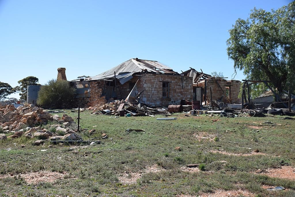
Not far down the road we called in to the Mt Jackson homestead and was saddened to see the deterioration of the old girl:

A bit further on and we hit the salt of Hamersley Lakes. Whilst it was not covered and slimy like I thought it might be, the puddles made us take some deviations:
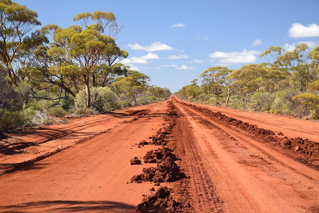
And here the road all the way to Bullfinch went down. Numerous puddles and slippery muddy sections to negotiate, but the worst part of it all was the apparently dry sections. The road had been recently graded (and alleviated my washout concerns) but the top soil was very soft. So soft in fact, that when you hit these patches, it was an amazing experience just noting how much power was sapped from the car. But we plugged on.
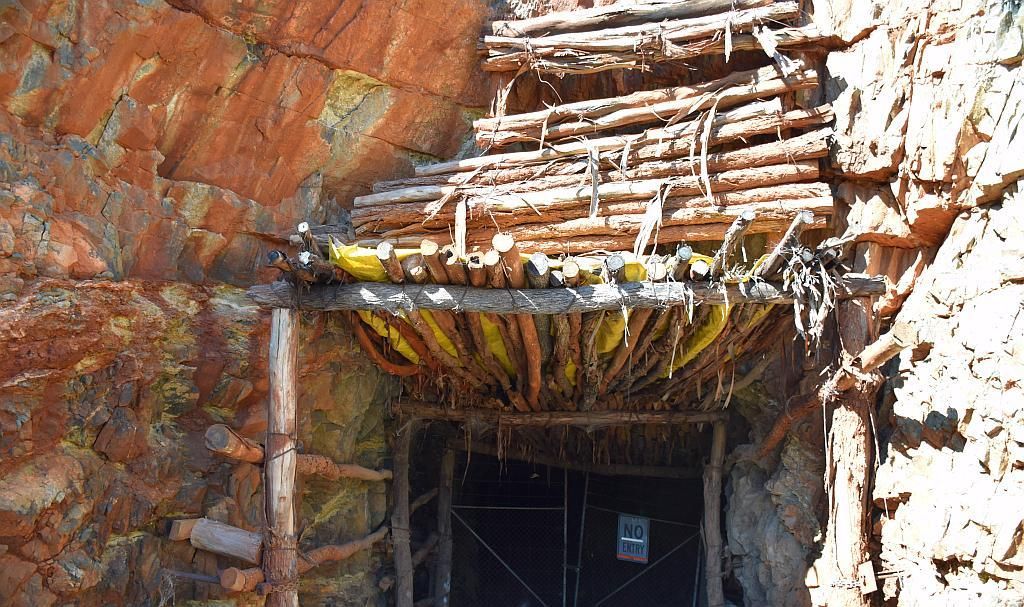
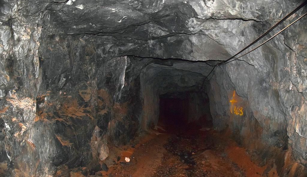
The main aim for me for the day was to visit an abandoned goldmine. Turning in off the road, we came across numerous diggings, but this was not the place I was looking for. A bit of exploration and we hit paydirt. Only to be overcome by a "trespassers will be prosecuted" sign. A bit of a bummer that was, so now I have to rely on pics I have ripped off the net for this blog entry:
From there it was a mad dash for home. I had to leave a handful of caches behind for next time. Stopping in Southern Cross at 1500 for fuel and lunch, we pointed West for the 400Km's to home. Apart from exploding a bird into feathers on the highway, the trip home was an uneventful affair. Bidding farewell to Bruce at Midland, I bid farewell to Matt in Middle Swan and arrived home at 2000. Now for the big clean up.
All in all, it was a massive 6 days. I would like to take a few weeks and spend a bit more time exploring and less travelling, but alas, that will take one powerball.
I would just like to take the opportunity to thank Matt, Bruce and Team Ellie (in no particular order)
for the company. It was a great trip and I hope I showed you some of what the country has to offer.
And so, that wraps up another fine trip. Year to date tally of nights under canvas now standing at 26.
Trip Stats:
2115Km travelled
239L fuel used
for an average of 11.3L/100Km
cost of fuel $371.00
EDIT: December 2015.
Trev finally got around to compiling his GoPro footage. This doesn't cover the last 2 days as TE went home, whilst we continued. Link to Vid below:
Mud, Mountains and Mines: the video.